Nations Online
All Countries in the World
Nations Online All Countries in the World | |
Home  |
___ Searchable Map and Satellite View of the City of Minneapolis, Minnesota
|
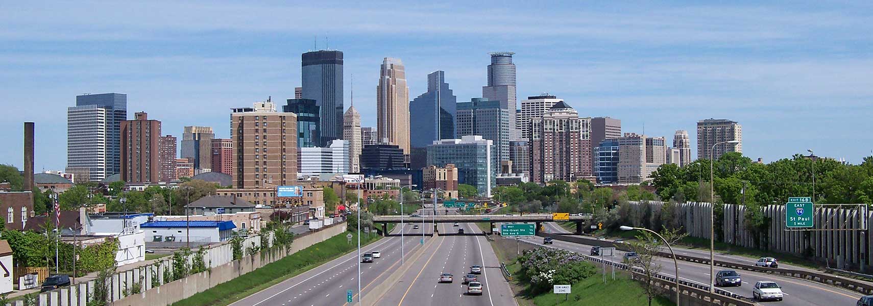 Looking north, Interstate 35W in direction of downtown Minneapolis, in background Minneapolis' skyline. Image: Alexius Horatius |
About Minneapolis |
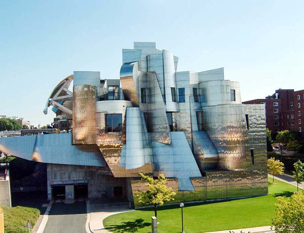
 Satellite view showing Minneapolis, the seat of Hennepin County and the largest city in the state of Minnesota in the Satellite view showing Minneapolis, the seat of Hennepin County and the largest city in the state of Minnesota in the In the 1820s, the U.S. government reinforced its strategic presence at the river junction with the construction of Fort Snelling to defend the Northwest region against British aggression and to secure fur trade profits for the United States. Fur trade was one of the most lucrative businesses during the 19th century. In 1823 the first steamboat arrives at the Fort. In 1850 Minneapolis was 'founded' when John H. Stevens built his house on the west bank of the Mississippi. 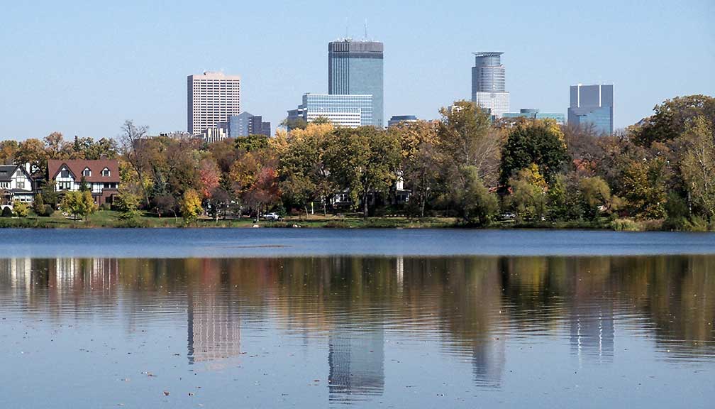 Lake of the Isles, one of the many lakes in the "Minneapolis Chain of Lakes" in Downtown Minneapolis, Minnesota. Image: Jon Platek (AlexiusHoratius) What distinguishes Minneapolis from other American cities? 1. The Minneapolis Skyway System 2. The Minneapolis park system has been called the best-designed, best-financed, and best-maintained in America. The "City of Lakes" was named a top enviro-city by National Geographic's Green Guide. The city is home to the University of Minnesota, the Walden University, and also to the Walker Art Center, the Weisman Art Museum and the Minneapolis Institute of Art and the yearly Art-A-Whirl event. Minneapolis points of interest: Art Museums: Minneapolis Institute of Arts (fine art museum) Weisman Art Museum (massive art collection of the University of Minnesota). Walker Art Center (one of the nation's "big five" museums for modern art, it operates also the Minneapolis Sculpture Garden (currently closed for renovation)). Katherine E. Nash Gallery and Quarter Gallery, art galleries at Regis Center For Art-East. Traffic Zone Center for Visual Art, artist cooperative. Other Museums: Mill City (all about flour milling, a history museum built within the ruins of what was once the world's largest flour mill) Concert Hall: Orchestra Hall, home to the acclaimed Minnesota Orchestra which plays classical and popular music. Performing arts/Theaters: Guthrie Theater (center for theater performance and production), Riverview Theater (neighborhood movie theater), Old Log Theater (possibly the oldest continuously operating professional theater in the US), State Theatre (historical movie theater opened in 1921, now venue for Broadway touring productions and concerts), Orpheum Theatre (one of four restored theaters on Hennepin Avenue, owned by Bob Dylan from 1979-1988, today a premier theater for musicals). Northrop Auditorium, performing arts venue with concerts, ballet performances, and lectures. Cedar Cultural Center (TheCedar), concerts in an old movie theater. Clubbing: Dakota Jazz Club, music, fine dining & cocktails. Churches: The Basilica of Saint Mary, the first basilica established in the United States. Our Lady of Lourdes Catholic Church, oldest continuously used church in the city. Convention Center: Minneapolis Convention Center, near Nicollet Mall and Orchestra Hall. Shopping: Gaviidae Common (shopping mall in downtown Minneapolis), Nicollet Mall (the shopping and dining district in the city) Parks: Minnehaha Park, one of Minneapolis' oldest and most popular parks features a 53-foot waterfall, the Minnehaha Falls. Lakes: The lake rich city features Minneapolis Chain of Lakes which consists of the shorelines of Brownie Lake, the Lake of the Isles, which is connected to Cedar Lake and Minneapolis' largest lake, Lake Calhoun and Lake Harriet with its picturesque park. Nearby Lake Hiawatha, just north of Lake Nokomis. Sports: Target Center (multi-purpose arena, playground of the basketball teams of NBA's Minnesota Timberwolves and the WNBA's Minnesota Lynx), Target Field (baseball park, home of the Minnesota Twins), U.S. Bank Stadium (known as Vikings Stadium, controversial 75,000-seat facility and home to the Minnesota Vikings (NFL)), Mariucci Arena, ice rink. Just zoom in (+) to see Central Minneapolis, the Central Business District of the city. The page shows a city map of Minneapolis with expressways, main roads and streets, zoom out to find Minneapolis-Saint Paul International Airport (IATA code: MSP) about 10 mi (16 km) by road southeast of the CBD. Located south of the airport is The Mall of America, the largest shopping and entertainment complex in the U.S. and the most visited of any mall in the world. To find a location use the form below. To view just the map, click on the "Map" button. |
|
| To find a location type: street or place, city, optional: state, country. |
Local Time Minneapolis:
Wednsday-April-24 19:34
Standard time zone: Central Standard Time (CST); UTC/GMT -6 hours
Central Daylight Time (CDT) in use from the second Sunday in March, ends on the first Sunday in November; time zone offset: UTC/GMT -5 hours |
One World - Nations Online .:. let's care for this planet Promote that every nation assumes responsibility for our world. Nations Online Project is made to improve cross-cultural understanding and global awareness. More signal - less NOISE |
| Site Map
| Information Sources | Disclaimer | Copyright © 1998-2023 :: nationsonline.org |