Advertising

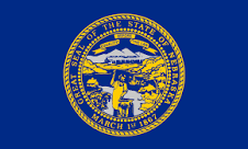
Flag of Nebraska detail
Home Earth Continents The Americas USA Country Profile US State Capitals Nebraska Map

US States Maps Index
World Maps Index

Map of Nebraska (NE)


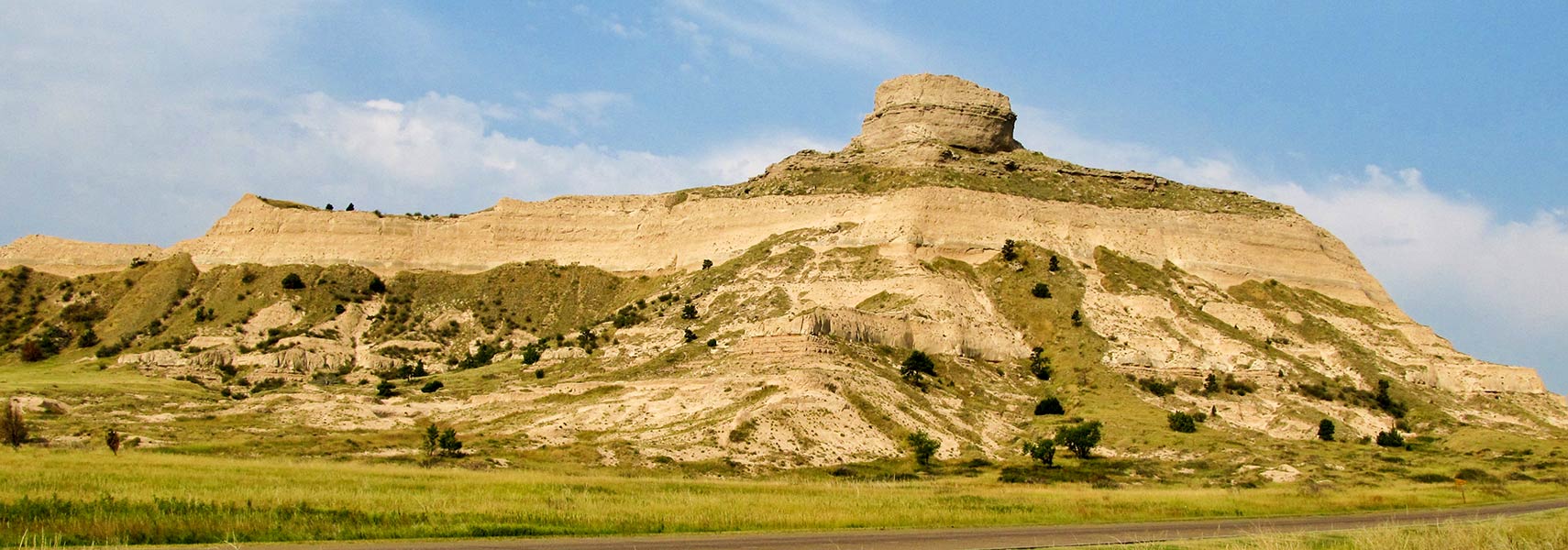
Scotts Bluff National Monument in Scotts Bluff County in Nebraska
Scotts Bluff National Monument in Scotts Bluff County in Nebraska's panhandle. The monument was an important landmark on the Oregon Trail and the Mormon Trail.
Image: Jasperdo

Nebraska Flag
Nebraska State Flag


About Nebraska


Location map of Nebraska state USA
Where in the United States is Nebraska? Location map of Nebraska in the US.
 
Nebraska is a landlocked state, west of the Mississippi River in the central US mainland. It is one of the states in the Great Plains region, the broad territory of mostly flat land expanding north to south in the middle of the United States.


Nebraska borders South Dakota to the north, Kansas to the south, Colorado to the southwest, and Wyoming to the west, the Missouri River creates the border with Iowa and Missouri in the east.


Nebraska State Map
Reference Map of Nebraska
General Map of Nebraska, United States.

The detailed map shows the US state of Nebraska with boundaries, the location of the state capital Lincoln, major cities and populated places, rivers and lakes, interstate highways, principal highways, and railroads.


You are free to use this map for educational purposes (fair use); please refer to the Nations Online Project.
 
History


Bison at Fort Robinson Lodge, Crawford, Nebraska
Bison at Fort Robinson Lodge, Crawford, Nebraska.
Image: Thomas Fields

 
Indigenous people of the Great Plains have occupied the area for thousands of years.

In 1682, René-Robert Cavelier (aka Sieur de La Salle), a French Jesuit and "discoverer," claimed a vast territory in Central North America for the French crown, including the region of present-day Nebraska.

The claim included all the territory drained by the Mississippi River and its tributaries. La Salle named it Louisiana, later known as Louisiana Territory.

Nebraska was acquired in 1803 as part of the Louisiana Purchase. A plot of land of 2.14 million km² (828,000 sq mi) changed ownership for $15 million, equivalent to $300 million today.

Sixty-four years later, Nebraska became the 37th state of the US in 1867. The state's nickname is the Cornhusker State. Corn is a major cash crop that is farmed in Nebraska.


More about Nebraska State


Some Geography

Area
Nebraska Topographic Regions Map Topographic Regions Map of Nebraska. (Click the map to enlarge)

 
The state occupies an area of 200,330 km² [1], it's about two-thirds the size of Italy. Compared with other US states, Nebraska would fit into Texas 3.5 times.

Nebraska's landscape is mostly flat with gently rolling hills in the east, known as the Pine Ridge escarpment.
The Sand Hills, a region of mixed-grass prairie on grass-stabilized dunes, and the semi-arid High Plains are also part of the Great Plains biome.

On the High Plains is Nebraska's highest point, the Panorama Point at 1654 m (5,424 ft), situated in the southwestern corner of the panhandle, in southwestern Kimball County in the middle of a vast flat landscape, the location is only visible by a stone marker.

Rivers
Several rivers cross the state from west to east. Principal rivers are the Loup River, a tributary of the Platte River, the Platte River, and the Niobrara River, both tributaries of the Missouri River.
The Republican River in the south flows through Nebraska and Kansas.

 
Population


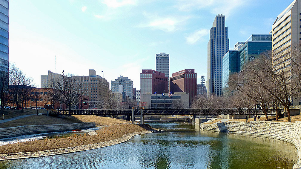
View of the Omaha skyline from Gene Leahy Mall, Nebraska
Omaha skyline from Gene Leahy Mall. Omaha is the largest city in Nebraska and the county seat of Douglas County. The downtown area is dominated by the First National Bank Tower (right), Woodmen Tower in the background center.
Image: Ali Eminov

 
Nebraska has a population of 1.93 million people (est. 2019) [2]. The capital city is Lincoln; the largest city is Omaha, the largest metropolitan area is Omaha–Council Bluffs with a population of 942,000 people.


Race and Ethnic groups
The population of Nebraska is composed of Caucasian 78.2%, Hispanic or Latino 11.4%, African American 5.2%, Asian 2.7%, and Native American 1.5%. [3]


The largest airport is Omaha's Eppley Airfield (IATA code: OMA).


Cities and Towns in Nebraska

The map shows the location of following cities and towns in Nebraska:

Largest cities in Nebraska with a population of more than 50,000:
Omaha (468,000), Lincoln (capital city, 287,400), Bellevue (53,600), Grand Island (51,400)
Population figures in 2018


Other cities and towns in Nebraska
Ainsworth, Alliance, Alma, Ansley, Auburn, Beatrice, Benkelman, Blair, Bridgeport, Broken Bow, Burwell, Chadron, Columbus, Crawford, Dunning, Fairbury, Falls City, Fremont, Gordon, Hartington, Hastings, Holdrege, Hyannis, Imperial, Kearney, Kimball, Lexington, McCook, Minden, Nebraska City, Neligh, Norfolk, North Platte, O'Neill, Ogallala, Rushville, Scottsbluff, Sidney, South Sioux City, Superior, Thedford, Valentine, Wahoo, Wayne, West Point, and York.
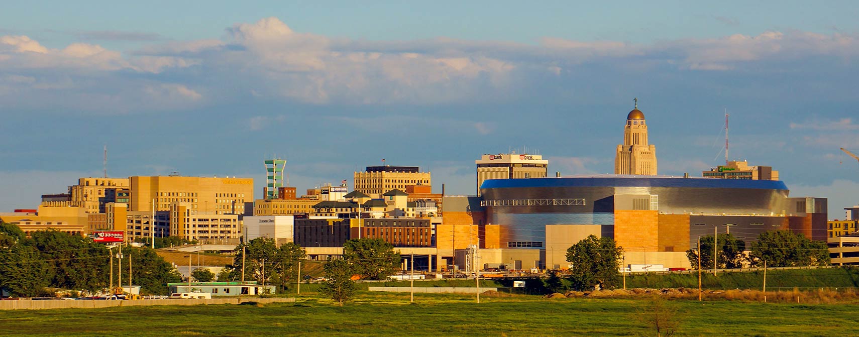
Skyline of Lincoln, capital city of Nebraska
Skyline of Lincoln, Nebraska, with the tower of the Nebraska State Capitol to the right.
Image: Collin Ulness

 

Weather Conditions Omaha

OMAHA WEATHER


Advertisements:


Maps of the 50 U.S. States
Alabama | Alaska | Arizona | Arkansas | California | Colorado | Connecticut | Delaware | Florida | Georgia | Hawaii | Idaho | Illinois | Indiana | Iowa | Kansas | Kentucky | Louisiana | Maine | Maryland | Massachusetts | Michigan | Minnesota | Mississippi | Missouri | Montana | Nebraska | Nevada | New Hampshire | New Jersey | New Mexico | New York | North Carolina | North DakotaOhio | Oklahoma | Oregon | Pennsylvania | Rhode Island | South Carolina | South Dakota | Tennessee | Texas | Utah | Vermont | Virginia | Washington | West Virginia | Wisconsin | Wyoming

20 Most Populous U.S. Cities (in 2018):
1. New York City 2. Los Angeles 3. Chicago 4. Houston 5. Phoenix 6. Philadelphia 7. San Antonio 8. San Diego 9. Dallas 10. San Jose 11. Austin 12. Jacksonville 13. Fort Worth 14. Columbus 15. San Francisco 16. Charlotte 17. Indianapolis 18. Seattle, 19. Denver, 20. Washington D.C.

Other Major U.S. Cities:
Albany, Anchorage, Annapolis, Atlanta, Atlantic City, Augusta, Baltimore, Baton Rouge, Bismarck, Boise, Boston, Carson City, Charleston, WV, Cheyenne, Cincinnati, Cleveland, Columbia, Concord, Des Moines, Detroit, Dover, DE, El Paso, Frankfort, Harrisburg, Hartford, Helena, Honolulu, Jackson, Jefferson City, Juneau, Kansas City, Lansing, Las Vegas, Lincoln, Little Rock, Long Beach, Madison, Memphis, Miami, Milwaukee, Minneapolis, Montgomery, Montpelier, Nashville, New Orleans, Norfolk, Oklahoma City, Olympia, Orlando, Pierre, Pittsburgh, Portland, Providence, Richmond, VA, Raleigh, Sacramento, St. Louis, St. Paul, Salem (OR), Salt Lake City, Santa Fe, Springfield, Tallahassee, Tampa, Topeka, Trenton, Tucson