Advertising

India Flag detail
Home Earth Continents Asia India Country Profile States and Union Territories of India Google Earth Odisha Map

___ Satellite View and Map of Odisha (ओडिशा), India


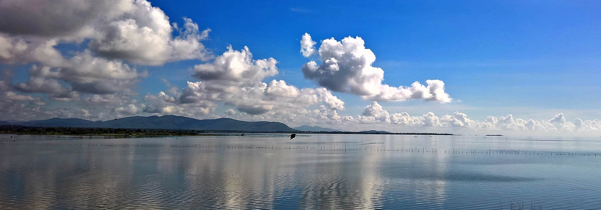
Chilika Lake in the  Puri, Khurda and Ganjam districts of Odisha
Chilika Lake is a large shallow brackish lagoon or estuary on the east coast of India in Odisha state.
Image: Pratyush Jena

About Odisha


Odisha seal
Satellite view and map of Odisha, a state in India formerly known as Orissa. Odisha is located in the eastern part of India with a coastline at the Bay of Bengal.

Odisha borders West Bengal in the northeast, Jharkhand in the north, Chhattisgarh in the west and northwest, and Andhra Pradesh in the south and the southeast.


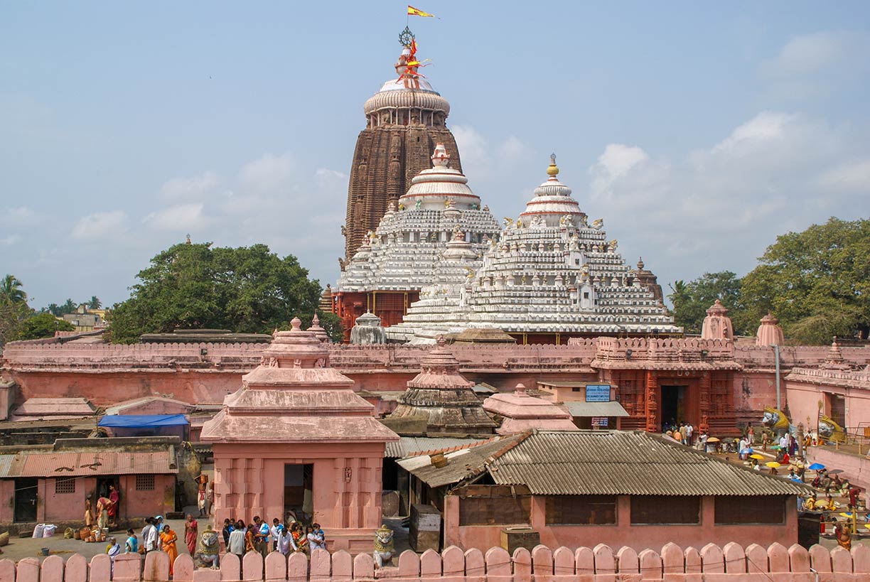
Swetaganga Tank in Puri, Odisha
The Shree Jagannath Temple in Puri is dedicated to Lord Jagannath (Vishnu). The temple compound is an important pilgrimage destination for many Hindu devotees. Jagannath is one of the four great 'Char Dham' (four abodes) pilgrimage sites.
Image: Patrik M. Loeff
 
Odisha covers an area of 155,707 km² (60,119 sq mi), compared it is about half the size of Italy, or slightly larger than the US state of Georgia.


Odisha has a population of 45 million people (2018 est.). The state has a rich cultural heritage; it is a mix of the Aryan, Dravidian and Adivasi culture. Odisha is known for its tribal cultures and famous for its many festivals and ancient Hindu temples.

The largest city and state capital is Bhubaneswar. Other major cities are Cuttack (the former capital), Rourkela (a planned steel city located in the northern part of the state), Brahmapur (the economic capital of South Odisha), Sambalpur (a transportation and education hub in Western Odisha), and Puri (a coastal city famous for its Jagannatha Temple).
The official language in the state is Oriya (Odia) and English. The main religion is Hinduism (over 94%).


Odisha Points of interest

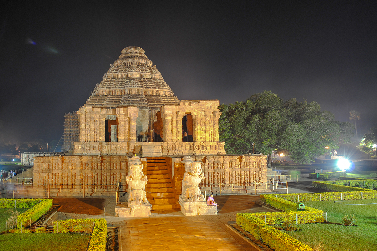
Mandapa of the Sun Temple in Konârak, Odisha
The Mandapa of the Sun Temple in Konârak, a medium-sized town in the Puri district of Odisha.
Image: Santosh.pati
 
The Jagannath Temple of Puri is a Hindu pilgrimage site.

Puri Beach is a popular beach at the Bay of Bengal.

Konark Sun Temple, 13th-century Oriya architecture at its finest and famous also for its erotic sculptures; the Sun Temple, Konâraka is a UNESCO World Heritage Site in Puri District.

Lingaraja Temple and Rajarani Temple are famous Hindu temples in Bhubaneswar.

Udayagiri and Khandagiri Cavesare ancient Jain rock-cut shelters near Bhubaneswar.

Simlipal National Park is a national park and a tiger reserve in Mayurbhanj district.

Bhitarkanika National Park, mangroves and wildlife in Kendrapara district, Bhitarkanika has missed the World Heritage Site (WHS) tag in the natural properties category. [1]


The map shows a map of Odisha with state border, cities and towns, expressways, main roads and streets, and the location of Bhubaneswar Airport (IATA code: BBI).


To find a location use the form below.
 
Sorry! Google's pricing policy has made it impossible for us to continue showing Google Maps. We apologize for any inconvenience.

Google Map: Searchable map and satellite view of Odisha state, India.

φ Latitude, λ Longitude (of Map center; move the map to see coordinates):

,


Bookmark/share this page
  Instagram button
More about India

Landmarks:
Taj Mahal
Satellite view of the famous mausoleum.

Cities:
Information and searchable map/satellite views of
Delhi
Chandigarh
Chennai
Hyderabad
Kolkata
Mumbai

Country:
Searchable map/satellite view of India
Map of India
Administrative Map of India
Political Map of Northern India and the Kashmir region
Searchable location map of India's airports
India Country Profile
India in numbers
India Key Statistical Data.

States and Union Territories of India

Continent:
Map of Southeast Asia
Map of Asia


External Links:
Odisha
The official government website

Odisha Tourism
Odisha Tourism portal

Wikipedia: Odisha
 
Current Weather Conditions Odisha:

BHUBANESWAR WEATHER

Advertisements:


States of India:
Andhra Pradesh, Arunachal Pradesh, Assam, Bihar, Chhattisgarh, Goa, Gujarat, Haryana, Himachal Pradesh, Jammu & Kashmir, Jharkhand, Karnataka, Kerala, Madhya Pradesh, Maharashtra, Manipur, Meghalaya, Mizoram, Nagaland, Odisha, Punjab, Rajasthan, Sikkim, Tamil Nadu, Telangana, Tripura, Uttarakhand, Uttar Pradesh, West Bengal

Google Maps of India's Union Territories:
Andaman and Nicobar Islands, Chandigarh, Dadra & Nagar Haveli, Daman & Diu, Lakshadweep, Puducherry

Major Cities in South-Central Asia:
Almaty, Ashgabat, Astana, Baku, Bishkek, Colombo, Dhaka, Dushanbe, Islamabad, Kabul, Karachi, Kathmandu, Lahore, Lhasa, Male, Samarkand, Tashkent, Tehran, Thimphu

Map Help [ show ]
up