Nations Online
All Countries in the World
Nations Online All Countries in the World | |
Home  |
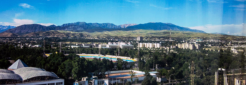 Dushanbe landscape |
___ Satellite View and Map of the City of Dushanbe (Душанбе), Tajikistan |
About Dushanbe
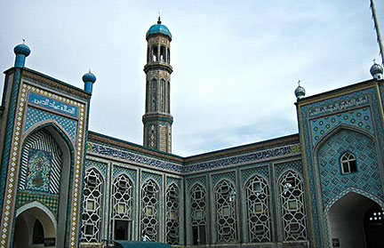 Grand Mosque in Dushanbe. Image: VargaA Dushanbe has a population of about 700,000 inhabitants. Official language is Tajik (a variant of Persian; Farsi) Russian is widely used. The map shows a city map of Dushanbe with expressways, main roads and streets, and the location of Dushanbe Airport (IATA code: DYU) southeast of the city. To find a location use the form below. |
|
| To find a location type: street or place, city, optional: state, country. |
Local Time Tajikistan:
Friday-July-31 12:01
Time zone: Tajikistan Time (TJT) :: UTC/GMT +5 hours |
|
φ Latitude, λ Longitude (of Map center; move the map to see coordinates): , |
||||||
| Google Earth: Searchable Map and Satellite view of Dushanbe, Republic of Tajikistan. City Coordinates: 38°32′12″N 68°46′48″E |
Bookmark/share this page |
|||||
| More about Tajikistan: Country: Tajikistan key statistical data. Continent: External Links: Dushanbe Official website of Dushanbe (in Tajik) Wikipedia: Dushanbe |
Weather Conditions Dushanbe
|
|
||||
Other Cities in South-Central Asia: Almaty, Ashgabat, Astana, Baku, Bishkek, Colombo, Dhaka, Islamabad, Kabul, Kathmandu, Male, New Delhi, Tashkent, Tehran, Thimphu |
||||||
Map Help [ show ] |
||||||
One World - Nations Online .:. let's care for this planet Promote that every nation assumes responsibility for our world. Nations Online Project is made to improve cross-cultural understanding and global awareness. More signal - less NOISE |
| Site Map
| Information Sources | Disclaimer | Copyright © 1998-2024:: nationsonline.org |

