Nations Online
All Countries in the World
|
One Planet Nations Online All Countries in the World | |
Home  |
___ Satellite View and Map of the City of Almaty (Алматы; Alma-Ata: Алма-Ата), Kazakhstan |
 Panoramic night view of Almaty from Kok-Tobe mountain. Image: Edgarpo01 |
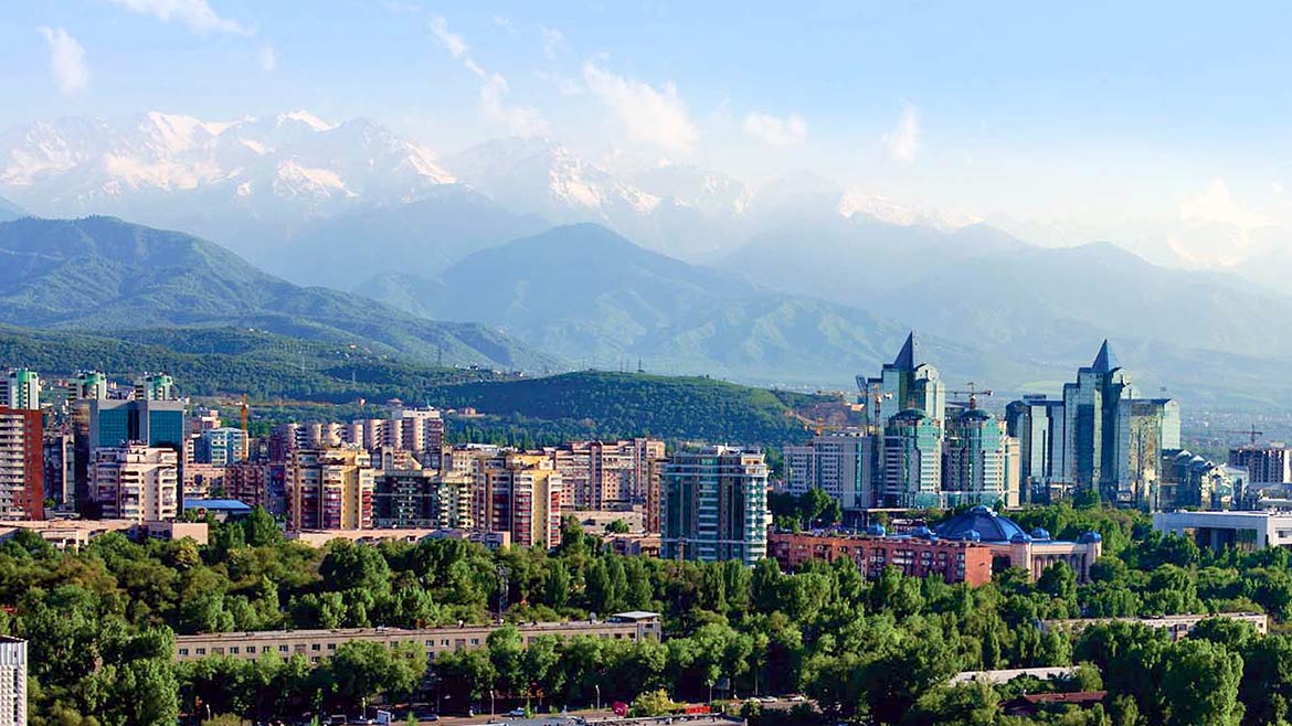
About Almaty Satellite view is showing Almaty, largest city and the former capital of Satellite view is showing Almaty, largest city and the former capital of  Cityscape Almaty with Ili Alatau mountains, part of the Northern Tian Shan mountain range in background. Founded in 1854 as a Russian military post, it was built on the site of a settlement destroyed by the Mongols in the 13th century. It became the capital of the Kazakh SSR in 1929 and capital of the independent state of Kazakhstan in 1991. In 1997, the capital was moved from Almaty to the more centrally located Astana. Today Almaty is Kazakhstan's largest metropolis with a population of about 2 million inhabitants. The city remains Kazakhstan's trading and cultural hub, Central Asia's largest museum, the Central State Museum of Kazakhstan is located in Almaty. Main sights in the city are, the Park of 28 Panfilov Guardsmen surrounding Zenkov Cathedral, The Golden Warrior (Independence Monument), Almaty Tower (a television and observation tower), Kok-Tobe (mountain), Sayran Lake (artificial lake and reservoir), Almaty Zoo, the Ile-Alatau National Park south of Almaty, Shymbulak (ski resort), the A. Kasteyev State Museum of Arts (largest art museum in Kazakhstan), the Astrophysical Observatories of Almaty (Fesenkov Astrophysical Institute), and the Kazakh Museum of Folk Musical Instruments. Capital city of Kazakhstan is Astana. Spoken languages are Kazakh (official) and Russian. The map shows a city map of Almaty with expressways, main roads and streets, zoom out to find the location of Almaty International Airport (IATA code: ALA), about 14 km (9 miles) by road north east of the center of Almaty. To find a location use the form below. To view just the map, click on the "Map" button. |
|
| To find a location type: street or place, city, optional: state, country. |
Local Time Almaty:
Friday-April-19 02:01
UTC/GMT +6 hours |
|
φ Latitude, λ Longitude (of Map center; move the map to see coordinates): , |
||||||
| Google Maps: Searchable map/satellite view of Almaty, Kazakhstan. City Coordinates: 43°16′39″N 76°53′45″E |
Bookmark/share this page
|
|||||
| More about Kazakhstan: Cities: Country: Kazakhstan key statistical data. Continent: |
Weather Conditions Almaty External Links: Almaty (official website) Almaty (visitors website) The Astana Times English-language Kazakhstan news. Wikipedia: Almaty Wikipedia entry Almaty. |
Related Consumer Information:
|
||||
| Other Cities in South-Central Asia: Ashgabat, Astana, Baku, Bishkek, Colombo, Dhaka, Dushanbe, Islamabad, Kabul, Kathmandu, Male, New Delhi, Tashkent, Tehran, Thimphu |
||||||
Map Help [ show ]  |
||||||
One World - Nations Online .:. let's care for this planet Promote that every nation assumes responsibility for our world. Nations Online Project is made to improve cross-cultural understanding and global awareness. More signal - less NOISE |
| Site Map
| Information Sources | Disclaimer | Copyright © 1998-2023 :: nationsonline.org |