Nations Online
All Countries in the World
|
One Planet Nations Online All Countries in the World | |
Home  |
___ Map/Satellite View of Kabul (کابل Kābul) |
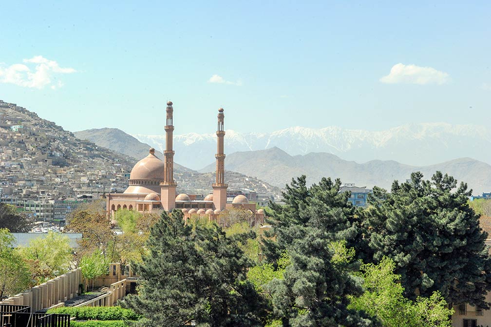
About Kabul Abdul Rahman Mosque in Kabul is the largest mosque in Afghanistan. Image: Daniel Wilkinson Today Kabul has a population of about 3.7 million inhabitants (in 2016). Kabul's population is mainly Dari speaking (local form of Persian). Some points of interest in the city are: Bala Hissar, an ancient fortress with a long bloody history, built in the 5th century, the fort is located on Kuh-e-Sherdarwaza hill. National Museum of Afghanistan (Kabul Museum), the museum's collection had been one of the most important in Central Asia, but with the start of the civil war in 1992, the museum was looted several times resulting in the loss of two-thirds of the 100,000 objects formerly on display. The Gardens of Babur (Bagh-e Babur), the historic park on the slopes of Kuh-e Sher Darwaza is also the last resting-place of the founder of the Mughal dynasty, first Mughal emperor Babur (Ziihir ad-Din Muhammad Biibur (1483-1530)). The Bagh-e Babur The map shows a city map of Kabul and the location of Kabul Airport (IATA code: KBL) situated in a distance of 16 km (9 miles) north of the city center. Just zoom in (+) to see the Presidential Palace, the Arg, the citadel serves as the office of Afghan's President. To find a location use the form below. |
|
| To find a location type: street or place, city, optional: state, country. | Local Time Afghanistan:
Thursday-April-25 09:25
Afghanistan Time Zone (AFT): UTC/GMT +4:30 hours |
|
φ Latitude, λ Longitude (of Map center; move the map to see coordinates): , |
||||||
| Google Maps: Map/Satellite View of the City of Kabul, Afghanistan. City Coordinates: 34°31′59″N 69°09′58″E |
Bookmark/share this page
|
|||||
| More about Afghanistan: Country: Afghanistan key statistical data. Continent: External Link: Wikipedia: Kabul |
Weather Conditions Kabul |
Related Consumer Information:
|
||||
Other Cities in South-Central Asia: Almaty, Ashgabat, Astana, Baku, Bishkek, Colombo, Dhaka, Dushanbe, Islamabad, Kathmandu, Male, New Delhi, Tashkent, Tehran, Thimphu |
||||||
Map Help [ show ]  |
||||||
One World - Nations Online .:. let's care for this planet Promote that every nation assumes responsibility for our world. Nations Online Project is made to improve cross-cultural understanding and global awareness. More signal - less NOISE |
| Site Map
| Information Sources | Disclaimer | Copyright © 1998-2023 :: nationsonline.org |