One World
Nations Online
Countries in the World
|
|
|
One World Nations Online Countries in the World | |
Home  |
___ Satellite View and Map of the City of Istanbul, Turkey |
 Panorama of the skyline of Istanbul, view from the site where the Bosporus meets the Sea of Marmara. Several landmarks of the city can be seen along their shores, including the Hagia Sophia, the Topkapı Palace, formerly a major residency of the Ottoman sultans, and the Dolmabahçe Palace, the main administrative center of the Ottoman Empire. Image: Ben Morlok |
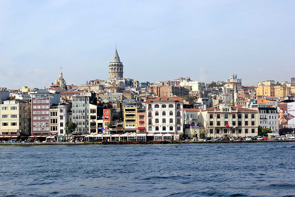
About IstanbulIstanbul is ranked as an Alpha World City, according to GaWC.  Istanbul highlights in one image: Topkapı Palace, Hagia Sophia (Ayasofya; the Church of the Holy Wisdom) and Sultanahmet Mosque, the Blue Mosque, are famous landmarks of Istanbul. In 73 AD Byzantium became a part of the Roman Empire. In 324 AD Constantine the Great became the emperor of the Roman Empire and he had plans to replace Byzantium for the new imperial capital of the empire. Constantine essentially rebuilt the city and called it Nova Roma (New Rome). It became the largest and wealthiest city in Europe for the next nine centuries, known as Constantinople. This wealth was an attraction. The capital of Christian civilisation was taken in 1204 by the Crusader armies of the Fourth Crusade, they looted, and destroyed large parts of Constantinople. The city never truly recovered from the devastation of the Fourth Crusade. In 1453 the Ottomans conquered the city after a month-long siege. Constantinople became the center of Ottoman power and the capital of the Ottoman Empie from 1453 until 1923. Since the 1950s the population of the city has increased tenfold, about 14 million people live today in Istanbul. Official language is Turkish. Istanbul is the only city in the world that lies in two continents. The only sea route between the Black Sea and the Mediterranean goes straight through the city, making its location really advantageous from a strategic point of view. The Historic Areas of Istanbul are a UNESCO World Heritage Site Istanbul Points of interest: Well known attractions: Hagia Sophia (formerly a Greek Orthodox Christian patriarchal basilica built in 537 AD, it was the the seat of the Ecumenical Patriarchate of Constantinople, made a mosque by the Ottomans in 1453, since 1935 a museum), Sultan Ahmed Mosque (also known as the 'Blue Mosque' built in the beginning of the 17th century by Sultan Ahmet I to reassert Ottoman power), Topkapı Palace (between the 15th and 19th century the court of the Ottoman empire with a large harem), Galata Tower (67-meter medieval stone tower offers a great panoramic view of the city) Other sights: Basilica Cistern (subterranean cathedral-size water supply reservoir capable of holding 80,000 cubic meters of water, built in the 6th century), Süleymaniye Mosque (16th-century mosque built by Suleiman the Magnificent, with gardens, a restaurant and a terrace with views over the Golden Horn, the famous inlet of the Bosporus) 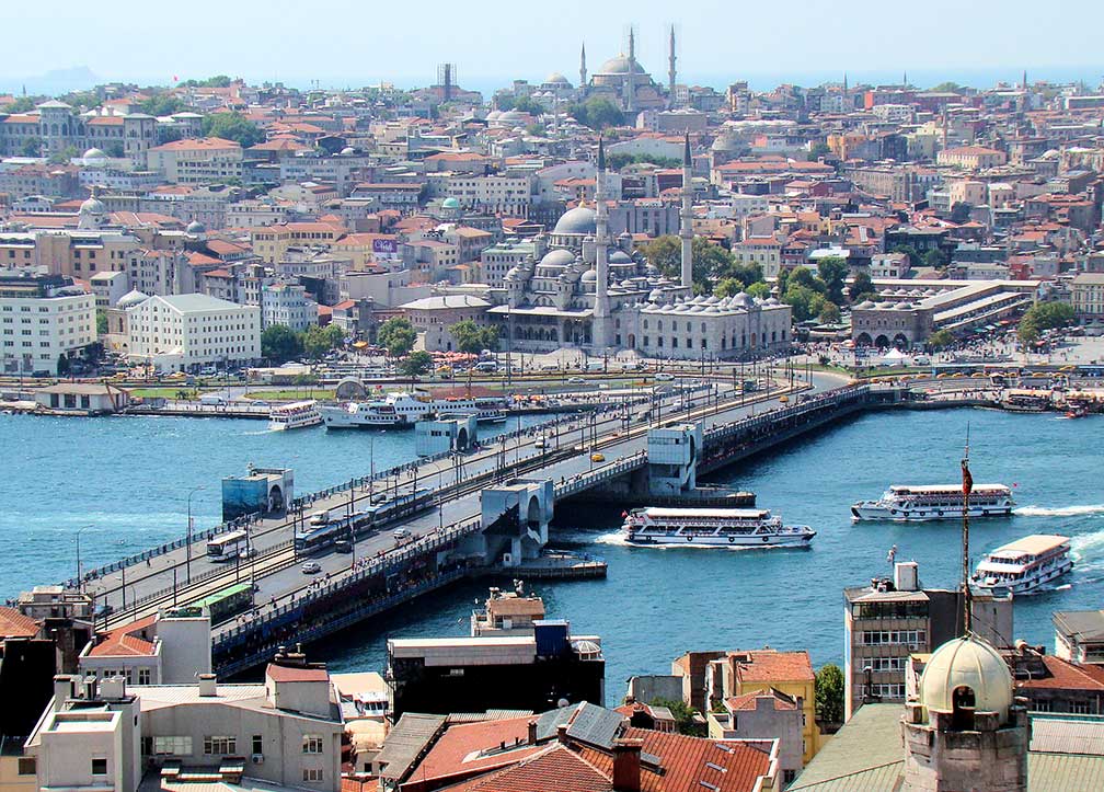 Galata Bridge Istanbul spanning the Golden Horn, view from Galata Tower. The mosque near the bridge is Yeni Cami (New Mosque). Image: Bjørn Christian Tørrissen Performing arts: Leyla Gencer Opera and Art Center, opera house in Istanbul. Parks: Emirgan Park (historical public urban park) Sports: Atatürk Olympic Stadium (first-class venue and the largest-capacity stadium in Turkey), Türk Telekom Arena (playground of the Süper Lig (Super League) club Galatasaray S.K.), Ülker Stadium (football stadium and the home of Fenerbahçe S.K. football club), Vodafone Arena (multi-purpose stadium and home of Beşiktaş J.K. football club) Just zoom in (+) to see Ayasofya (Ayasofya Meydanı Fatih (Hagia Sophia)) and neighboring Sultanahmet Mosque. The Map shows a city map of Istanbul with expressways, main roads and streets, zoom out to find the location of Atatürk International Airport (IATA Code: IST) which is located in west, and Sabiha Gökçen International Airport (IATA Code: SAW) 45 km (28 mi) by road, southeast of central Istanbul in the Asian part of the city. To find a location use the form below. To view just the map, click on the "Map" button. |
|
| To find a location type: street or place, city, optional: state, country. |
Local Time Istanbul:
Thursday-July-30 01:20
Standard time zone: Eastern European Time (EET) UTC/GMT +2 hoursDaylight saving time in use from end of March until end of October, time zone offset: UTC/GMT +3 hours |
One World - Nations Online .:. let's care for this planet Promote that every nation assumes responsibility for our world. Nations Online Project is made to improve cross-cultural understanding and global awareness. More signal - less NOISE |
| Site Map
| Information Sources | Disclaimer | Copyright © 1998-2024:: nationsonline.org |