Nations Online
All Countries in the World
Nations Online All Countries in the World | |
Home  |
___ Satellite View and Map of Alexandria (Al-Eskandariyya), Egypt |
 Alexandria Waterfront. Image: Francisco Anzola |
About the City of AlexandriaAlexandria is situated in the north central part of Egypt on the coast of the Mediterranean Sea. The city has a population of more than 4 million inhabitants. Official language is Arabic. History (short version) 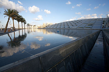 Front of the Bibliotheca Alexandrina in Alexandria The "New" Library of Alexandria is a major library and a cultural center, the library is both, a commemoration of the ancient Library of Alexandria that was lost in antiquity, and an attempt to rekindle something of the brilliance that this early center of study and education represented. Image: © Carsten Whimster Alexander's successors built the seaport into a center of trade between Europe and the East, surpassing Carthage in size and importance. The library at Alexandria held the greatest collection of books in the world. The great library suffered destruction through a series of fires and attacks, and in a.d. 215 a general massacre of the city’s population was ordered by the Roman emperor Caracalla. Alexandria became a major Christian theological center but found itself increasingly isolated from the rest of Egypt. When the Roman Empire began to disintegrate in the third century, the city began a speedy decline. The Map shows a city map of Alexandria with expressways, main roads and streets, and the location of Alexandria International Airport (ALY), currently Alexandria's busiest airport, zoom out to (-) find Borg al Arab Airport (IATA code: HBE) located about 40 km (25 mi) southwest of the city center. Borg El Arab Airport is today the principal airport of Alexandria, all traffic has been transferred from Alexandria International Airport which is closed for two years for major renovation. |
|
| To find a location type: street or place, city, optional: state, country. |
Local Time Alexandria:
Friday-July-31 02:59
Standard time zone is Eastern European Time (EET): UTC/GMT +2 hoursEgypt does not observe Daylight Saving Time (DST) since 2011 |
One World - Nations Online .:. let's care for this planet Promote that every nation assumes responsibility for our world. Nations Online Project is made to improve cross-cultural understanding and global awareness. More signal - less NOISE |
| Site Map
| Information Sources | Disclaimer | Copyright © 1998-2024:: nationsonline.org |

