
One World
Nations Online
Countries in the World
 |
|
 One World Nations Online Countries in the World | |
Home  |
___ Satellite View and Map of Athens - (Greek: Αθήνα, Athina) |
 Athens cityscape from the Odeon of Herodes Atticus, a stone theatre structure located on the southwest slope of the Acropolis of Athens. Image: Mstyslav Chernov |
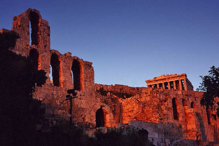
About Athens Satellite view is showing Athens (Αθήνα), largest city and the national capital of Satellite view is showing Athens (Αθήνα), largest city and the national capital of  The Acropolis, the Parthenon and the Odeon of Herodes Atticus during sunset, Athens, Greece. Image: Aaron Logan. Athens was a powerful flourishing city-state in ancient Greece, it was an important cultural center in the 5th century B.C.. The city is named after Athena, the Greek goddess of wisdom. Athens was chosen as the capital of a newly independent Greece in 1834. Today Athens is still the center of the cultural, economical, financial, industrial, and political life in Greece. The city has has a population of about 3.8 million inhabitants in its metropolitan area. The Map shows a city map of Athens with expressways, main roads and streets, zoom out to find Eleftherios Venizelos International Airport (IATA code: ATH), located about 20 km (12 mi) to the east of Athens' city center and Ellinikon International Airport about 7 km (4.3 mi) south of Athens. To find a location use the form below. To view the map, click on the "Map" button. |
|
| To find a location type: street or place, city, optional: state, country. |
Local Time Athens:
Tuesday-April-23 19:01
Standard Time Zone (EET): UTC/GMT +2 hoursDaylight Saving Time in use from end of March until end of October: time zone offset: UTC/GMT +3 hours |
|
φ Latitude, λ Longitude (of Map center; move the map to see coordinates): , |
||||||
| Google Earth: Searchable map/satellite view of Athens, Greece. City Coordinates: 37°58′N 23°43′E |
Bookmark/share this page
|
|||||
| More about Greece: Landmarks: Country: Cyprus: Continent: Political Map of the Mediterranean Region. Political Map of the Balkans. |
Weather Conditions Athens External Links: City of Athens (official website) Wikipedia: Athens Wikipedia entry Athens, Greece. |
Related Consumer Information:
|
||||
Other Cities on the Balkan Peninsula Belgrade, Bucharest, Constanţa, Istanbul, Ljubljana, Podgorica, Sarajevo, Skopje, Sofia, Tirana, Zagreb Other Cities in the Mediterranean Barcelona, Cannes, Florence, Istanbul, Lisbon, Madrid, Marseille, Monaco, Milan, Naples, Nice, Rome, San Marino, Tirana, Valletta, Vatican City, Venice, Zagreb Alexandria, Algiers, Beirut, Benghazi, Cairo, Jerusalem, Nicosia, Tobruk, Tripoli, Tunis, Tel Aviv Maps of other Countries in Southern Europe Croatia Map, Cyprus Map, Greece Map, Italy Map, Macedonia Map, Vatican City State Map Montenegro Map, Portugal Map, Serbia Map, Slovenia Map, Spain Map, Turkey Map Searchable Maps of other Countries in Southern Europe Croatia, Cyprus, Greece, Italy, Macedonia, Vatican City State Montenegro, Portugal, Serbia, Slovenia, Spain, Turkey Profiles of other Countries in Southern Europe Croatia, Cyprus, Greece, Italy, Macedonia, Vatican City State Montenegro, Portugal, Serbia, Slovenia, Spain, Turkey |
||
Map Help [ show ]  |
||
One World - Nations Online .:. let's care for this planet Promote that every nation assumes responsibility for our world. Nations Online Project is made to improve cross-cultural understanding and global awareness. More signal - less NOISE |
| Site Map
| Information Sources | Disclaimer | Copyright © 1998-2023 :: nationsonline.org |