Advertising

Cameroon Flag detail
Home Earth Continents Europe Portugal Country Profile Map of Portugal

Maps Index

Map of Portugal


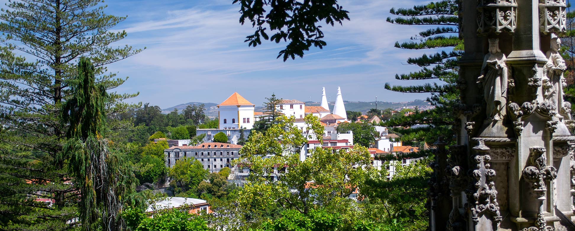
Palace of Sintra as seen from the Quinta da Regaleira
The Palace of Sintra as seen from the Quinta da Regaleira. The Cultural Landscape of Sintra is a UNESCO World Heritage Site in Portugal.
Image: kk nationsonline.org


About Portugal


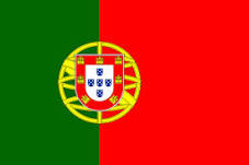
Portugal Flag
The map shows Portugal, officially the Portuguese Republic (Portuguese: República Portuguesa), a sovereign state in southwestern Europe. It comprises the continental part of Portugal on the western coast of the Iberian peninsula and the archipelagos of Madeira and the Azores in the Atlantic Ocean. The most western European state is only bordered by one other country, Spain. Additionally, Portugal shares a maritime border with Morocco.

With an area of 92,090 km², compared, Portugal is slightly smaller than Hungary (93,028 km²), or the U.S. state of Indiana.

Portugal has a population of 10.3 million people (in 2019); the capital and largest city is Lisbon, with about 500,000 inhabitants.

The official language is Portuguese.


Political Map of Portugal

Political Map of Portugal

The map shows Portugal and a portion of neighboring Spain with international borders, the national capital Lisbon, governorate capitals, major cities, main roads, railroads, and major airports.

You are free to use the above map for educational purposes (fair use); please refer to the Nations Online Project.


More about Portugal


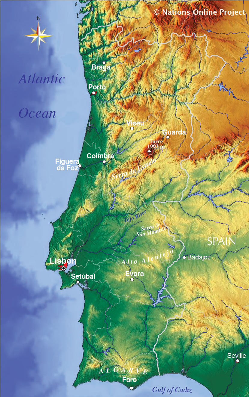
Topographic map of Portugal
Topographic map of Portugal.
Map: nationsonline.org


Portugal's Main Geographical Regions

Mountains
The cooler and rainier northern part of the country to the north of the city of Castelo Branco is, apart from the coastal areas, mostly mountainous with elevations up to almost 2000 m in the Serra da Estrela. Torre, a peak within the mountain range at 1,993 m (6,539 ft), is the highest point in Mainland Portugal.

The southern part of the country, which extends as far as the Algarve, consists mostly of rolling plains and has a climate somewhat warmer and drier than in the north.

Rivers:
Portugal's main rivers are the Douro river with its tributary, the Tamega river. The Rio Minho, which forms part of the Spanish/Portuguese border in the northwest. Rio Mondego is the longest river that flows exclusively in Portuguese territory, and the Tagus (Rio Tejo), the longest river on the Iberian Peninsula.


Coastal areas:
Algarve
The southernmost province of Portugal, on the Atlantic coast with its capital, Faro is a major tourist destination in Europe.

Costa Vicentina
The Southwestern Alentejo and Vicentine Coast Nature Park in Alentejo and Algarve's regions in southern Portugal features an outstanding coastal scenery with cliffs and beaches.

Islands:
The island of Madeira is located in the Atlantic Ocean, 520 km off the northwest African coast. The group of islands constitutes an autonomous region of Portugal. 290,000 people live on the Madeira (est. 2019). The capital city is Funchal. The island is a popular year-round destination, visited by about one million people every year, contributing 20% of the region's GDP.

Azores - Ilhas dos Açores
The Azores are a group of nine volcanic islands in the Atlantic Ocean, located about 1,500 km west of Portugal, 255,000 people (est. 2019) people live on the islands. The archipelago is in Portuguese possession but partially autonomous. The largest city and the capital is Ponta Delgada on the island of São Miguel.


Cities and Towns in Portugal:

The map shows the location of following Portuguese cities:

Largest Cities (pop. 2013) after Lisbon are Porto (Oporto), Portugal's second city and capital of the District of Porto, 2 million people live in Porto's metropolitan area.

Vila Nova de Gaia is located opposite Porto at Douro River (population 180,000; part of Porto Metropolitan Area).

Amadora (pop. 177,000) is a city and municipality in Lisbon Metropolitan Area.

Braga (pop.: 175,000), capital of Braga District.

Agualva-Cacém (90,000) is a city in the municipality of Sintra in the Lisbon Metropolitan Area.


Other cities in Portugal depicted on the map:
Albufeira, Alcácer do Sal, Alfena Vila Nova de Gaia, Alijó, Aljezur, Aljustrel, Almodôvar, Alverca, Amadora, Aveiro, Barcelos, Barreiro, Beja, Bragança, Caldas da Rainha, Cascais, Castelo Branco, Castro Daire, Castro Verde, Chaves, Coimbra, Covilha, Elvas, Entroncamento, Espinho, Évora, Fafe, Faro, Fátima, Ferreira do Alentejo, Figueira da Foz, Funcheira, Gondomar, Grãndola, Guarda, Guimarães, Ílhavo, Lagos, Leiria, Loures, Maia, Marinha Grande, Matosinhos, Monchique, Monforte, Montemor-o-Novo, Moura, Odivelas, Oeiras, Ourém, Ovar, Paredes, Pedroso, Peniche, Pinhal Novo, Pinhão, Pocinho, Pombal, Portalegre, Portimão, Porto, Póvoa de Varzim, Redondo, S. Joao da Madeira, Santa Maria da Feira, Santarém, Santiago do Cacém, Seixal, Setúbal, Sines, Tavira, Tomar, Tondela, Torre de Moncorvo, Torres Vedras, Vagos, Valença, Valpaços, Viana do Castelo, Vila Flor, Vila Franca de Xira, Vila Real, Vila Real de Santo António, Vinhais, and Viseu.


Bookmark/share this page
  Instagram button

Weather Conditions Lisbon:

LISBON WEATHER


Advertisements:


Maps of other Countries in Southern Europe
Albania Map, Croatia Map, Cyprus Map, Greece Map, Italy Map, Macedonia Map
Montenegro Map, Serbia Map, Slovenia Map, Spain Map, Turkey Map, Vatican City State Map 
up