
One World
Nations Online
Countries in the World
 |
|
 One World Nations Online Countries in the World | |
Home  |
___ Satellite View and Map of the City of Lisbon (Lisboa), Portugal |
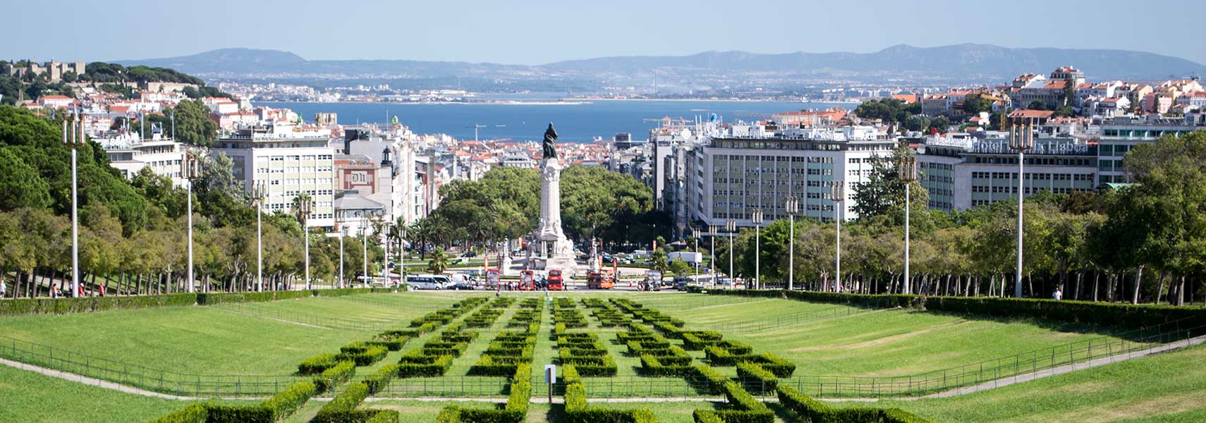
 The central lane of Eduardo VII Park (Miradouro do Parque Eduardo VII), with Lisbon's Marquess of Pombal Square in center and the Tagus river in the background. Image: kk - nationsonline.org |
About Lisbon
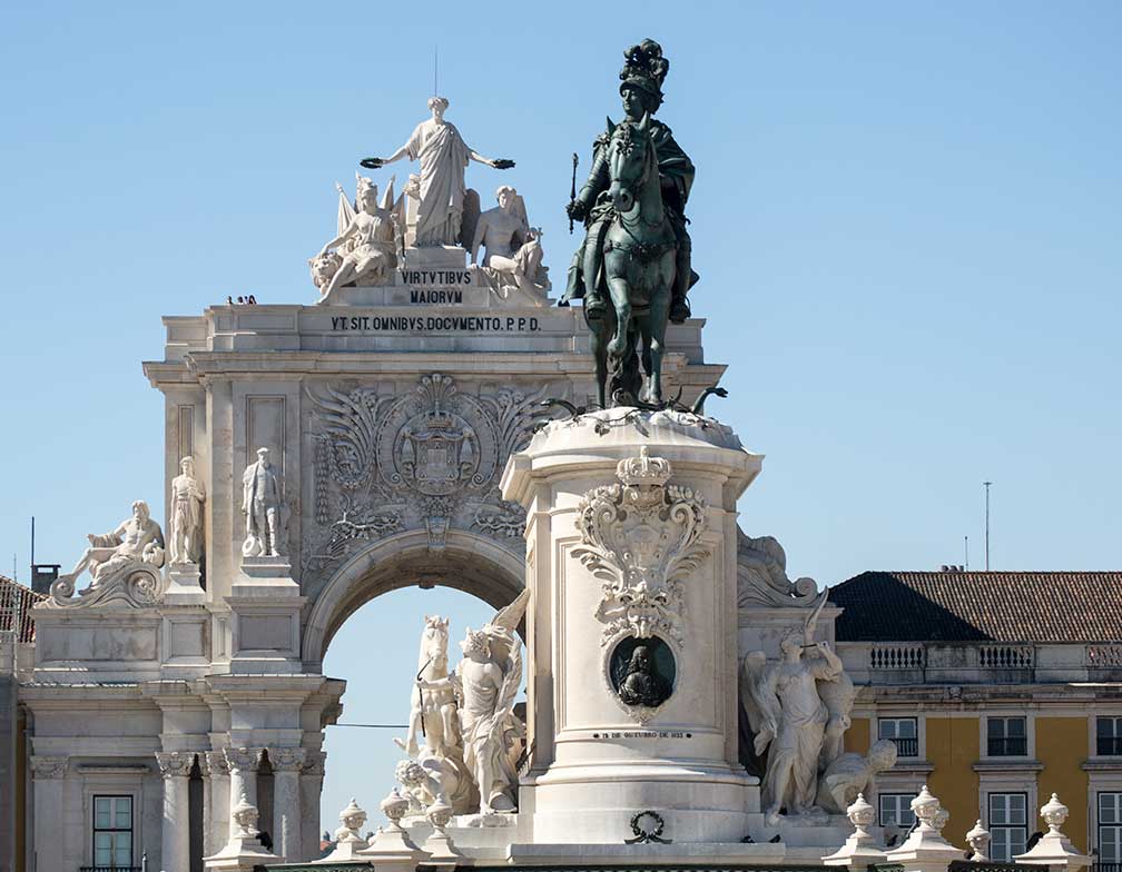
 Praça do Comércio (Commerce Square), Lisbon with the equestrian statue of King José I, Rua Augusta Arch in background. Image: © kk - nationsonline.org It is the westernmost city in continental Europe. Greater Lisbon (Grande Lisboa) is the major political, economic and cultural center of Portugal and offers a wide variety of options for visitors, including historical sites, city-life, beaches, countryside, mountains and other areas of interest only a few kilometres away from the city center. Lisbon has a populaton of about 550,000 people, 2.8 million live in the metropolitan area. Official language is Portuguese. Just zoom in (+) to see São Bento Palace (Saint Benedict's Palace), which houses the Portuguese parliament. The Map shows a city map of Lisbon with expressways, main roads and streets, Lisbon Portela Airport (Aeroporto de Lisboa; IATA Code: LIS) is situated in north, by road via Avenida Almirante Reis and Avenida Almirante Gago Coutinho, by metro with the Red Line. To find a location use the form below. To view just the map, click on the "Map" button. |
|
| To find a location type: street or place, city, optional: state, country. |
Local Time Portugal:
Sunday-April-14 15:01
Standard time zone: Western European Time (WET), no UTC/GMT offsetDaylight saving time in use from end of March until end of October, time zone offset: UTC/GMT +1 hour |
|
φ Latitude, λ Longitude (of Map center; move the map to see coordinates): , |
||||||
| Google Maps: Searchable map/satellite view of the City of Lisbon (Lisboa), Portugal. City Coordinates: 38°42′25.11″N 9°8′7.75″W |
Bookmark/share this page
|
|||||
| More about Portugal: Country: Continent: Political Map of the Mediterranean Region. External Links: Câmara Municipal de Lisboa Lisboa Municipality website (in Portuguese). Visit Lisboa Official tourism web site of the city. Wikipedia: Lisbon Wikipedia article about Lisbon. |
Weather Conditions Lisbon |
Explore More:
Related Consumer Information:
|
||||
Cities in the Mediterranean Athens, Barcelona, Florence, Istanbul, Ljubljana, Madrid, Monaco, Milan, Naples, Rome, San Marino, Tirana, Valletta, Vatican City, Venice, Zagreb Alexandria, Algiers, Beirut, Benghazi, Cairo, Jerusalem, Nicosia, Tripoli, Tunis, Tel Aviv Maps of other Countries in Southern Europe Croatia Map, Cyprus Map, Greece Map, Italy Map, Macedonia Map, Vatican City State Map Montenegro Map, Portugal Map, Serbia Map, Slovenia Map, Spain Map, Turkey Map Searchable Maps of other Countries in Southern Europe Andorra, Croatia, Cyprus, Greece, Italy, Macedonia, Vatican City State Montenegro, Portugal, Serbia, Slovenia, Spain, Turkey Profiles of other Countries in Southern Europe Andorra, Croatia, Cyprus, Greece, Italy, Macedonia, Vatican City State Montenegro, Portugal, Serbia, Slovenia, Spain, Turkey |
||||||
Map Help [ show ]  |
||||||
One World - Nations Online .:. let's care for this planet Promote that every nation assumes responsibility for our world. Nations Online Project is made to improve cross-cultural understanding and global awareness. More signal - less NOISE |
| Site Map
| Information Sources | Disclaimer | Copyright © 1998-2023 :: nationsonline.org |