Nations Online
All Countries in the World
|
One Planet Nations Online All Countries in the World | |
Home  |
___ Satellite View and Map of the City of Ljubljana, Slovenia |
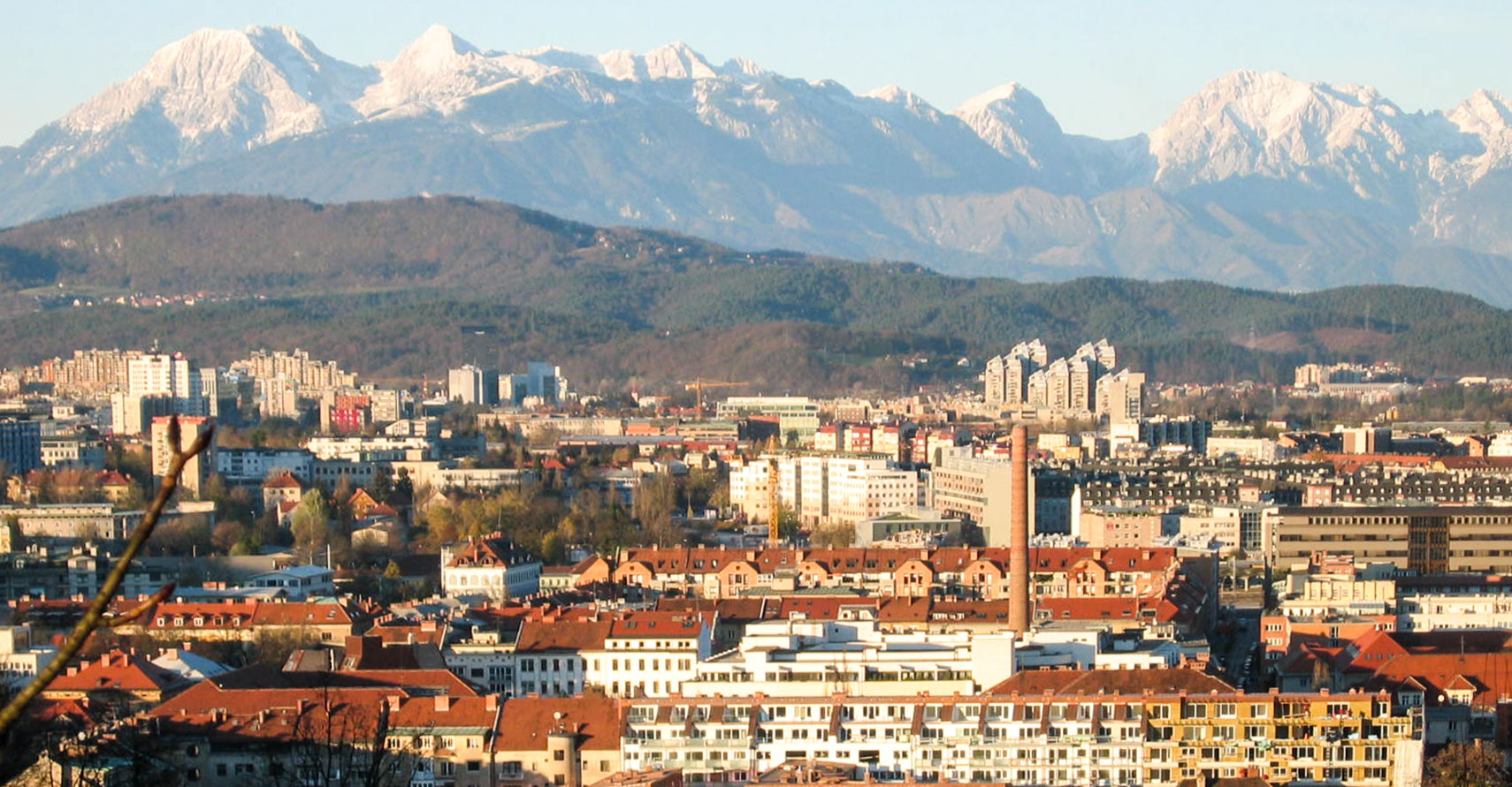
 City of Ljubljana with the Alps in the background. Image: Žiga |
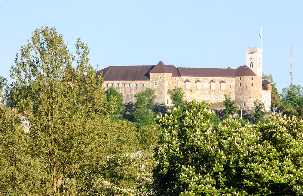
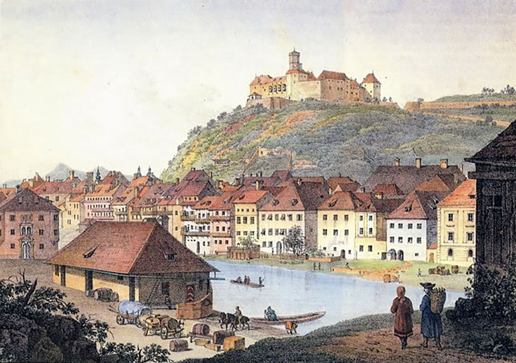
About Ljubljana Satellite view is showing Ljubljana, since 1991 the national capital of Satellite view is showing Ljubljana, since 1991 the national capital of  Ljubljana Castle the iconic fortress in the center of Slovenia's capital. The settlement was located at a major trade route between the northern Adriatic Sea and the Danube region. The Ljubljanica river played an important role as a transport route for the trade between the city and the rest of the region. In the Middle Ages the town was the historical capital of Carniola, then part of Austria-Hungary, and known as Laibach in German.  A painting of historical Ljubljana in the 18th century. The city is the educational center of the nation, home to the University of Ljubljana Just zoom in (+) to see Ljubljana Castle, the medieval castle is built on Castle Hill in the center of the city, one of Ljubljana's main tourist attractions. The map shows a city map of Ljubljana with expressways, main roads and streets, zoom out to find the location of Ljubljana Jože Pučnik Airport To find a location use the form below. To view just the map, click on the "Map" button. |
|
| To find a location type: street or place, city, optional: state, country. |
Local Time Ljubljana:
Tuesday-April-23 04:20
Standard Time Zone (CET): UTC/GMT +1 hourCEST (Daylight Saving Time) in use from end of March until end of October. Time zone offset: UTC/GMT +2 hours |
|
φ Latitude, λ Longitude (of Map center; move the map to see coordinates): , |
||||||
| Google Maps: Searchable map/satellite view of Ljubljana, capital city of Slovenia City Coordinates: 46°3′5″N 14°30′20″E |
Bookmark/share this page
|
|||||
| More about Slovenia: Country: Key statistical data of Slovenia. Continent: Political Map of the Mediterranean Region. Political Map of the Balkans. External Links: Ljubljana Official web site of the City of Ljubljana. Visit Ljubljana Official city guide. Wikipedia: Ljubljana Wikipedia article about Ljubljana. |
Ljubljana Weather Conditions: |
Explore more:
Related Consumer Information:
|
||||
Other Cities on the Balkan Peninsula Athens, Belgrade, Bucharest, Constanţa, Istanbul, Podgorica, Sarajevo, Skopje, Sofia, Tirana, Zagreb Other Cities in the Mediterranean Barcelona, Cannes, Florence, Istanbul, Lisbon, Madrid, Monaco, Milan, Naples, Nice, Rome, San Marino, Tirana, Valletta, Vatican City, Venice, Sarajevo,Tirana Alexandria, Algiers, Beirut, Benghazi, Cairo, Jerusalem, Nicosia, Tobruk, Tripoli, Tunis, Tel Aviv Maps of other Countries in Southern Europe Croatia Map, Cyprus Map, Greece Map, Italy Map, Macedonia Map, Vatican City State Map Montenegro Map, Portugal Map, Serbia Map, Slovenia Map, Spain Map, Turkey Map Searchable Maps of other Countries in Southern Europe Croatia, Cyprus, Greece, Italy, Macedonia, Vatican City State Montenegro, Portugal, Serbia, Slovenia, Spain, Turkey Profiles of other Countries in Southern Europe Croatia, Cyprus, Greece, Italy, Macedonia, Vatican City State Montenegro, Portugal, Serbia, Slovenia, Spain, Turkey |
||||||
Map Help [ show ]  |
||||||
One World - Nations Online .:. let's care for this planet Promote that every nation assumes responsibility for our world. Nations Online Project is made to improve cross-cultural understanding and global awareness. More signal - less NOISE |
| Site Map
| Information Sources | Disclaimer | Copyright © 1998-2023 :: nationsonline.org |