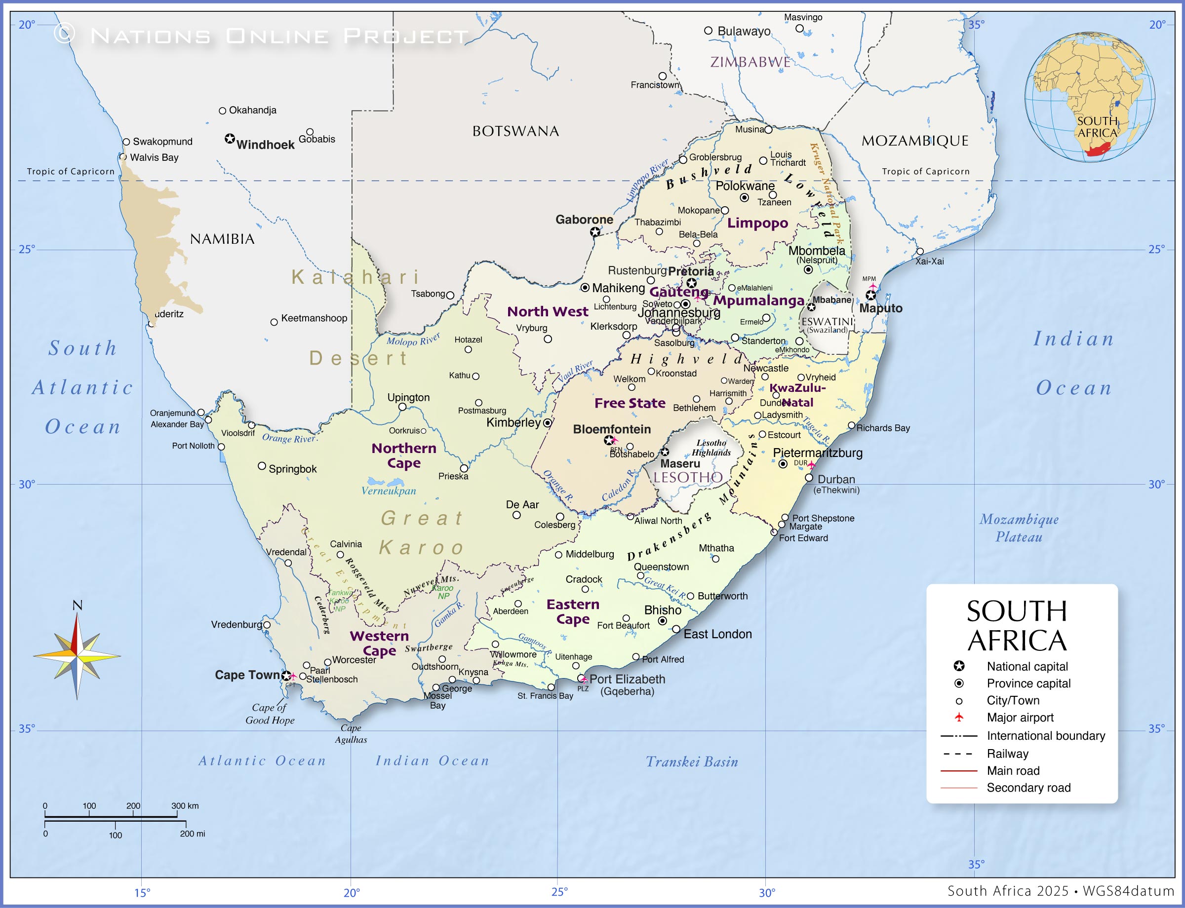
The map shows South Africa's administrative divisions. The country is divided into nine provinces, each with its own legislature and executive council.
These provinces are in alphabetical order: Eastern Cape, Free State, Gauteng, KwaZulu-Natal, Limpopo, Mpumalanga, Northern Cape, North West, and Western Cape.
Map of the administrative units of South Africa
Administrative Map of South Africa's provinces.
Depicted on the map is Southern Africa with the administrative divisions of South Africa, surrounding countries, international borders, provincial capitals, and major cities. The map also shows the location of the country's three national capitals: the administrative capital, Pretoria; the legislative capital, Cape Town; and the judicial capital, Bloemfontein.
You are free to use the above map for educational and similar purposes; if you publish it online or in print, you need to credit the Nations Online Project as the source.
More about South Africa's provinces
The Boardwalk entertainment complex in Port Elizabeth (Gqeberha), Eastern Cape.
Photo: flowcomm
The nine provinces of South Africa in their current form have existed since 27 April 1994, the date of the first non-racial elections and the adoption of the Interim Constitution (it was superseded by the final Constitution on 4 February 1997).
The provinces in alphabetical order are Free State, Gauteng, KwaZulu-Natal, Limpopo, Mpumalanga, Northern Cape, North West, and Western Cape.
Eastern Cape
(Transkei)
The Eastern Cape is located on the southeastern seaboard of South Africa. It is the country's second-largest province, covering an area of 168,966 km², and is home to about 7.2 million people. Nearly 80% of the population speaks IsiXhosa, followed by Afrikaans (10.6%) and English (5.6%).
The capital is Bhisho, while the largest city is Gqeberha (formerly Port Elizabeth). Major airports are located in Port Elizabeth, East London, Mthatha, and Bhisho. East London and Port Elizabeth also serve as the province's main port cities.
The Eastern Cape is the heartland of the Xhosa people, one of South Africa's largest ethnic groups. The province is culturally vibrant, with deep-rooted traditions, language, and music, especially in rural communities.
The Eastern Cape played a key role in the country's liberation history and is the birthplace of leaders like Nelson Mandela and Steve Biko. The Eastern Cape Province was established in 1994, incorporating areas from the former Xhosa homelands of Transkei and Ciskei, along with parts of the old Cape Province.
Free State
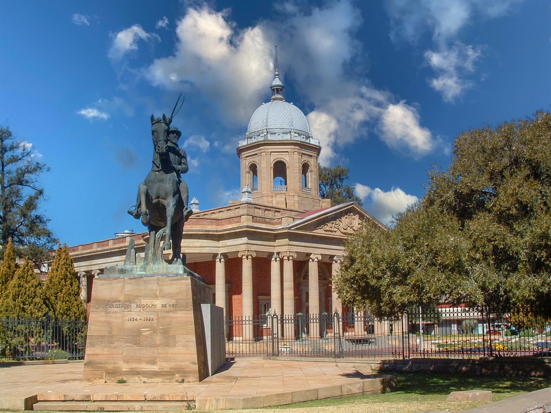
Free State's parliament building, the "Vierde Raadsaal" in Bloemfontein, South Africa. An equestrian monument of Christiaan de Wet, a Boer general, rebel leader and politician, in the foreground. Photo: Anne97432
The Free State is a landlocked province located in the center of South Africa. Formerly known as the Orange Free State (Afrikaans: Oranje Vrystaat).
The central province covers an area of 129,825 km² and is home to around 3 million people (in 2024).
The capital is Bloemfontein, which also serves as the judicial capital of South Africa. Other major towns and urban centers include Botshabelo, Welkom, Kroonstad, Sasolburg, and Bethlehem.
The largest ethnic group in the Free State is the Sesotho-speaking Basotho people. Sesotho is spoken by around two-thirds of the population. Other languages spoken are Afrikaans (12.7%) and isiXhosa (7.5%). The province's other ethnic groups include Afrikaners, Xhosa, and Coloured South Africans. The population of the Free State reflects a mixture of cultures shaped by history and geography.
Landscape and Economy
The northwestern part of the Free State lies within the Highveld, a high-altitude grassland plateau, while the southwestern corner borders the Great Karoo, a vast semi-arid region known for its rugged terrain and sparse vegetation. To the northeast are the foothills of the Drakensberg Mountains.
Free State's economy is based on agriculture and mining. The province is known as South Africa's "breadbasket"; it is the leading producer of maize and also grows sunflowers, wheat, and potatoes. Cattle farming is widespread. In the Welkom–Virginia–Odendaalsrus area, gold mining remains a significant economic activity, though it has declined in recent decades. The petrochemical industry around Sasolburg is also important.
History and Identity
Historically, the Free State was an independent Boer republic in the 19th century before becoming part of the Union of South Africa in 1910. It was renamed simply Free State after the end of apartheid in 1994. The province is deeply linked to both Afrikaner and Basotho heritage and remains a place where language, tradition, and land are closely intertwined. Its central location has made it a crossroads of South African history, with influences from the neighboring provinces and the Kingdom of Lesotho.
Gauteng
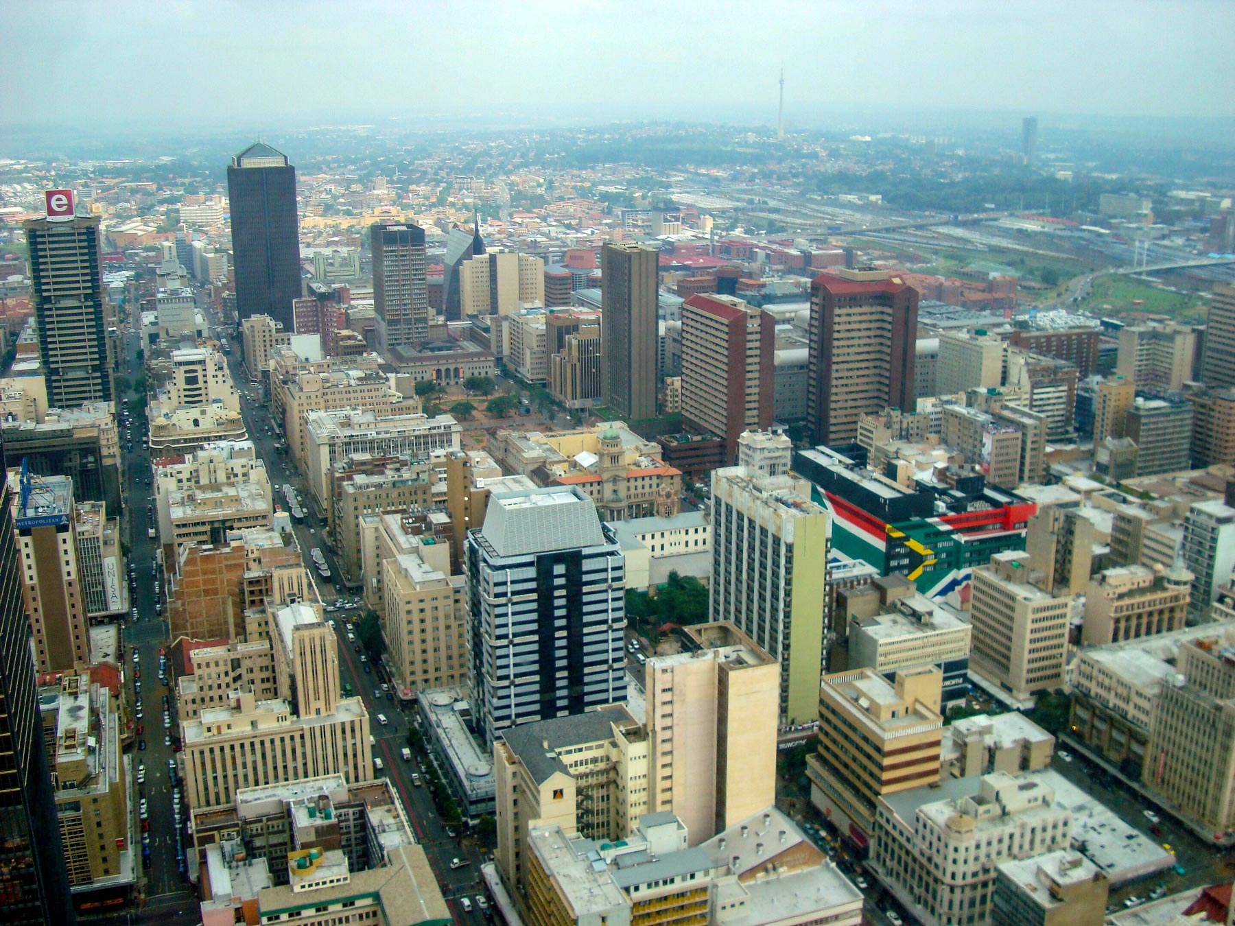
View from the Carlton Centre, a 50-storey skyscraper and shopping center on Commissioner Street in central Johannesburg. Photo: Adamina
With an area of only about 17,000 km², Gauteng is South Africa's smallest province, but also the most densely populated and economically vital. The name Gauteng, in the seSotho languages, means "Place of Gold," referring to the region's rich gold deposits. Most of the province lies on the Highveld, a flat to gently rolling plateau covered by grasslands.
Gauteng is the country's economic and financial hub. It is home to Johannesburg, South Africa's largest city and the provincial capital, and to Pretoria, the nation's administrative capital. Other major urban centers include Midrand, Vanderbijlpark, and Sandton.
Gauteng has a population estimated between 15 and 16 million people (2025), with approximately 5.5 million in Johannesburg and 2.8 million in Pretoria. The majority of the population is Black African, including Zulus, Xhosas, Sothos, and Tswanas. Principal languages are isiZulu (19.8%), English (13.3%), and Afrikaans (12.4%).
Gauteng is a cultural melting pot, known for its vibrant arts scene, music, and theater, especially in Johannesburg's Maboneng and Newtown districts.
Despite its urban sprawl, the province preserves pockets of green space, including botanical gardens, nature reserves, and the Cradle of Humankind, Fossil Hominid Sites of South Africa, a UNESCO World Heritage Site northwest of Johannesburg.
KwaZulu-Natal
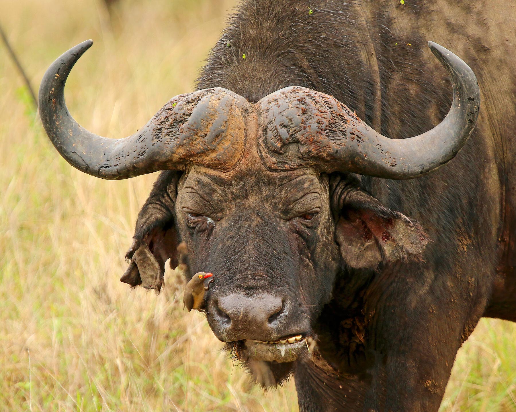
Besties. An African buffalo and an Oxpecker in Phinda Private Game Reserve in KwaZulu-Natal. Photo: Charles J. Sharp
KwaZulu-Natal, also known as "the Garden Province," is the ancestral home of the Zulu nation. It is located in the southeastern part of South Africa, south of Mpumalanga. The province is bounded by the Indian Ocean to the east and shares borders with Mozambique and the Kingdom of Eswatini (formerly Swaziland).
KwaZulu-Natal has a population of estimated 12.8 million people. The capital is Pietermaritzburg; the largest city and South Africa's chief port is Durban. The main languages spoken are Zulu (80.0%), English (14.4%), and Xhosa (3.1%).
KwaZulu-Natal's territory offers diverse landscapes. Along the Indian Ocean lies the coastal plain, known for its beaches, coastal dunes, and subtropical vegetation. Inland, the terrain rises gradually through undulating hills and a broad plateau. The Drakensberg Escarpment forms the western portion of KwaZulu-Natal. This mountainous region includes Mafadi, South Africa's highest peak at 3,446 meters. Just 30 km to the south is Thabana Ntlenyana, the highest mountain in Lesotho, at 3,482 meters.
KwaZulu-Natal was formed in 1994 when the Zulu homeland of KwaZulu ("Place of the Zulu" in Zulu) was merged with the former Natal Province.
KwaZulu-Natal is the cultural heartland of the Zulu people, where traditional leadership, rituals, and oral history continue to shape identity alongside modern urban life.
Ecologically, the province is rich in biodiversity, home to subtropical forests, coastal wetlands, and wildlife reserves, including the iSimangaliso Wetland Park, a UNESCO World Heritage Site.
Limpopo
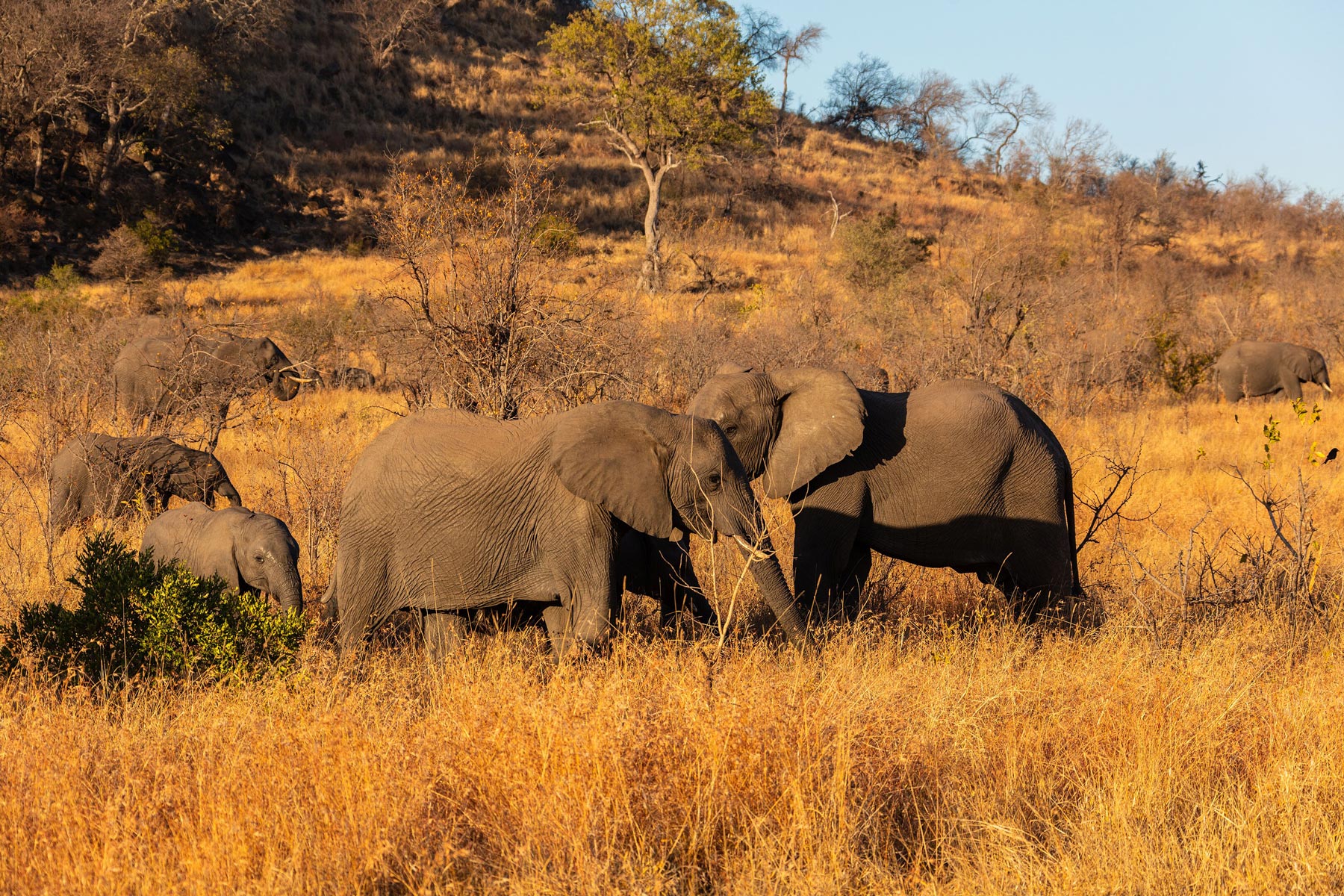
African bush elephants in Kruger National Park, South Africa. As you can see, the animals are well adapted to their surroundings in terms of color. Photo: Diego Delso
Limpopo is South Africa's northernmost province. It is named after the Limpopo River, one of South Africa's major rivers. The Limpopo forms the province's western and northern borders with Botswana and Zimbabwe, respectively. To the east, Limpopo province shares a border with Mozambique. Much of western Limpopo is covered by the Bushveld, a subtropical woodland ecoregion known for its open savanna landscapes. Toward the Mozambican border in the east lie the lower-lying areas of the Lowveld, a hot and humid region closer to the coastal plains of Mozambique. Within the Lowveld is Kruger National Park, one of Africa's largest and most iconic game reserves. The park is renowned for its rich biodiversity and for being home to the "Big Five": lion, leopard, elephant, rhino, and buffalo.
The capital and largest city of Limpopo is Polokwane (formerly Pietersburg). Other major urban centers include Bela-Bela (previously Warmbad), Lephalale (Ellisras), Makhado (Louis Trichardt), Musina (Messina), Thabazimbi, and Tzaneen.
Limpopo is home to around 5.4 million people. The main languages spoken in the province are Pedi (55.5%), Venda (17.4%), and Tsonga (17.3%). The province was established in 1994 after the end of apartheid, initially named the Northern Province. Before that, it was part of the Northern Transvaal. In 2003, it was renamed Limpopo Province, after the Limpopo River.
Limpopo is one of South Africa's most culturally diverse provinces, home to the Pedi (Northern Sotho), Venda, and Tsonga peoples, each with distinct languages, traditions, and artistic heritage.
Economically, Limpopo is rich in natural resources. It is a major center for mining, producing platinum, chromium, coal, and diamonds.
Agriculture also plays a vital role. Limpopo produces 75% of the country's mangoes, 65% of its papayas, 36% of its tea, 25% of its citrus, bananas, and litchis; 60% of its avocados; and two-thirds of its tomatoes. [gov.za]
Mpumalanga
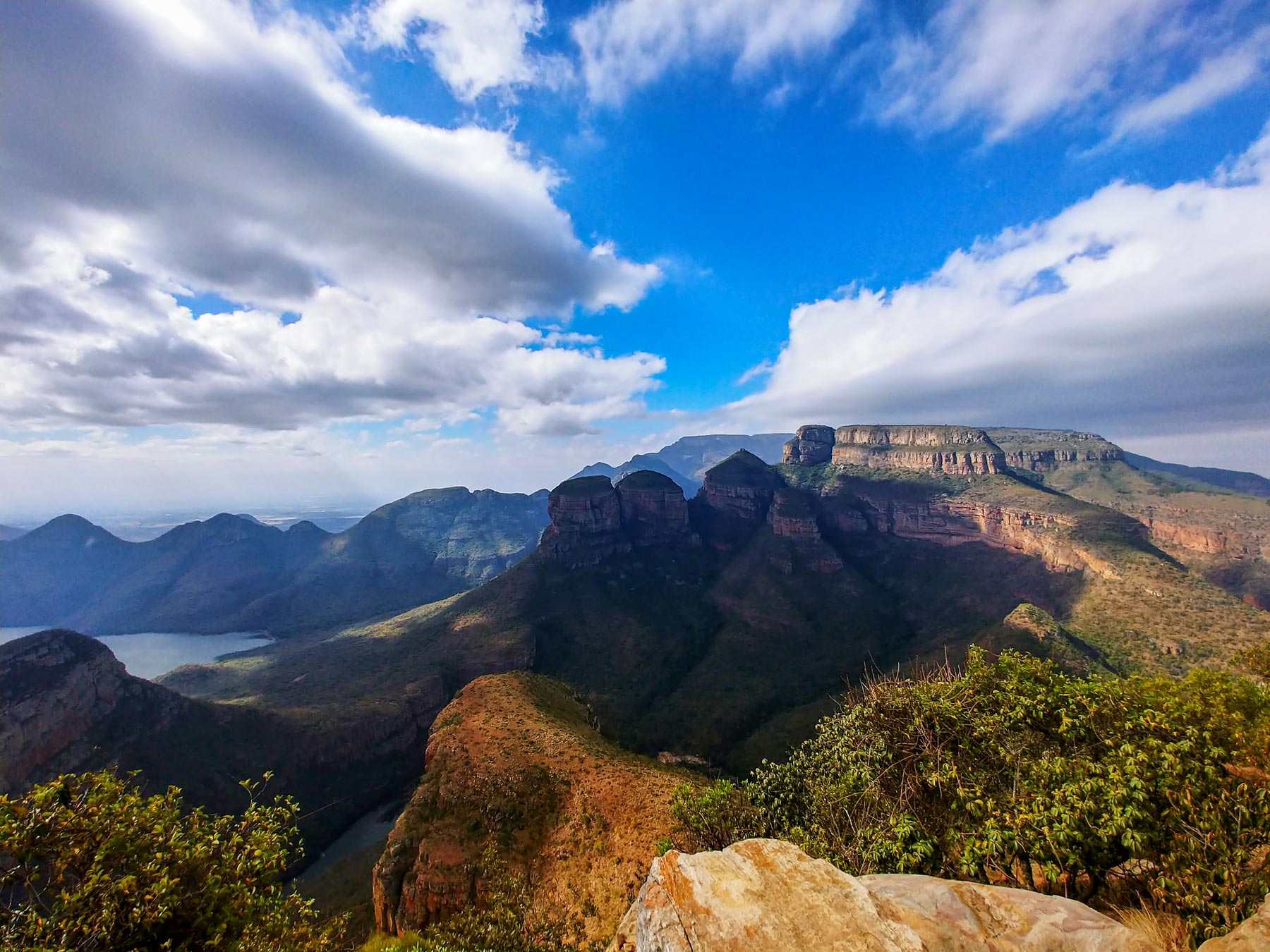
A dramatic sky over the "Three Rondavels" and the Blyde River Canyon in Mpumalanga province. The canyon forms part of South Africa's Blyde River Canyon Nature Reserve. Photo: Claidheamhmor
Landlocked Mpumalanga lies in the northeast of South Africa, north of KwaZulu-Natal, and shares borders with Eswatini (formerly Swaziland) and Mozambique. The province features a landscape of rolling grasslands and rugged mountain peaks. Its northeastern region includes the southern section of the Kruger National Park—one of Africa's premier wildlife reserves. Other natural highlights include the Blyde River Canyon and the Sudwala Caves.
Mpumalanga spans an area of 76,495 km²—making it slightly larger than the Republic of Ireland and about half the size of the U.S. state of Georgia.
The province has an estimated population of 5.2 million people (in 2025). The principal languages spoken are siSwati (27.7%), isiZulu (24.1%), and isiNdebele (10%).
The capital and largest city is Mbombela (also known as Nelspruit). Major towns are eMalahleni (Witbank) and Piet Retief (eMkhondo). Other urban centers within the province are Malalane, Ermelo, Standerton, Sabie, and Barberton.
Mpumalanga is a key agricultural region, producing crops such as tobacco, cotton, wheat, and a wide variety of fruits and vegetables. [MEGA]
Northern Cape
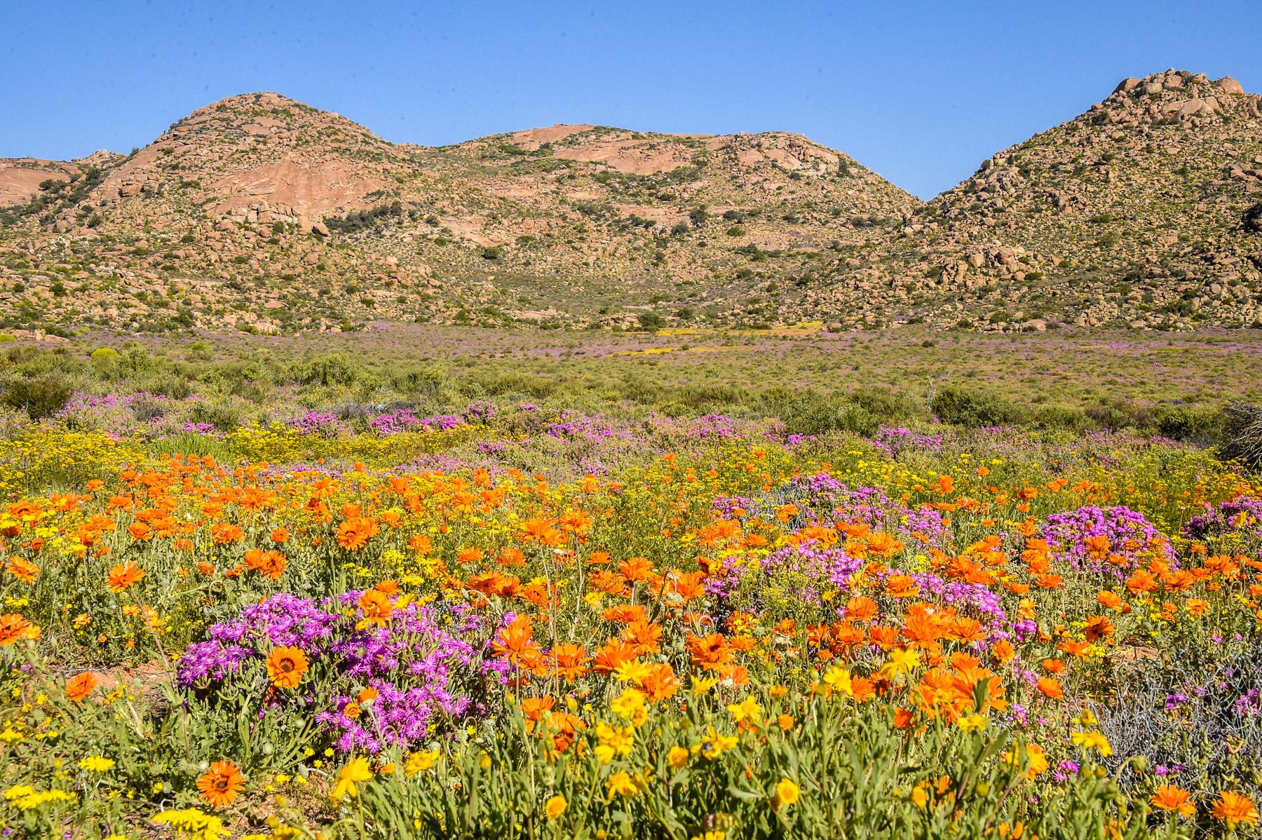
Spring in Namaqualand near Springbok, Northern Cape. The best time to visit the Wildflower Route is spring. Springtime in South Africa is from the end of August to the end of September. Photo: John Ramatsui
The Northern Cape is South Africa's largest province and also its most sparsely populated. It is bounded by the South Atlantic Ocean in the west and borders Namibia and Botswana in the north. The province features a variety of amazing landscapes, from parts of the Kalahari Desert and the Karoo Basin to the famous spring-blooming Namaqualand.
The southeast of the Northern Cape is dominated by the Great Karoo, a semi-desert plateau basin known for low rainfall, arid air, and wide temperature swings. The Karoo, its name is derived from a Khoisan word, meaning "land of thirst," is divided into the Great Karoo and the Little Karoo, the latter lying mostly in the neighboring Western Cape. The vegetation in the Karoo is typically sparse, consisting of a variety of hardy succulents and scrub bushes.
Kimberley is the provincial capital. Other notable towns include Upington, Springbok, De Aar, Kuruman, and Sutherland. Afrikaans is the most widely spoken language (68%), followed by Setswana (33.1%). The Northern Cape was formed in 1994 from the northern and central parts of the former Cape Province.
Culturally, the Northern Cape is shaped by its Khoisan heritage, Afrikaans-speaking communities, and Tswana traditions. The province is known for its storytelling, music, and crafts rooted in desert life.
Economically, the Northern Cape is rich in natural resources. Mining dominates, especially diamonds, iron ore, manganese, and zinc.
Agriculture, though limited by arid conditions, includes sheep farming and forage crop vineyards along the Orange River.
Western Cape
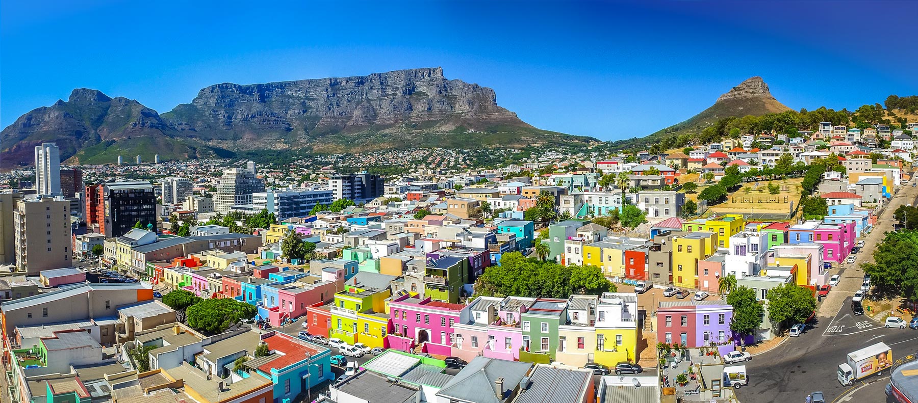
Bo-Kaap, the colorful "Malay Quarter" of Cape Town on the slopes of Signal Hill. Photo: SkyPixels
The Western Cape lies at the southwestern tip of Africa, bordered by both the Atlantic and Indian Oceans. The province covers an area of 129,462 km²; it is slightly smaller than Greece and somewhat larger than the US state of Mississippi.
About 7.5 million people live in the Western Cape. Its population is diverse and consists of multiracial people (42.07%), Africans (38.84%), Whites (16.4%), and Indians (1.14%). The principal languages of Western Cape are Afrikaans (55.3%), isiXhosa (24.7%), and English (19.3%).
The capital and largest is Cape Town. It is the economic and administrative hub of the province, known as South Africa's "Mother City." The country's legislative capital is home to the South African Parliament and the National Assembly. Other major urban centers are Paarl, Stellenbosch, Worcester, Mossel Bay, and George.
The Western Cape is one of South Africa's most popular tourist destinations. Tourism is a key economic driver in Western Cape. Its landscape offers a diverse range of attractions, activities, and landmarks such as the iconic flat-topped Table Mountain, the Cape of Good Hope, and the Garden Route. Visitors flock to the semi-arid plains of the Little Karoo for the Cango Caves and ostrich farming. The fertile Cape Winelands, a wine-growing region with towns like Stellenbosch and Franschhoek, are renowned for their good wines and gourmet food. Other highlights include Robben Island, which served as a prison for many apartheid opponents, and the famous Kirstenbosch Botanical Gardens.
The Cape Floral Region Protected Areas have been a UNESCO World Heritage Site since 2004. The site consists of eight protected areas known for their rich biodiversity.
The cold waters of the South Atlantic Ocean are highly productive fishing grounds and a rich marine environment in Western Cape. Seventy-five percent of all South African fishing takes place along the Western Cape's coastline.
The map shows the location of the following South African cities and towns:
Aberdeen, Aliwal North, Amanzimtoti, Beaufort West, Bethlehem, Bhisho, Bloemfontein (judicial capital of South Africa, Sesotho name is Mangaung), Calvinia, Cape Town (third most populous city and the legislative capital), De Aar, Durban (major seaport and the third largest city), East London, Ermelo, Estcourt, George, Graaff- Reinet, Hotazel, Johannesburg (largest city and industrial and mining capital), Kathu, Kimberley, Klerksdorp, Knysna, Kroonstad, Ladysmith, Mafikeng, Makhanda, Middelburg, Mossel Bay, Mthatha, Musina (Messina), Nelspruit (Mbombela), Newcastle, Oorkruis, Orkney, Oudtshoorn, Paarl, Pietermaritzburg, Polokwane (formerly Pietersburg; capital of Limpopo province), Port Alfred, Port Elizabeth (major seaport), Port Nolloth, Port Shepstone, Postmasburg, Pretoria (administrative capital of South Africa), Prieska, Queenstown, Richards Bay, Rustenburg (a major city in North West Province), Springbok, Stellenbosch, Strand, Swellendam, Uitenhage, Upington, Vereeniging, Victoria West, Vioolsdrif, Vredenburg, Vredendal, Vryheid, Welkom, and Worcester.
Advertisements:
More about South Africa
Map of South Africa
A map that shows South Africa with major cities, roads and airports.


 Earth
Earth 
 You are free to use the above map for educational and similar purposes; if you publish it online or in print, you need to credit the Nations Online Project as the source.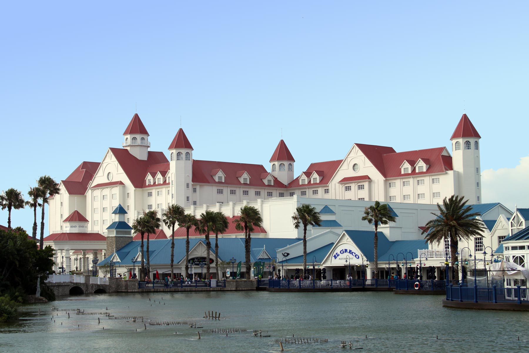
 , a UNESCO World Heritage Site.