
| Home |
|
|
|
___ Administrative Map of Cameroon |
|
About Cameroon |
|
| Cameroon is a West African country bordering the Bight of Biafra in southwest. Capital city is Yaounde. Spoken languages are French and English (official), as well as many local languages and pidgin. Map is showing Cameroon and the surrounding countries with international borders, provinces boundaries, the national capital Yaoundé, provinces capitals, major cities, main roads, railroads and airports. Border Countries: Central African Republic, Chad, Republic of the Congo (Brazzaville), Equatorial Guinea, Gabon, Nigeria |
 Bookmark/share this page |
 One World - Nations Online All Countries of the World |
|
|
||
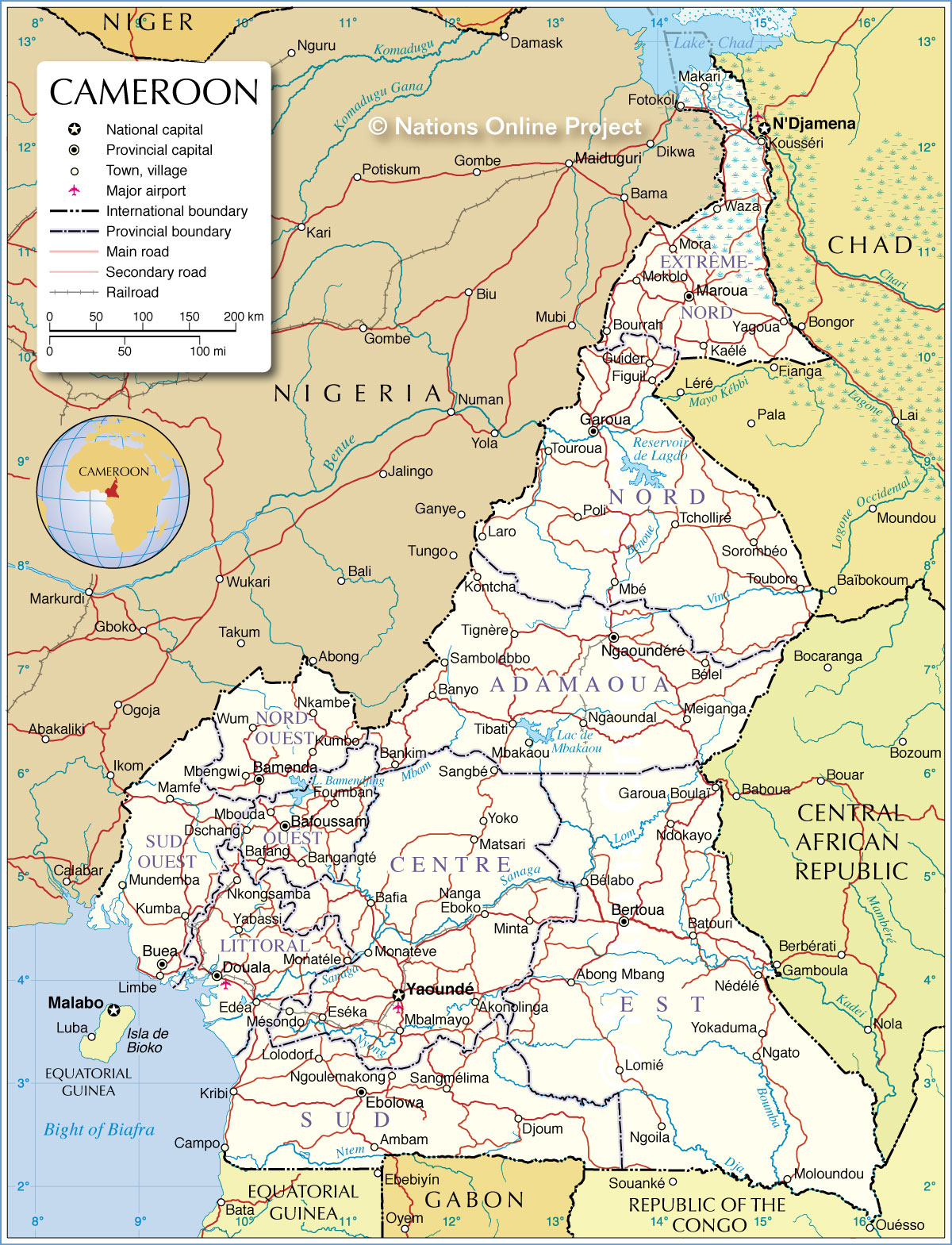 Administrative Map of Cameroon Map based on a UN map. Source: UN Cartographic Section | |||||||
| Administrative Divisions of Cameroon Cameroon is divided into ten provinces (province capital in brackets): Adamaoua (Ngaoundéré), center (Yaoundé), Est (Bertoua), Extreme-Nord (Maroua), Littoral (Douala), Nord (Garoua), Nord-Ouest (Bamenda), Ouest (Bafoussam), Sud (Ebolowa), Sud-Ouest (Buea) |
More about Cameroon: Cities: Country: Continent: |
Cameroon Current Weather Conditions
|
Related Consumer Information:
|
||||
| Maps of other Countries in Central Africa Angola Map | Central African Republic Map | Chad Map | Republic of the Congo Map Democratic Republic of the Congo Map | Equatorial Guinea Map | Gabon Map |
|||||||
One World - Nations Online .:. let's care for this planet Every nation is responsible for the current state of our world. |
| Site Map
| Information Sources | Disclaimer: Privacy Policy, etc. Contact: [email protected] | Copyright © 1998-2021 :: nationsonline.org |
