One World
Nations Online
One World Nations Online |
|
Home  |
|
___ Provinces of the Republic of South AfricaOfficial sites of the nine Provinces, their capital cities as well as tourist guides, newspapers and other information.Destination South Africa, this page invites you to a virtual travel to the 9 provinces of South Africa. Here you will find comprehensive information about all the provinces' geography, economy, people, culture, environment, government and history. You will have access to newspapers from South African provinces and you will find travel and tourism information. |
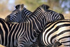 Kruger National Park © SA Tourism |
|
|
 Flag of South Africa Note: External links will open in a new browser window. South Africa Government Online The South Africa Government Online South Africa Tourism South Africa, official site of the South Africa Tourism Board. State Capital Cities: Pretoria (administrative) Bloemfontein (judiciary) Mangaung Local Municipality; (the city's name in seSotho is Mangaung). Cape Town (legislative center) Maps Detailed Map of South Africa. South Africa's Provinces Map. Political Map of Africa. |
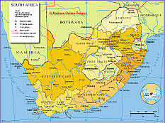 South Africa's Provinces Map (click to enlarge). |
|
| South Africa's Provinces
Eastern Cape | Free State | Gauteng | KwaZulu-Natal | Limpopo | Mpumalanga | Northern Cape | North-West | Western Cape |
|
||
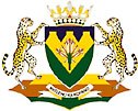
The Eastern Cape is located on the south eastern seaboard of South Africa and is the second largest province with an area of 170 600 sq. km, home to 6 300 000 people more than 80% of them speak IsiXhosa. |
 Eastern Cape Coat of Arms Capital: Bhisho (formerly Bisho) Other Cities: Port Elizabeth Information about and a searchable map and satellite view of Port Elizabeth. Area: 170,600 sq km (13.9% of country's total) Population: 6.4 million (14.4% of the total) Languages: isiXhosa (83%), Afrikaans (9.6%), English (3.7%) |
|
Eastern Cape Eastern Cape Provincial Government. Maps Map of Eastern Cape Eastern Cape Map Newspapers online Dispatch Online Eastern Cape and South Africa News The Herald Regional and national news. |
Arts
& Culture National Arts Festival Grahamstown One of Africa's largest and most colorful cultural event. Guides Eastern Cape Tourism Board Education Rhodes University Grahamstown. University of Port Elizabeth The only South African university situated in a nature reserve, founded 1964. University of Transkei - Unitra Founded 1976. |
|
|
||
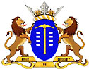
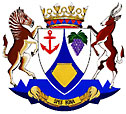
| Free State Province was formerly the Orange Free State (Afrikaans: Oranje Vrystaat) |
 Free State Coat of Arms Capital City: Bloemfontein Bloemfontein Online Area: 129 480 sq km (10.6% of country's total) Population: 2.8 million (6% of the total) Languages: Sotho (62%), Afrikaans (14%), Xhosa (9.5%) |
|
Free State Provincial Government Official site of the Free State Administration. Free State Legislature Online Map Clickable Map of Free State Map of Free State Newspapers online Die Volksblad News (Afrikaans) IOL Free State News Independent Online's Free State news. |
Business
& Economy Bloemfontein Chamber of Commerce and Industry Guides Free State Tourism Tourism in the Free State. Southern Africa Places Provides information on Free State. Education University of the Free State Bloemfontein. Central University of Technology |
|
|
||
With over 17 000 sq km the smallest of the nine provinces. In the seSotho languages 'Gauteng' means 'Place of Gold'. |
 Gauteng Coat of Arms Capital City: Johannesburg Johannesburg The official City of Johannesburg website. Other Cities: Pretoria, The Jacaranda City Area: 17 010 sq km (1.4% of country's total) Population: 8,8 million (20% of total) Languages: isiZulu (21.5%), Afrikaans (14.4%), Sesotho (13.1%), English (12.5%) |
|
Gauteng Provincial Government The Gauteng Government website. Map Gauteng Regions Map Gauteng Map Newspapers online Beeld Johannesburg Mail&Guardian National newspaper. Pretoria News Independent daily newspaper, first published in 1898, Pretoria. Rekord Pretoria news in Afrikaans. Sunday Times Weekly newspaper. The Star Regional news. |
Arts
& Culture Pretoria Art Museum Business & Economy Johannesburg Chamber of Commerce & Industry Guides Gauteng Province Gauteng guide by the Gauteng Tourism Authority. Johannesburg Travel & Tourism Information. Education Rand Afrikaans University Johannesburg Universiteit van Pretoria University of Pretoria, founded in 1908. University of the Witwatersrand Johannesburg World Heritage Cradle of Humankind Gauteng Site about amazing finds that have led leading palaeo-anthropologists and archaeologists to suggest that humankind first appeared in this corner of Africa and from there spread out to populate the world. |
|
|
||
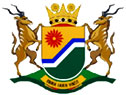
The garden province, home of the Zulu nation, situated south of Mpumalanga province in the southeast of South Africa, bordering the Indian Ocean, Mozambique, Swaziland, and Lesotho. |
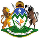 KwaZulu-Natal Coat of Arms Capital City: Pietermaritzburg Other Cities: Durban eThekwini Municipality, the official web site of Durban. Area: 92 100 sq km (7.5% of country's total) Population: 9.4 million (21.6% of total) Languages: isiZulu (80.59%), English (13.6%), isiXhosa (2.3%), Afrikaans (1.5%) |
|
KwaZulu-Natal Provincial Government KwaZulu-Natal Tourism Authority Map Map of KwaZulu-Natal Newspapers online Daily News Independent daily newspaper. The Mercury High Road Good News from KwaZulu-Natal. The Natal Witness KZN and South Africa News (note: requires registration) |
Guides Durban A guide to Durban. Pietermaritzburg's Friendly Tourism Office A guide to Pietermaritzburg and surrounding areas. KwaZulu-Natal Tourism Authority. Education University of Natal Durban, Pietermaritzburg, founded 1910. |
|
|
||
Situated at the North Eastern corner of South Africa, Limpopo shares borders with Botswana, Zimbabwe and Mozambique. The former Northern Province has been renamed Limpopo Province in February 2002. Home of the Northern Sotho (SePedi) 57%, the Tsonga (Shangaan) 23%, and the Venda 12%. Afrikaans speakers make up 2.6 per cent while English-speaking whites are less than half a per cent. |
 Limpopo Coat of Arms Capital City: Polokwane ( Pietersburg ) Area: 123 910 sq km (10.2% of country's total) Population: 5.3 million Language: SePedi (57%), followed by XiTsonga (23%) and TshiVenda (15.9%) |
|
Limpopo Provincial Government The site also provides information about Limpopo Province. Map Map of Limpopo District Map of Limpopo |
Guides Limpopo Tourism and Parks Board (LTPB) Provides some general information about Limpopo. |
|
|
||
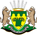
Mpumalanga lies in the east of South Africa, north of KwaZulu-Natal bordering Swaziland and Mozambique. |
 Mpumalanga Coat of Arms Capital City: Nelspruit Area: 79 490 sq km (6.5% of country's total) Population: 3.1 million Language: IsiSwati (30.8%), followed by isiZulu (26.4%) and isiNdebele 12.1%) |
|
Mpumalanga The Mpumalanga Provincial Government Website. Map Map of Mpumalanga Newspapers online The Lowvelder - Die Laevelder Mpumalanga and South African news. |
Guides Mpumalanga Tourism Authority The official provincial website providing Tourist Information on Mpumalanga. Mpumalanga Explorer Mpumalanga Explorer provides some information about the province and Kruger National Park. |
|
|
||
Situated in the north-western part of South Africa, the Northern Cape is the largest province of the nine provinces, about trice the size of Germany, but it's the province with the smallest population. The Province is home to 840 000 people, most of them speak Afrikaans, about 70% of the population is urbanised. |
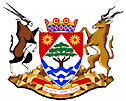 Northern Cape Coat of Arms Capital City: Kimberley Kimberley information page. Area: 361 830 sq km (29.7% of country's total) Population: 840 000 Language: Afrikaans (68%), followed SeTswana (20.8%) |
|
Northern Cape Northern Cape Provincial Government. Map Map of Northern Cape News IOL Northern Cape news Independent Online's Northern Cape news |
Guides Northern Cape Tourism A guide to Namaqualand, Green Kalahari, Kalahari, the Diamond Fields and more. |
|
|
||
The Province in the north of South Africa is home to 3,7 million people of whom 2,2 million live in functional urban areas. In terms of population, the largest urban area is Kleksdorp, with 423 000 people. The second largest nodal point is Potchefstroom. |
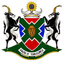 North-West Province Coat of Arms Capital City: Mafikeng Other Cities: Potchefstroom Potchefstroom City Council. Area: 118 797 sq km ( 9.5% of country's total) Population: 3.7 million Language: SeTswana (65.4%), followed by Afrikaans (7.5%) |
|
The Platinum Province Online Official site of the North-West Province Government. North-West Province - State of the Environment Report 2002 Map North-West Province map Clickable search map of the North-West Province. Map of the North-West News IOL North West Province News Independent Online's North-West Province news. |
Guides Tourism North-West Tour and travel guide to the North-West Province. North-West Parks and Tourism Board Parks, Game and Nature Reserves in the North-West Province. Education University of the North-West Potchefstroom University Native Royal Bafokeng Nation |
|
|
||
The Western Cape is situated on the south-western tip of the African continent. In total the Western Cape includes an area of 129 386 sq km. There are approximately 4.5 million people, living in the province, the majority of whom are Afrikaans-speaking. The other official languages are English and Xhosa. |
 Western Cape Coat of Arms State Capital City: Cape Town Cape Town Official site for the City of Cape Town. Area: 129 370 sq km (10.6% of country's total) Population: 4.5 million Language: Afrikaans (55.3%), followed by English (19.3%) and isiXhosa (23.7%) |
|
Western Cape Administration Cape Gateway is a single point of access to government information and services for the citizens of the Western Cape. Map Western Cape Clickable search map of Western Cape. Western Cape map News Die Burger Cape Town, regional Afrikaans newspaper. Cape Argus Regional news. Cape Times Daily, published since 1876, Cape Town. CityVision Western Cape news. Independent Regional news. |
Guides The Cape Official web site of the Western Cape Tourism Board. Cape Town The official Cape Town Tourism site with travel, accommodation, and event details for visits to Cape Town. The Garden Route The Garden Route of Western Cape. overberginfo.com Comprehensive information about the Overberg region on the Southernmost tip of Africa. Overberg Tourism Official web site of the regional tourism office for the Overberg region. West Coast A guide to Cape's West Coast. Education A project to empower educators to use appropriate and available technology to deliver curriculum. University of Cape Town - UCT Founded in 1829. Universiteit Stellenbosch Stellenbosch, founded in 1918. University of the Western Cape Established in 1959 as an ethnic college for "coloured" students, today a national university. |
|
| More about South Africa: Capital Cities of South Africa: Country: Continent: |
||
Search Nations Online

|
Bookmark/share this page: |
 |
|
Other Countries of Southern Africa: Botswana | Lesotho | Namibia | Swaziland Countries of the World: A - C | D - G | H - L | M - P | Q - T | U - Z Continents: Africa | The Americas | Asia | Australia/Oceania | Europe |
One World - Nations Online .:. let's care for this planet Promote that every nation assumes responsibility for our world. Nations Online Project is made to improve cross-cultural understanding and global awareness. More signal - less NOISE |
| Site Map
| Information Sources | Disclaimer | Copyright © 1998-2024:: nationsonline.org |