Advertising

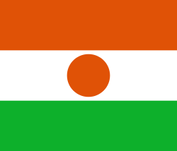
Niger Flag detail
Home Earth Continents Africa Niger Country Profile Map of Niger

Maps Index


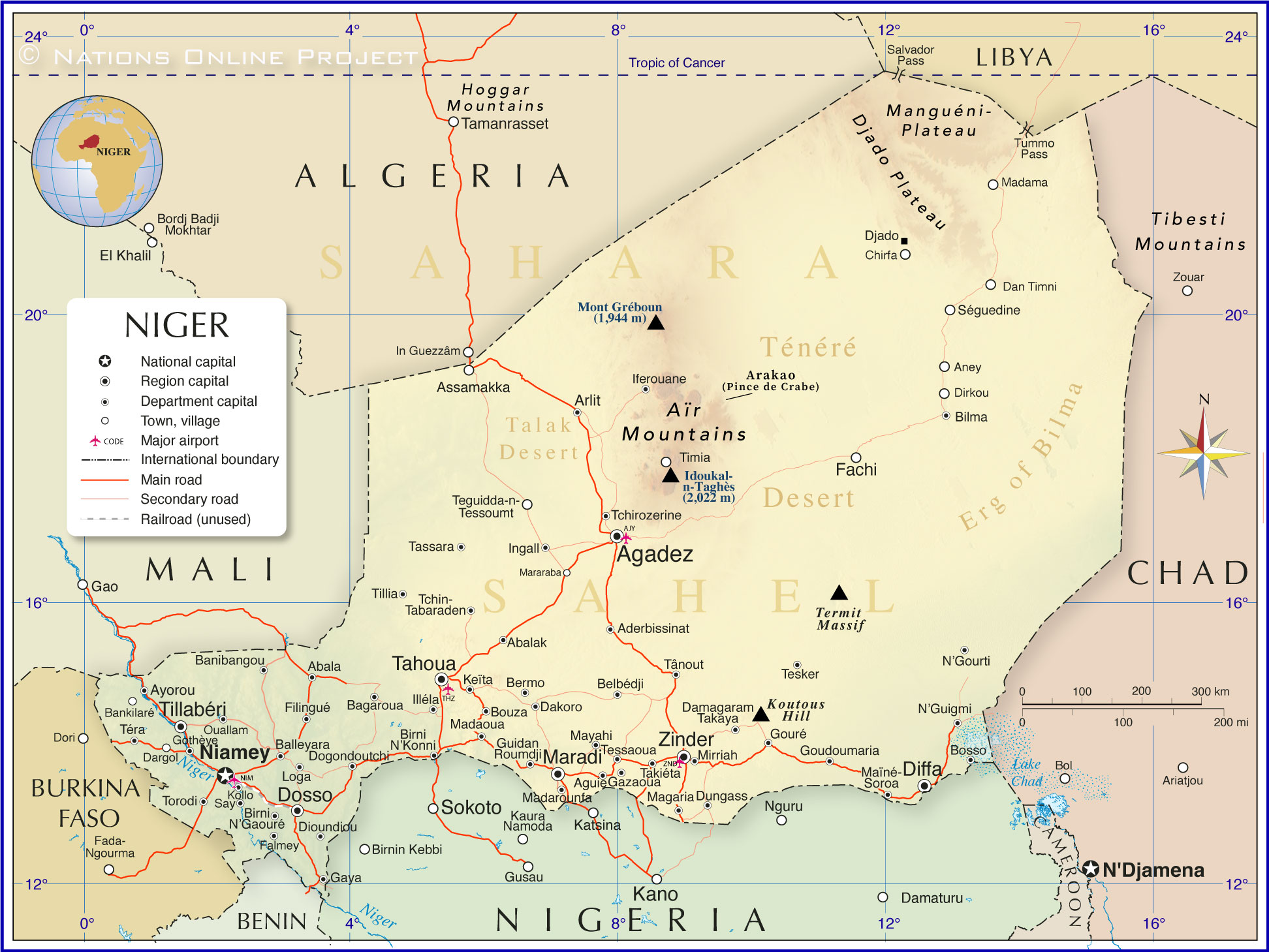
Map of Niger

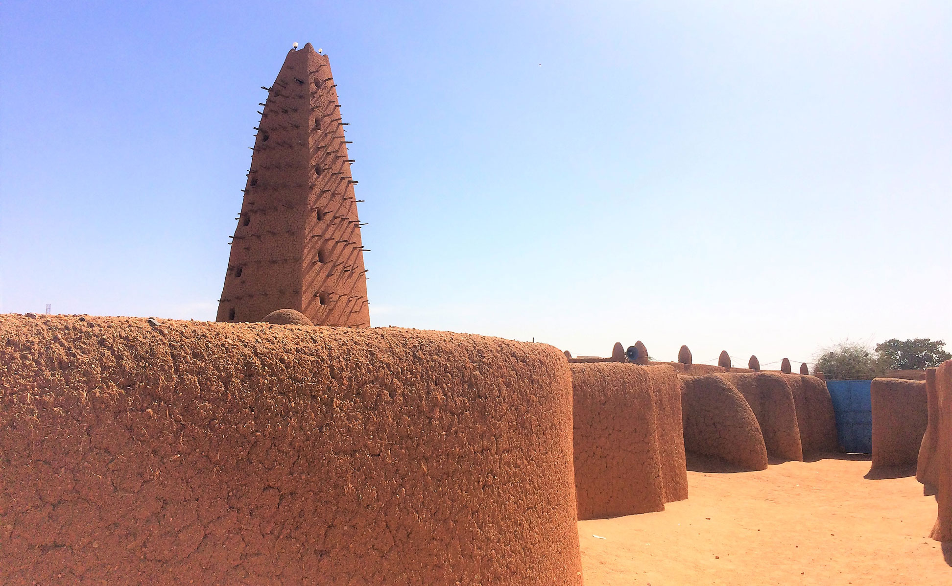
The mosque in Agadez is a famous landmark of Niger.
The famous mud brick mosque in the center of Agadez with its 27 meters (89 feet) tall minaret. The Islamic place of worship is a landmark of Niger.
Image: Vincent van Zeijst

About Niger


Niger Flag
The map shows Niger, officially the Republic of the Niger (French: République du Niger), an independent landlocked country in West Africa south of Algeria and Libya. The northern part of Niger is located in the southern part of the Sahara, the world's largest hot desert that covers vast parts of North and West Africa. The central part of Niger lies in the Sahel, the semi-arid transition zone between the Sahara in the north and the Sudanese Savannah in the south, the region that includes the more fertile southwest of the country.

Besides Algeria and Libya, Niger borders Benin and Nigeria in the south, Burkina Faso in the southeast, Mali in the west, and Chad in the east.

With an area of 1,267,000 km², the country is more than twice the size of (Metropolitan) France (543,940 km²) or slightly less than twice the size of the U.S. state of Texas.

Population
Niger has a population of 25.4 million people (est. 2023). It is the country with the world's highest birth rate, with almost 7 children per woman. [CIA] [WB]
The population of Niger is a mix of African tribes like the Hausa people 50%, Zarma/Songhai 21%, Fulani (Peuhl) 6.5% and Kanuri 5.9%. Niger has 11 national languages; French is the official language and Hausa the most widely spoken.
The capital and largest city is Niamey, other major cities are Agadez, Maradi and Zinder.

Religion
The vast majority (more than 98%) of the country's population are followers of Islam. [state.gov]


Map of Niger

Political Map of Niger (updated)
Political Map of Niger

The map shows Niger and surrounding countries with international borders, the national capital Niamey, administrative capitals, major physical features, major cities, main roads, railroads, and major airports.

You are free to use the above map for educational and similar purposes; if you publish it online or in print, you need to credit the Nations Online Project as the source.


More about Niger


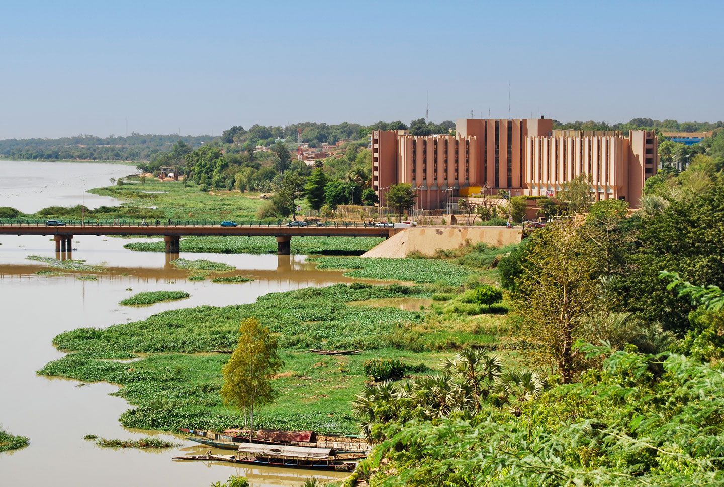
Niamey, Niger's capital on the Niger River
Niamey, Niger's capital on the Niger River with the Hôtel Gaweye and the Kennedy Bridge.
Photo: eric hamus


Before France incorporated the region as part of its colonial African possessions in the early 20th century, the area was subject to conflicts between various African kingdoms and tribes such as the Songhai Empire, the Kanem-Bornu Empire and semi-nomadic Tuareg (Berber) tribes.

The Colonie Niger (French: Colonie du Niger) was part of French colonial possessions that comprised much of present-day Niger and parts of Mali, Burkina Faso and Chad. The colony existed in various forms from 1900 to 1960.
Niger was also part of French West Africa (French: Afrique-Occidentale française, AOF), a federation of eight French colonial territories, which ceased to exist in 1960. Niger gained independence from France on 3 August 1960.


Geography of Niger
The largest country in West Africa offers diverse geographical features, including mountains in deserts, one major river, the Niger, after which the country was named, and several wildlife conservation areas and national parks. A few seasonal rivers (wadis) drain the country during the rainy season.
The three main regions that determine the country's landscapes and climate are the Sahara Desert, the Sahel and the Sudanese Savannah.


UNESCO World Heritage Site of Niger

There are three properties inscribed on Niger's world heritage list:

The Historic Centre of Agadez
The desert city of Agadez is famous for being made entirely of mudbrick, and it has been described as "the gateway to the desert." The historic town became a crossroads for the caravan trade in the 15th century and a major center for trans-Saharan cultural interchanges.

The Air and Ténéré Natural Reserves are among the largest protected areas in Africa, covering some 77,000 km² (almost twice the size of Switzerland), located in the Saharan desert of Ténéré. The property includes the volcanic Aïr Mountains, a unique plateau with various landscape formations such as cliffs, canyons, and natural arches can be found. The region is home to several threatened species, including the Saharan cheetah and the dama gazelle.

The W National Park (French: W du Niger) is an important transboundary protected area known as the W-Arly-Pendjari Complex. The complex includes areas of three countries, Niger, Benin and Burkina Faso. The territory serves as a refuge for threatened or endangered animal species and is home to African manatees, cheetahs and leopards; it also hosts the largest African elephant population and the only viable lion population in West Africa.


The map shows the location of the following Nigerien cities and towns:

Abala, Abalak, Aderbissinat, Agadez, Aguie, Aney, Arlit, Assamakka, Ayorou, Bagaroua, Balleyara, Banibangou, Bankilaré, Belbédji, Bermo, Bilma, Birni N'Gaouré, Birni N'Konni, Bosso, Bouza, Chirfa, Dakoro, Damagaram, Dan Timni, Dargol, Diffa, Dioundiou, Dirkou, Djado, Dogondoutchi, Dosso, Dungass, Fachi, Falmey, Filingué, Gaya, Gazaoua, Gothèye, Goudoumaria, Gouré, Guidan Roumdji, Iferouane, Illéla, Ingall, Keïta, Kollo, Loga, Madama, Madaoua, Madarounfa, Magaria, Maïné-Soroa, Maradi, Mararaba, Mayahi, Mirriah, N'Gourti, N'Guigmi, Niamey, Ouallam, Say, Séguedine, Tahoua, Takaya, Takiéta, Tânout, Tassara, Tchin-Tabaraden, Tchirozerine, Teguidda-n-Tessoumt, Téra, Tesker, Tessaoua, Tillabéri, Tillia, Timia, Torodi and Zinder.
 

Advertisement:


Weather Conditions Niamey:

NIAMEY WEATHER


Advertisement:


Maps of Countries in North Africa
Algeria Map | Egypt Map | Libya Map | Morocco Map | Sudan Map | Tunisia Map

Political Maps of Countries in Central Africa
Angola Map | Cameroon Map | Central African Republic Map | Chad Map | Republic of the Congo Map | Democratic Republic of the Congo Map | Equatorial Guinea Map | Gabon Map

Political Maps of Countries in West Africa
Benin Map | Burkina Faso Map | Cape Verde Map | Côte d'Ivoire Map | Ghana Map | Guinea Map | Guinea-Bissau Map | Liberia Map | Mali Map | Mauritania Map | Niger Map | Nigeria Map | Senegal Map | Sierra Leone Map | Togo Map

Political Maps of Countries in East Africa
Burundi Map | Comoros Map | Djibouti Map | Eritrea Map | Ethiopia Map | Kenya Map | Madagascar Map | Malawi Map | Mozambique Map | Réunion Map | Rwanda Map | Somalia Map | Tanzania Map | Uganda Map | Zambia Map | Zimbabwe Map

Maps of Countries in Southern Africa:
Botswana Map | Namibia Map | South Africa Map | Swaziland Map