Nations Online
All Countries in the World
Nations Online All Countries in the World | |
Home  |
___ Satellite View and Map of the City of Mbombela (Nelspruit), South Africa |
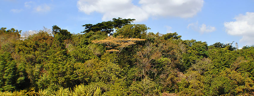 Lowveld National Botanical Garden, Nelspruit, Mpumalanga. Image: Karen Wiebe |
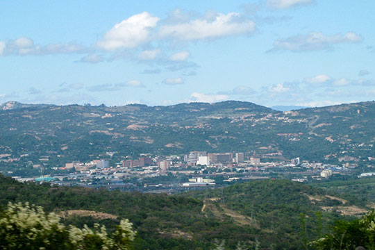
About NelspruitThe city is located in the north-eastern part of the country on the Crocodile River about 110 km (68 mi) west of the countries border with Mozambique and about 150 km north of Mbabane capital of Swaziland. The City of Nelspruit was officially renamed Mbombela by the South African government in October 2009. The North Gauteng High Court in Pretoria ruled in 2014 that the name-change was legally. Mbombela has a population of about 58,672 inhabitants, 588, 794 people live in Mbombela Local Municipality. Spoken languages in Mpumalanga are Swati, Zulu, Tsonga, Ndebele, and Northern Sotho. The city is a center for manufacturing and an agricultural hub for northeastern South Africa. Mpumalanga's mild subtropical climate (winter months are June, July and August) facilitates the growing of citrus and tropical fruits, for this reason many fruit production farms settle in the area around Mbombela. Mbombela is a gateway to Mpumalanga province and a stopover point for tourists travelling to the Kruger National Park. The city was one of the ten venues for the FIFA World Cup 2010. Some points of interest: When in Mbombela you may visit Lowveld National Botanical Garden, Montrose Falls (Crocodile River), Sudwala Caves and Dinosaur Park, the Kruger National Park one of the largest game reserves in Africa. The map shows a city map of Mbombela with expressways, main roads and streets, and the location of Mbombela Stadium as well as Nelspruit Airport (IATA Code: NLP) southwest of Mbombela. Zoom out (-) to find Kruger Mpumalanga International Airport (IATA Code: MQP) north east of the city. To find a location use the form below. |
|
| To find a location type: street or place, city, optional: state, country. |
Local Time Nelspruit:
Tuesday-July-7 18:44
(UTC/GMT +2 hours)
|
|
φ Latitude, λ Longitude (of Map center; move the map to see coordinates): , |
||||||
| Sorry! Google's pricing policy has made it impossible for us to continue showing Google Maps. We apologize for any inconvenience. Google Map: Searchable Map and Satellite View of the City of Mbombela (or Nelspruit), South Africa. City Coordinates: 25°27′57″S 30°59′07″E |
Bookmark/share this page |
|||||
| More about South Africa: Other major Cities in South Africa: Country: South Africa key statistical data. Continent: |
Weather Conditions Nelspruit
External Links: Nelspruit Info More information about Nelspruit. Wikipedia: Nelspruit Wikipedia article about Nelspruit. |
Explore more:
Related Consumer Information:
|
||||
Other Countries of Southern Africa: Botswana | Lesotho | Namibia | Swaziland Maps of other Countries of Southern Africa: Botswana Map | Namibia Map | Swaziland Map Searchable Maps of other Countries of Southern Africa: Botswana Interactive Map | Namibia Interactive Map | Lesotho Interactive Map | Swaziland Interactive Map Other Major Cities in Southern Africa: Gaborone | Lobamba | Maseru | Mbabane | Windhoek |
||||||
Map Help [ show ] |
||||||
One World - Nations Online .:. let's care for this planet Promote that every nation assumes responsibility for our world. Nations Online Project is made to improve cross-cultural understanding and global awareness. More signal - less NOISE |
| Site Map
| Information Sources | Disclaimer | Copyright © 1998-2024:: nationsonline.org |