More about Mauritania
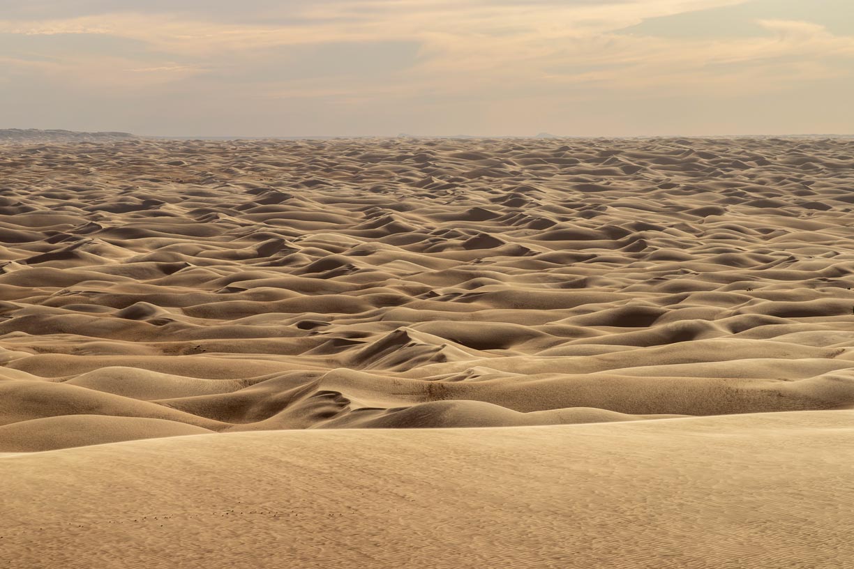
 Waves in a sea of sand. Windswept sand in the Amatlich Erg between Akjoujt and the Adrar Plateau in the Mauritanian Sahara.
Photo: Valerian Guillot
Mauritania lies at the crossroads between the Maghreb region and sub-Saharan Africa. The northern two-thirds of the country is dominated by the Sahara desert, while the southern part of the country lies in the Sahel. The semi-arid steppe of the Sahel is a roughly 350 km wide transition zone between the Sahara to the north and the Sudanian Region (West Sudanian Savanna) in the south.
In the southwest of the country, the alluvial soils in the Senegal River Valley facilitate agriculture; the river forms the country's border with Senegal.
The landscape of Mauritania is generally flat with broad, dry sandy plains with occasional oases, dune fields, depressions, and salt pans, interspersed with dramatic sandstone plateaus and rocky escarpments.
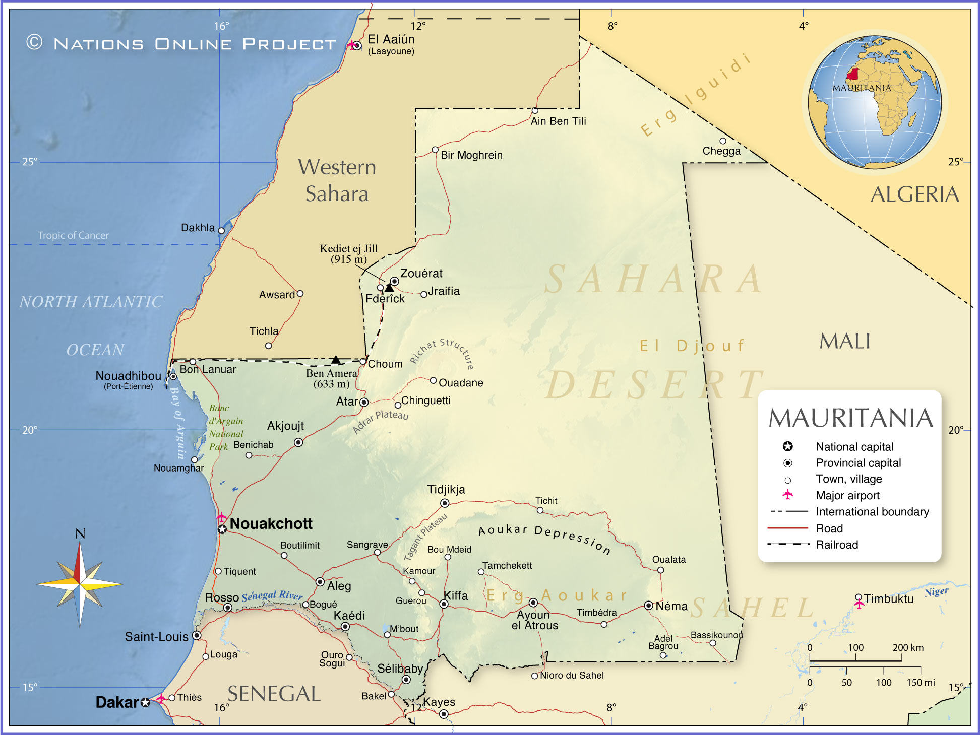
Major geographical features of Mauritania.
The main geographical features are the coastal areas where the country's two largest cities are located,
Nouakchott and
Nouadhibou.
The arid
Adrar Plateau with mountains that reach 815 meters high, such as
Teniaggoûri.
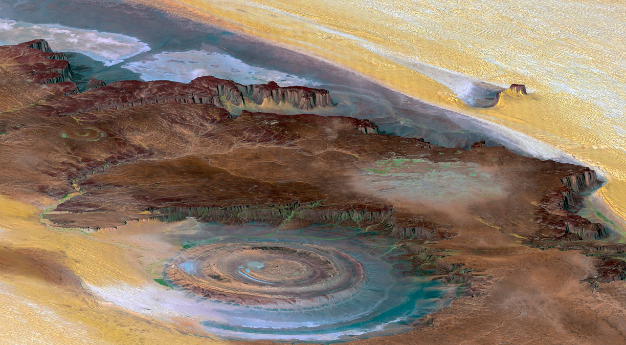
 Probably the most impressive geological formation of Mauritania, the Eye of the Sahara, known as the Richat Structure, an eroded dome of sedimentary rocks with a diameter of about 50 km (32 mi).
Photo: NASA/JPL/NIMA
To the northeast of the Adrar is the
Richat Structure, also known as the Eye of the Sahara, a ring-shaped, crater-like geological formation with a diameter of 50 kilometers.
The
Aoukar Depression, until about 2400 years ago, the vast depression was covered by a lake without an outlet. People settled on its shores, but they lost their livelihoods when the lake eventually dried up. Of their abandoned settlements, about four hundred have been found to date.
Ben Amera, the largest monolith in Africa, rises more than half a kilometer from the floor of the Sahara Desert.
Kediet ej Jill is a black metal-mountain in north-central Mauritania between the towns of Zouérat and Fderick, near the border to Western Sahara. The iron ore of the mountain has been mined commercially for decades. The only railroad line in the country connects the mines with the port city of Nouadhibou. At 915 m (3,002 ft), Kediet ej Jill includes the highest point in Mauritania.
The
Senegal River is a 1,086 km (675 mi) long river in West Africa that forms the border between Senegal and Mauritania, it is the largest river in Mauritania.
The
Sahara, a vast arid to semi-arid area across North Africa, from the North Atlantic Ocean to the Red Sea. It is the world's largest (hot) desert with an area of about 8,600,000 km² (3,320,000 sq mi), roughly the size of the
United States. The Sahara covers large parts of
Morocco,
Algeria,
Tunisia,
Libya,
Egypt, Western Sahara,
Mauritania,
Mali,
Niger,
Chad, and
Sudan.
The map shows the location of the following cities, towns and villages in Mauritania:
Cities and Towns in Mauritania
Adel Bagrou, Akjoujt, Aleg, Atar, Ayoun el Atrous, Bassikounou, Benichab, Bir Moghrein, Bogué, Bou Mdeid, Boutilimit, Chegga, Fdérik, Guerou, Kaédi, Kamour, Kiffa, M'bout, Néma, Nouadhibou (Port-Étienne), Nouakchott, Nouamghar, Ouadane, Oualata, Rosso, Sangrave, Sélibaby, Tamchekett, Tidjikdja, Timbédra, Tiquent, and Zouerat.
Advertisements:


