 |
|
___ Political Map of Sierra Leone |
|
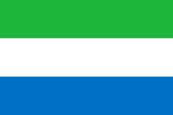
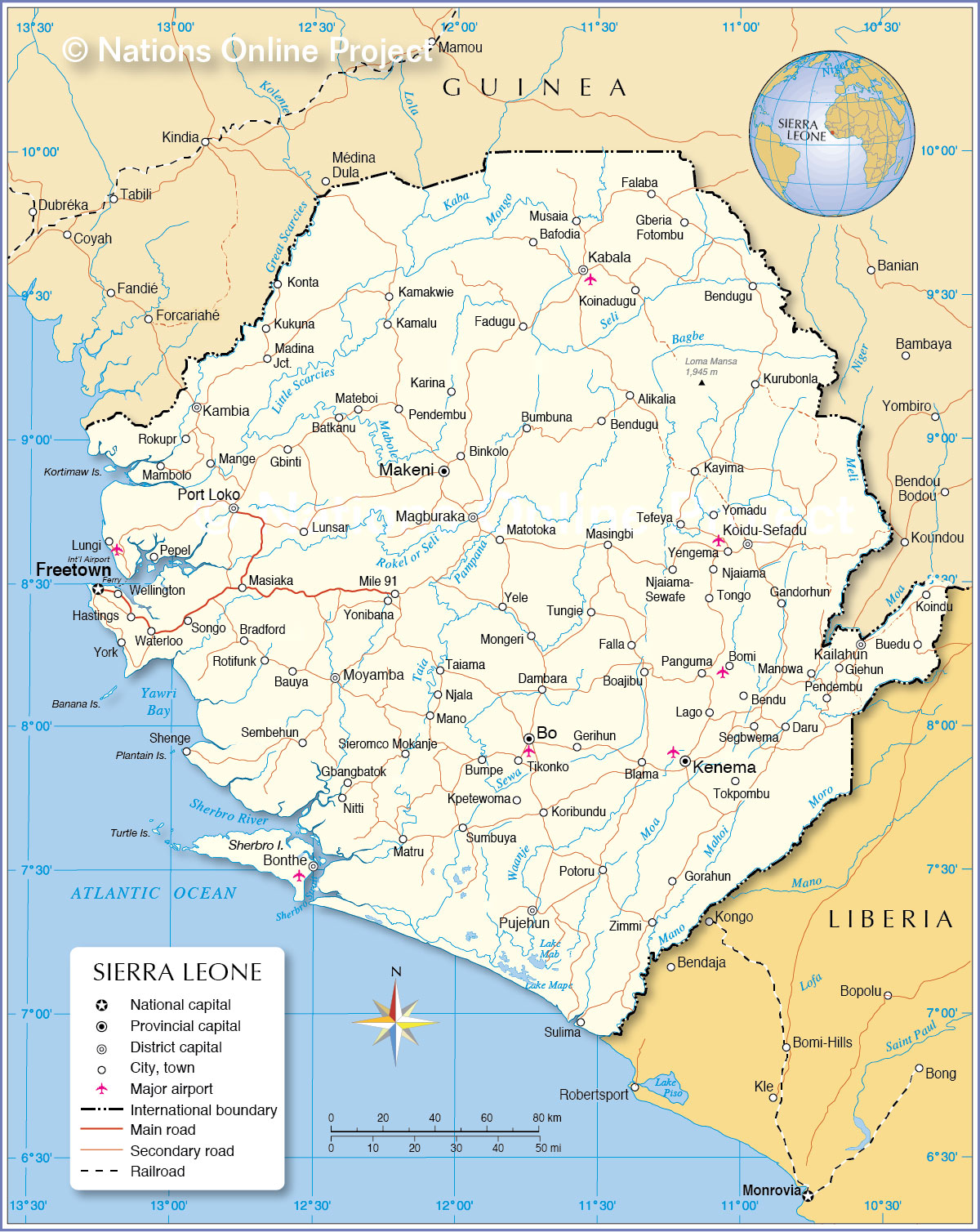
Sierra Leone is a country on the coast of West Africa, bordered only by the Atlantic Ocean, Guinea and Liberia. With an area of 71,740 km² it is just slightly larger than Ireland or slightly smaller than the U.S. state of South Carolina. The country has a population of 6.2 million people (est. 2014), its largest city, chief port and capital is Freetown situated in north west of the country at the North Atlantic Ocean. Spoken languages are English (official), English Creole, Temne, and other West African languages. Sierra Leone's terrain offers a coastal belt of mangrove swamps, broken here and there by numerous estuaries and some wide, sandy beaches, a wooded hill country, an upland plateau, and mountains in east. Its highest elevation is Loma Mansa, the Loma Mountains, with the highest peak at Mount Bintumani (also Bintimani and Loma Mansa) with 1,945 m, located in the upper eastern part of the country. Several rivers, including the Kolenté River (also known as the Great Scarcies), the Little Scarcies River (Kaba River), the Mano River and the Mano River flow through the country. Sierra Leone has a tropical monsoon climate with a wet season from June to October and a dry season from December to April. Map is showing Sierra Leone with surrounding countries, international borders, the national capital Freetown, province capitals, major cities, main roads, railroads and airports. |
 Bookmark/share this page 
|
 One World - Nations Online All Countries of the World |
|
|
||
 Political Map of Sierra Leone Map based on a map of the UN Cartographic Section |
|||||||
| Cities and Villages in Sierra Leone Map shows the location of following Sierra Leonean cities, towns and villages: Alikalia, Bafodia, Batkanu, Bauya, Bendu, Bendugu, Bendugu, Binkolo, Blama, Bo (second largest city; 270,000), Boajibu, Bomi, Bonthe, Bradford, Buedu, Bumbuna, Bumpe, Dambara, Daru, Fadugu, Falaba, Falla, Freetown (largest city with more than 1 million people), Gandorhun, Gbangbatoké, Gberia Fotombu, Gbinti, Gerihun, Giehun, Gorahun, Hastings, Kabala, Kailahun, Kamakwie, Kamalu, Kambia, Karina, Kayima, Kenema (third largest city; 160,000), Koidu-Sefadu (also known as Koidu Town; pop. 110,000), Koinadugu, Koindu, Konta, Koribundu, Kpetewoma, Kukuna, Kurubonla, Lago, Lungi, Lunsar, Madina Jct., Magburaka, Makeni (largest city and economic center in the Northern Province; pop. 110,000) , Mambolo, Mange, Mano, Manowa, Masiaka, Masingbi, Mateboi, Matotoka, Matru, Mile 91, Mongeri, Moyamba, Musaia, Nitti, Njaiama-Njaiama, Njala, Panguma, Pendembu, Pendembu, Pepel, Port Loko, Potoru, Pujehun, Rokupr, Rotifunk, Segbwema, Sembehun, Sewafe, Shenge, Sieromco Mokanje, Songo, Sulima, Sumbuya, Taiama, Tefeya, Tikonko, Tokpombu, Tongo, Tungie, Waterloo, Wellington, Yele, Yengema, Yomadu, Yonibana, York, and Zimmi. | More about Sierra Leone: Cities: Country: Continent: |
Freetown Current Weather Conditions at Freetown-Lungi International Airport |
Explore More:
Related Consumer Information:
|
||||
Political Maps of other Countries in West Africa: Benin Map | Burkina Faso Map | Cape Verde Map | Côte d'Ivoire Map | Ghana Map | Guinea Map | Guinea-Bissau Map Liberia Map | Mali Map | Mauritania Map | Niger Map | Nigeria Map | Senegal Map | Togo Map |
|||||||
One World - Nations Online .:. let's care for this planet Every nation is responsible for the current state of our world. |
| Site Map
| Information Sources | Disclaimer: Privacy Policy, etc. Contact: [email protected] | Copyright © 1998-2021 :: nationsonline.org |