About Libya
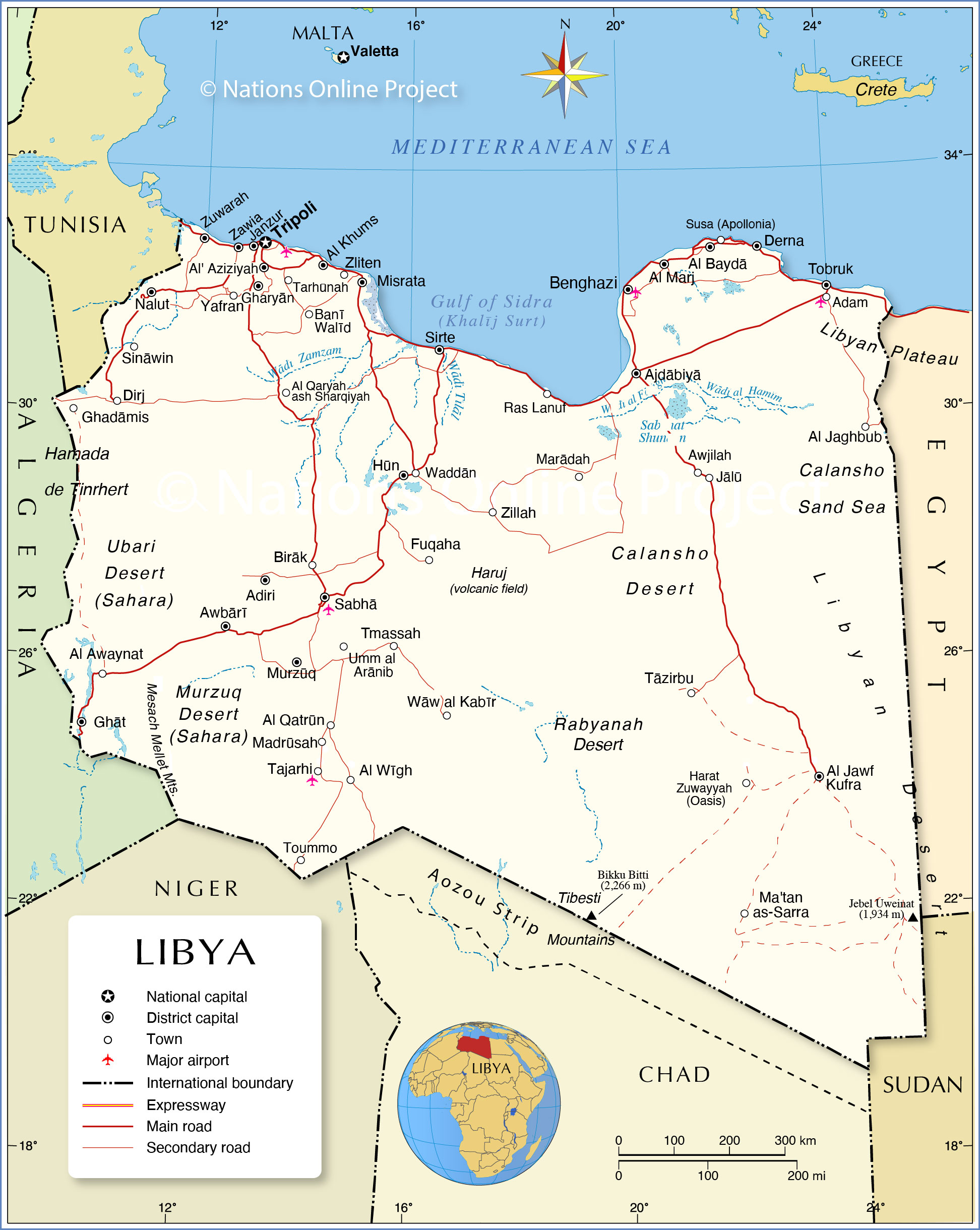
The map shows Libya, one of the five Maghreb countries in North Africa. Libya borders the
Mediterranean Sea to the north; it shares borders with
Algeria,
Chad,
Egypt,
Niger,
Sudan, and
Tunisia and has maritime borders with
Greece,
Italy, and
Malta.
An
area of 1,759,540 km² makes Libya
the fourth-largest country in Africa. It is about five times the size of
Germany or about 2.5 times the size of
Texas. Much of the country is covered by the Sahara Desert. The largest hot desert in the world covers most of the northern part of the African continent.
Libya has a
population of 6.9 million people; the largest city and constitutional capital of Libya is
Tripoli (Tarabulus). Spoken
languages are Arabic (official), Teda and various Berber dialects (Amazigh and Kabyle). The majority of people in Libya are Muslims.
Due to ongoing conflicts between armed groups in the country, the elected parliament operates from its exile in the city of Tobruk (Tubruq) near the Egyptian border. The North African nation descended into chaos after supreme leader
Muammar Gaddafi was toppled and killed in a NATO-backed uprising a decade ago. Since then, rival administrations in the east and west of the country have been fighting for power.
More about Libya
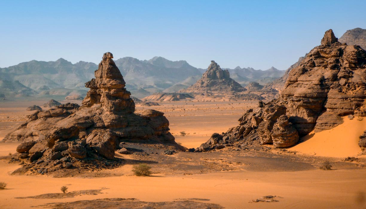 Rock formations in the Tadrart Akakus, a mountain range in southwestern Libya. It is located not far from the city of Ghat near the Idinen rock massif. A southern spur is the Tassili Tadrart.
Image: Franzfoto
The three historical regions of Libya are
Tripolitania, the vast northwestern portion of the country with its capital Tripoli;
Fezzan, the southwestern part of Libya with Sabha as capital, and
Cyrenaica, the eastern part of the country, named after Cyrene, an ancient Greek and later Roman city.
Since 2007 the country is divided into twenty-two districts (shabiyah).
People
The inhabitants of Libya are predominantly Arab, with an estimated 10 % of the population being Berber (Amazigh and Kabyles). The people of Libya, about 75%, live mainly along the Mediterranean coast, where the country's urban areas are located.
The rest of the Libyan population lives in scattered oasis towns in the Sahara, the most important oases are
Ghadames,
Sabha and
Kufra.
Cities
The largest city and designated capital is
Tripoli; other large cities are
Benghazi, a major seaport,
Misrata, known as the trade capital of Libya, and
Tobruk, the former waystation along the coastal caravan route is now the seat of the Libya interim government.
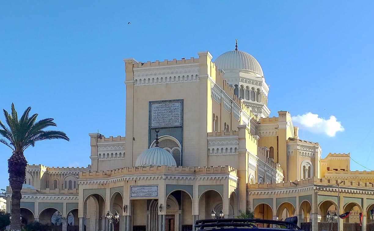 The Algeria Square Mosque, also known as Tripoli Cathedral, is located in the center of Tripoli, the capital of Libya. The building was converted into a mosque in 1970.
Photo: Ziad Fhema
Libya is one of the few countries in the world where there are no permanent rivers, but wadis, river beds, which only carry water temporarily after heavy rainfall. However, there are huge freshwater reserves under the territory of Libya, trapped in aquifers, underground layers of water-bearing permeable rock.
Sahara
Libya has its share of the world's largest desert. The
Libyan Desert covers much of eastern Libya; the desert extends into Egypt in the east. It is one of the Sahara's most arid and least populated regions. Within the desert lies the
Calanshio Sand Sea, an extremely hostile landscape of more than 60,000 square kilometers covered by dunes up to 100 meters high.
The Sahara covers two large basins in the east, the
Ghadamis Basin in the north with the
Hamada de Tinrhert, a rocky desert, and two ergs (sand seas), the
Idehan Ubari, a hyper-arid region further south, and the
Murzuq Basin with the
Idehan Murzuq (Murzuq Desert) to the south.
Mountains
In the northwest of the country are the
Nafusa Mountains, an extension of the Dahar mountain range in Tunisia. Several major mountain ranges lie in the Libyan Desert, such as the
Jebel Uweinat, a spectacular mountain on the border triangle of Libya, Egypt and Sudan. In the southeast, a small portion of the
Tibesti Mountains extends from Chad into the Libyan Desert. The mountain range is the location of
Bikku Bitti, Libya's highest mountain, at 2,266 m.
The map shows the location of the following Libyan cities and towns:
Adiri, Ajdabiya (Ajdābiyā), Al 'Adam, Al Awaynat, Al 'Aziziyah, Al Baydā, Al Fuqahā, Al Jaghbūb, Al Jawf, Al Khums, Al Kufrah, Al Marj (Barce), Al Qaryah ash Sharqīyah, Al Qatrūn, Al 'Uwaynāt, Al Wīgh, Awbārī, Awjilah, Zawiya (Az Zāwiyah), Banghāzī (Benghazi, second largest city in Libya), Banī Walīd, Birāk, Darnah (Derna), Dirj, Ghadāmis, Gharyān, Ghāt, Hūn (Houn), Jālū, Madrūsah, Marādah , Ma'tan as Sarra, Mişrātah (Misurata, third largest city in Libya), Murzūq, Nalut, Rabyānah, Ra's Lanuf, Sabhā, Sīnāwīn, Surt (Sidra), Sūsah (Apollonia), Taḥramī, Ţarābulus (Tripoli), Tarhūnah, Tāzirbu, Tmassah (Wadi Tmassah), Toummo, Tubruq (Tobruk), Umm al Arānib, Waddān, Waw al Kabir, Yafran, Zighan, Zillah, Zliten, and Zuwārah.
Advertisements:

