Nations Online
All Countries in the World
Nations Online All Countries in the World | |
| Home |
___ Administrative Map of Niger |
| Map is showing Niger and the surrounding countries with international borders, region boundaries, the national capital Niamey, region capitals, major cities and main towns, and airports. Primary Administrative Divisions of Niger (Capitals in brackets)The Republic of Niger is divided into 7 Regions:Agadez Region (Agadez), Diffa Region (Diffa), Dosso Region (Dosso), Maradi Region (Maradi), Tahoua Region (Tahoua), Tillabéri Region (Tillabéri),and Zinder Region (Zinder) Click on the map to enlarge. 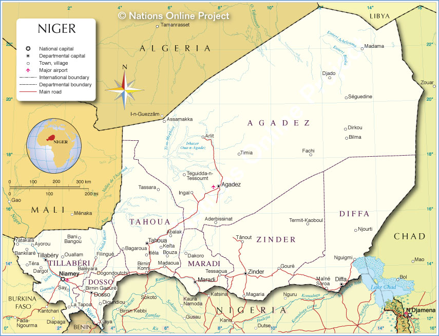 Administrative Map of Niger |
One World - Nations Online .:. let's care for this planet Promote that every nation assumes responsibility for our world. Nations Online Project is made to improve cross-cultural understanding and global awareness. More signal - less NOISE |
| Site Map
| Information Sources | Disclaimer | Copyright © 1998-2024:: nationsonline.org |