More about Jordan
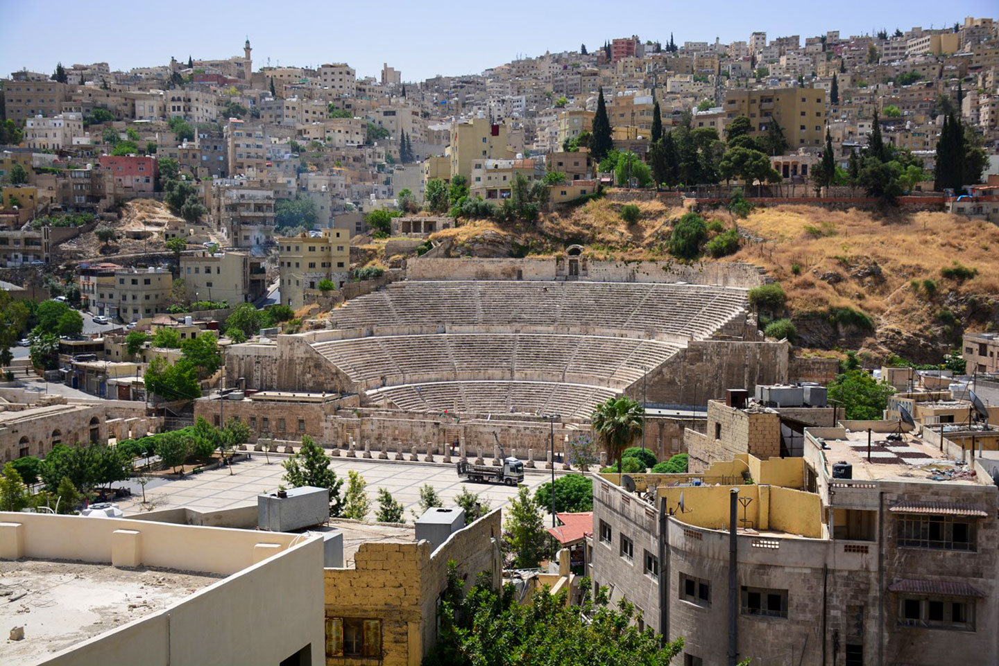 The 2nd-century Roman theater in Amman, the capital city of Jordan. Amman is the country's largest city with a population of 4 million people.
Photo: Paul Arps
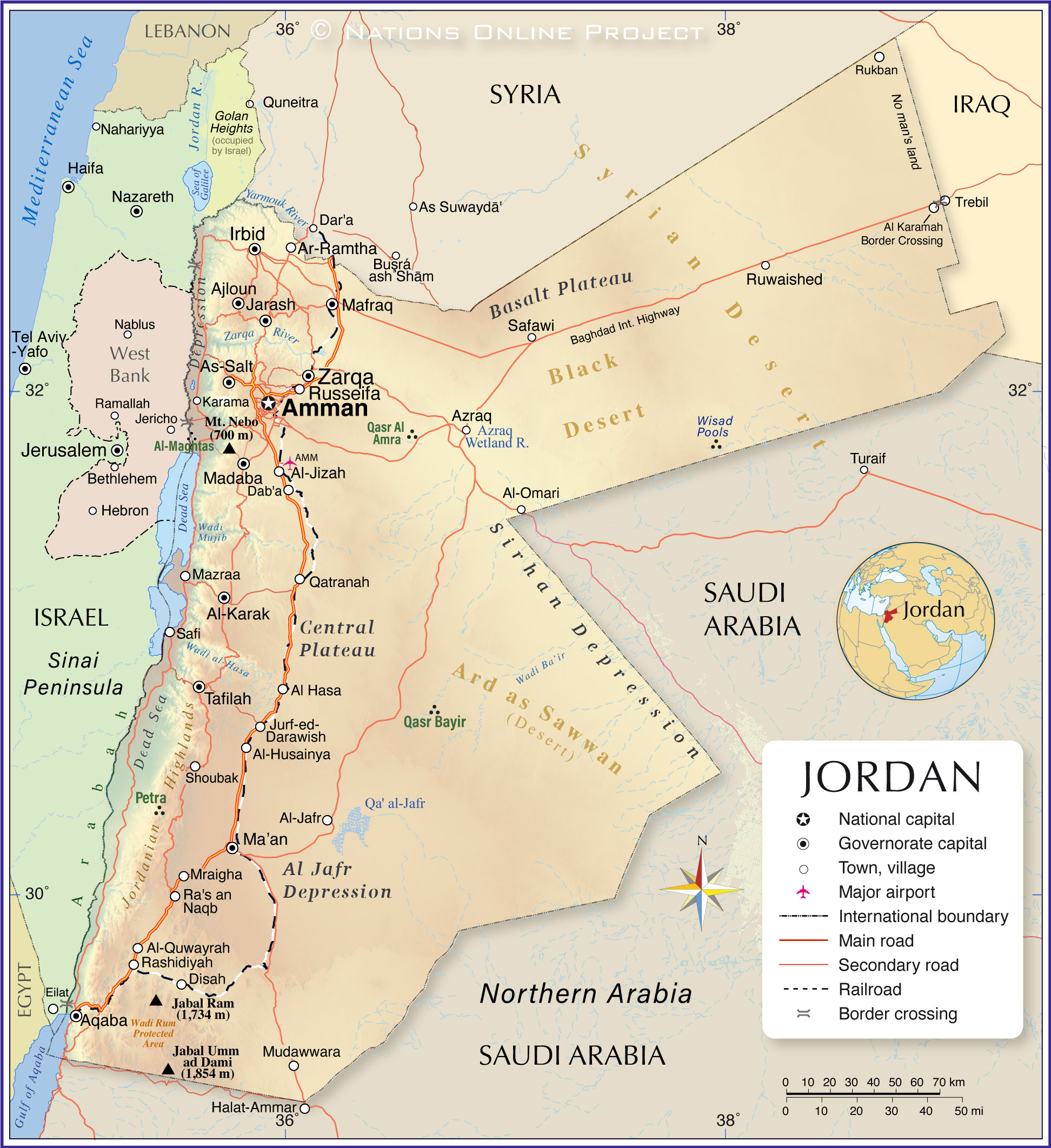
Jordan is an Arab kingdom in the Levant region of the Middle East. The country's landscape is a mixture of vast desert areas, rugged mountains, seasonally flooded riverbeds, the so-called wadis, and lush date palm oases. Aquifers, oases and seasonal water streams irrigate the country.
Jordan consists mainly of a plateau with elevations between 700 and 1,200 m. The tableland is divided into ridges by valleys and gorges and a few mountainous areas.
The region east of the Jordan River, the
East Bank, as a counterpart to the
West Bank, is also known as
Transjordan or the Transjordanian Highlands.
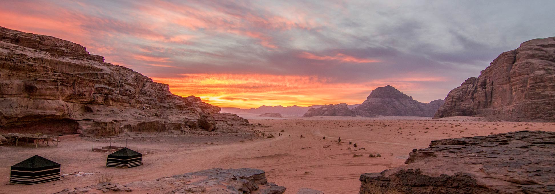
Deserts
Vast deserts dominate Jordan's terrain, accounting for about 80% of the country's territory. The kingdom has only 2% of arable land.
Jordan's eastern 'panhandle' is covered by the
Syrian Desert (Badiya), also known as the North Arabian Desert. Part of the Badiya is the
Black Desert (Harrat al-Shamah), a rocky, volcanic region that extends from Syria through Jordan into northern Saudi Arabia. The Baghdad International Highway runs through it connecting Jordan with Iraq's capital city. The Eastern Desert is also where most of Jordan's oil and gas reserves are located.
Located in the country's central-eastern region is the
Ard as Sawwan, a sparsely populated volcanic desert plain. A number of wadis, such as the
Wadi Bayir, intersect the plain.
The southeastern part of Jordan extends into the
Arabian Desert and the
Arabian Peninsula.
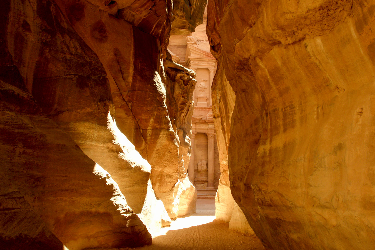 The entrance to Raqmu (today known as Petra) the capital of the Nabataean Empire (4th century BCE).
Photo: © Vyacheslav Argenberg
The Jordan Rift Valley is a long and deep trench, a tectonic zone where the Arabian plate (in the east) moves northwards away from the African tectonic plate (in the west). The Jordan Rift Valley is situated between Israel and the Westbank in the west and Jordan and Syria in the east. The valley is an extension of Africa's
Great Rift Valley, one of the most extensive rifts on Earth that runs from Jordan through eastern Africa to
Mozambique. Within the Jordan Rift Valley lies the Dead Sea. At the shore of the Dead Sea, the ground has droped to 430 meters (1,400 feet) below sea level; it is the lowest natural point on dry land on the Earth's surface.
Dead Sea
The Dead Sea (Sea of Salt) is a lake in the Jordan Rift Valley shared by Jordan, Israel and the Palestinian territory of the West Bank. The Dead Sea is one of the saltiest bodies of water in the world, with a salinity of about 34%, which makes it impossible for any
higher sea life to survive in it. Fish washed into the lake by the Jordan River do not survive. The shore of the lake is the lowest point on dry land on Earth, at about 430 m below sea level.
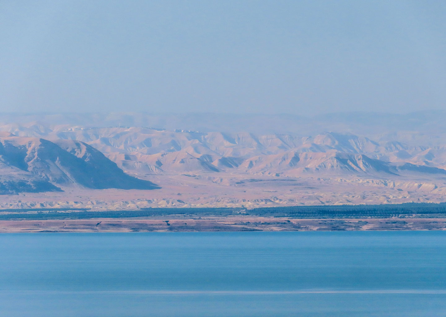 The Dead Sea and the Judean Mountains (Harei Yehuda) seen from Jordan. The Dead Sea is fed by the River Jordan. The lake has no outlet. The shore of the lake is the lowest point on dry land on Earth, at about 430 m (1.411 ft) below sea level.
Photo: Fallaner
Jordan is one of the four driest countries in the world. The kingdom has few rivers, and most of them are seasonal or have low water flow and high salinity levels. The main river is the Jordan River, which forms part of the border with Israel and the West Bank, one of the two Israeli-occupied Palestinian Territories. The river is polluted and saline and runs almost dry most of the year.
[1]
Most parts of the country have an arid desert climate; therefore, irrigation is essential for agriculture, which consumes about 70% of Jordan's water resources. However, irrigation is often inefficient and unsustainable, leading to groundwater depletion and water scarcity.
Jordan River
The river rises at
Mount Hermon in the
Golan Heights and flows south through the
Sea of Galilee (Lake Tiberias), and empties into the Dead Sea. The Jordan is an important historical and religious river because it was here that
Jesus was baptized by
John the Baptist in
Bethany "beyond the Jordan" (Al-Maghtas), a place north of the Dead Sea.
Wadis
The wadis of Jordan, like other wadis in Arabia, are dry riverbeds that only hold water during heavy rains.
Mountains
The western part of the country is dominated by the
Jordanian Highlands, also known as the Western Jordan Uplift, a complex mosaic of hills, escarpments and deep valleys with seasonal rivers (wadis). The mountain range stretches for 380 km (240 mi.) along the Red Sea-Dead Sea Depression to the west, north to south in an up to 60 km (40 mi.) wide strip. To the west the highlands drop steeply 1,000 meters or more to the
Jordan Rift Valley, which contains the Jordan River and the Dead Sea. The northern portion of the mountain chain lies in a region known as the
Fertile Crescent, a boomerang-shaped fertile region in
Western Asia formed by the Tigris and Euphrates rivers and the eastern
Mediterranean Sea. The region is known as the land where some of the world's first civilizations began, like the empires of Sumer, Akkad, Hittite, Assyria and
Babylon. The western part of Jordan was an integral part of the
Holy Land.
The 700m tall
Mount Nebo is revered as the place where
God showed
Moses a glimpse of the
Promised Land.
[Deuteronomy]
The mountain offers panoramic views of the
Jordan Valley and the Dead Sea. The mountain is also the place where the prophet
Jeremiah hid the
Tabernacle and the
Ark of the Covenant in a cave there.
[2 Maccabees]
Jordan's highest peak
Jordan's highest peak, with an elevation of 1,854 m (6,083 ft), is
Jabal Umm ad Dami. The mountain is situated in the Wadi Rum on the Jordan-Saudi Arabian border.
Gulf of Aqaba
Jordan's access to the world's oceans is in the far southwest, where Jordan has a 26 km (16 mi.) wide coastal strip on the
Gulf of Aqaba (Gulf of Eilat), an inlet of the
Red Sea. There, just east of the Israel-Jordan border lies
Aqaba, Jordan's only port city. The Gulf is also a popular destination for diving, snorkeling, and watching marine life.
Arabah
Arabah is the southern part of the rift valley, which extends from the Dead Sea to the Gulf of Aqaba. It is a dry and barren area with little vegetation and rainfall. It is also where the Wadi Arabah border crossing between Jordan and Israel is located.
Jordanian cities
Amman is the capital of Jordan and the center of a large, continuous urban sprawl.
The city is home to several ancient ruins, like the pillars of the Roman Temple of Hercules and the 8th-century palace complex from the Umayyad period.
Irbid, the kingdom's second largest urban settlement, lies in northern Jordan. The university town is a major industrial and administrative center.
Zarqa, the Blue City, is part of the extended metropolitan area of Amman; it was founded at the beginning of the 20th century by Chechen immigrants. Nearby is Zarqa camp, the oldest Palestine refugee camp in Jordan.
Between Amman and Zarqa lies
Russeifa, an industrial city and part of the extensive urban area of Amman.
Ajloun is the capital of the governorate of the same name; the hilly town with about 10,000 inhabitants is home to the 12th-century
Ajloun Castle.
Aqaba, Jordan's only coastal city, is located on the Gulf of Aqaba. The port city plays a significant role in the development of the nation's economy.

