Nations Online
All Countries in the World
Nations Online All Countries in the World | |
Home  |
___ Famous Landmarks - Map and Satellite View of Luxor (Al Aqṣur), Egypt |
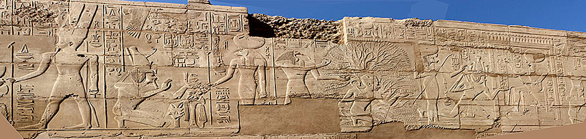 A frieze in the precinct of Amun in Karnak, the northern complex of monuments of ancient Thebes. Image by: Blalonde |
About LuxorSatellite View is showing Luxor, a city in central easternToday Luxor was the ancient city of Thebes (not to be confused with Ancient Thebes (Boeotia) in Greece). The Egyptian Thebes was once the center and the capital of the ancient "Egyptian Empire" (New Kingdom) situated in the 4th nome (an Ancient Egyptian regional area) named Was. Luxor Temple, a large ancient temple complex, dedicated to the Triad of Amun (Amun-Ra, the King of Gods, the Sun God who created himself), Mut (the Egyptian mother goddess), and Chons (Khonsu, god of the moon and time, son of Amun and Mut). The sanctuary was built by Amenophis III and Ramesses II, it was connected to the great Karnak Temple Complex by a long boulevard lined by sphinxes. Thebes with its necropolises and temples is a testimony to Ancient Egyptian civilization at its height. It is since 1979 a UNESCO World Heritage Site. Modern times Luxor has a population of about half a million residents. Official language is Arabic. The Map shows a city map of today Luxor with expressways, main roads and streets, and the location of Luxor International Airport (LXR). The map shows also the location of Luxor Temple, the Karnak sanctuary and the necropolises of the "Valley of the Kings" and the "Valley of the Queens". |
|
| To find a location type: street or place, city, optional: state, country. |
Local Time Luxor:
Sunday-July-12 20:50
Standard time zone is Eastern European Time (EET): UTC/GMT +2 hoursEgypt does not observe Daylight Saving Time (DST) since 2011 |
One World - Nations Online .:. let's care for this planet Promote that every nation assumes responsibility for our world. Nations Online Project is made to improve cross-cultural understanding and global awareness. More signal - less NOISE |
| Site Map
| Information Sources | Disclaimer | Copyright © 1998-2024:: nationsonline.org |

