Advertising

France Flag detail
Home Earth Continents Europe France Country Profile France Map

Maps

Map of France


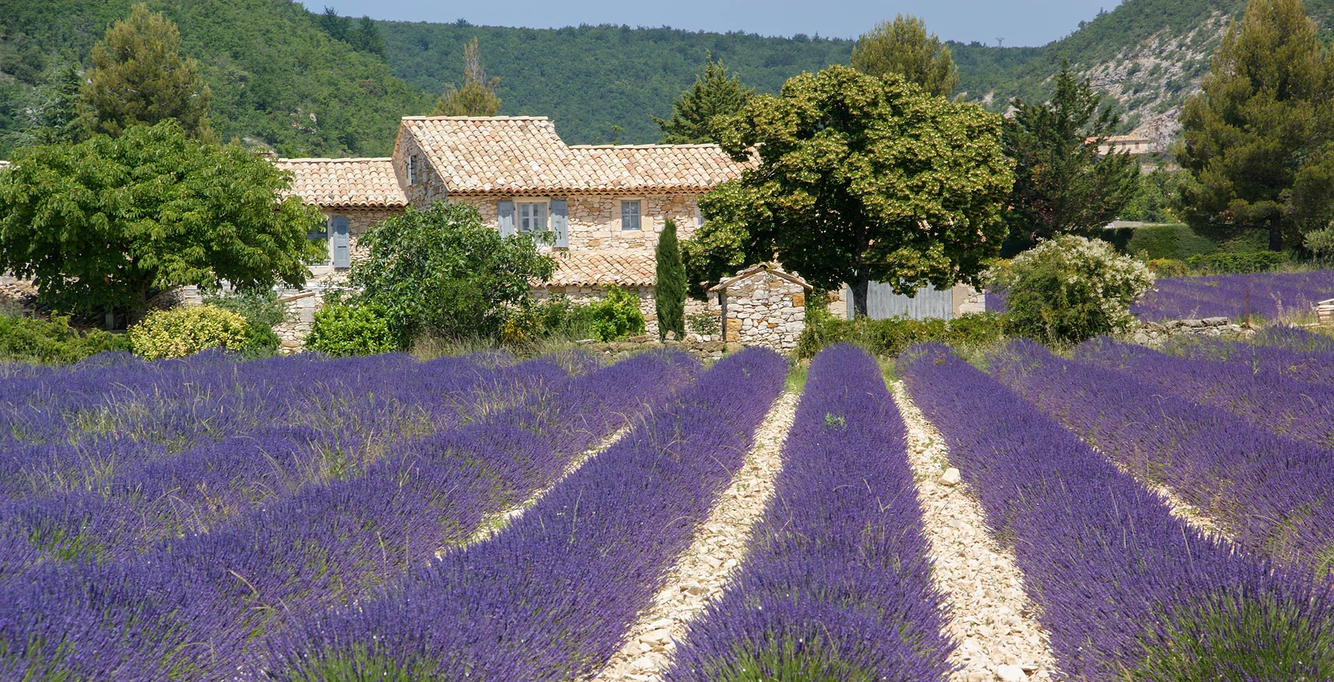
Lavender field in Côte d'Azur in Southern France
Lavender field in the Côte d'Azur (French Riviera) region of Southern France.
Image: dronepicr

About France

France is a country located on the western edge of Europe, bordered by the Bay of Biscay (North Atlantic Ocean) in the west, by the English Channel in the northwest, by the North Sea in the north. France borders Belgium and Luxembourg in the northeast, Germany, Switzerland, and Italy in the east, the Mediterranean Sea, Monaco, Spain, and Andorra in the south. France also shares maritime borders with the United Kingdom.

Since 1994 France and the UK are connected by the Channel Tunnel, a 50.5 km (31.4 mi) undersea rail tunnel linking Folkestone in Kent, in the UK with Coquelles, Pas-de-Calais, near Calais in northern France.

With an area of 551,500 km² Metropolitan France is more than twice the size of the United Kingdom or more than twice the size of the U.S. state Colorado.

France has a population of 67 million people (est. 2020); 64.8 million people in Metropolitan France and 2.2 million in its overseas regions.
The largest city and the capital is Paris. Spoken language is French (official).


Map of France showing Metropolitan France with surrounding countries, cities, and main roads

Map of France, Western Europe.

The map shows Metropolitan France, which consists of the French mainland and the island of Corsica. Depicted on the map is France with international borders, the national capital Paris, region capitals, major cities, main roads, and major airports.

You are free to use above map for educational purposes (fair use), please refer to the Nations Online Project.

Bookmark/share this page
  Instagram button


More about France


Fox Glacier, Aoraki/Mt Cook, New Zealand
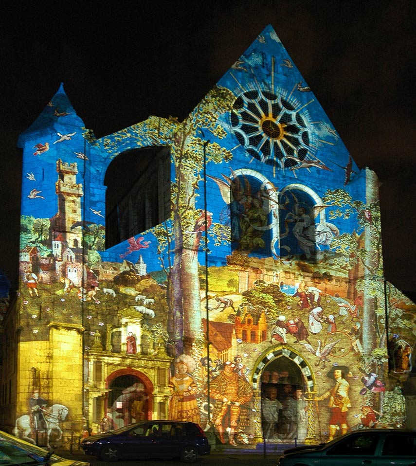
West facade of the Saint-Aignan church in Chartres during the Festival of Lights (Fête des lumières).
Photo: GIRAUD Patrick


Geography of France

Metropolitan France has two shorelines, one at the North Atlantic Ocean, the other at the Mediterranean Sea; it sums up to a total of 3,427 km of coastline.

About two-thirds of the county's interior (in north and west) consists of plains or gently rolling hills, within the plains there are two major basins: the Paris basin in the northwest, drained by the river Seine, and the Aquitaine basin in the southwest, emptied by the Garonne river. The plains are interspersed with highlands here and there.

To the south of the country are the rugged Pyrenees, two parallel mountain ranges that create a natural border between France and Spain, its highest mountains rise to more than 3,000 m.

In the southeast lies the Massif Central, a formerly volcanic highland region. Within the Massif, there is a large concentration of extinct volcanoes, like the Chaine des Puys, a chain of cinder cones, lava domes, and maars. East of the Massif, separated by a deep north-south cleft created by the Rhone River, are the French Alps, part of the Alps, the great mountain range system of Europe. Within the Alps is the highest mountain of France, the Mont Blanc, at 4,807 m. It is also Italy's highest peak because the "White Mountain" sits on the border, which separates both nations.

French Rivers:
The longest rivers within France are Loire, Seine, Garonne, and Rhone, the Rhine river in east forms the border with Germany for about 160 km (100 mi). The Seine and the Garonne are the main rivers for inland water transportation in France.


Cities and Towns in France:

The Map shows the location of following French cities:

Agen, Aix-en-Provence, Ajaccio, Alençon, Alès, Amiens, Angers, Angoulême, Annecy, Arcachon, Arles, Arras, Auch, Aurillac, Auxerre, Avallon, Avignon, Bastia, Bayonne, Beaune, Beauvais, Belfort, Besançon, Biarritz, Bonifacio, Bordeaux, Bourg-Saint-Maurice, Bourges, Bressuire, Brest, Brive-la-Gaillarde, Béziers, Caen, Calais, Calvi, Cannes, Carcassone, Castres, Chambéry, Cherbourg, Châlons-en-Champagne, Clermont-Ferrand, Colmar, Corte, Dieppe, Dijon, Douarnenez, Dunkirk, Gap, Grenoble, La Rochelle, Le Havre, Le Mans, Le Puy, Lille, Limoges, Lorient, Lourdes, Lyon (capital of Rhône-Alpes region; third largest city; pop. 720,000), Marseille (major seaport and second largest city; pop. 850,000), Meaux, Metz, Montpellier, Montélimar, Moulins, Mulhouse, Nancy, Nantes, Narbonne, Nice (fifth most populous city: pop. 350,000), Nîmes, Orléans, Pamiers, Paris (capital and largest city; pop. 2.1 million), Pau, Perpignan, Poitiers, Pontarlier, Périgueux, Reims, Rennes, Riom, Roanne, Rouen, Saint-Nazaire, Saint-Dizier, Saint-Étienne, Saintes, Sedan, St Malo, Strasbourg, Toulon, Toulouse, Tours, Troyes, Valence (Drôme dep.), Valenciennes, Verdun, and Versailles.
 

Bookmark/share this page
  Instagram button

Weather Conditions Paris

PARIS WEATHER


Advertisements:


Other Major Cities in Western Europe
Amsterdam, Berlin, Bern, Cologne, Brussels, Frankfurt, Hamburg, Luxembourg (City), Monaco,
Munich (München), Nice, Rotterdam, The Hague, Vaduz, Vienna (Wien), Zurich

Searchable Maps of other Countries in Western Europe:
Austria | Belgium | Germany | Liechtenstein | Monaco | Luxembourg | Netherlands | Switzerland

Maps of Other Countries in Western Europe:
 Austria Map, Belgium Map, Germany Map, Netherlands Map, Switzerland Map 

up