About Gabon
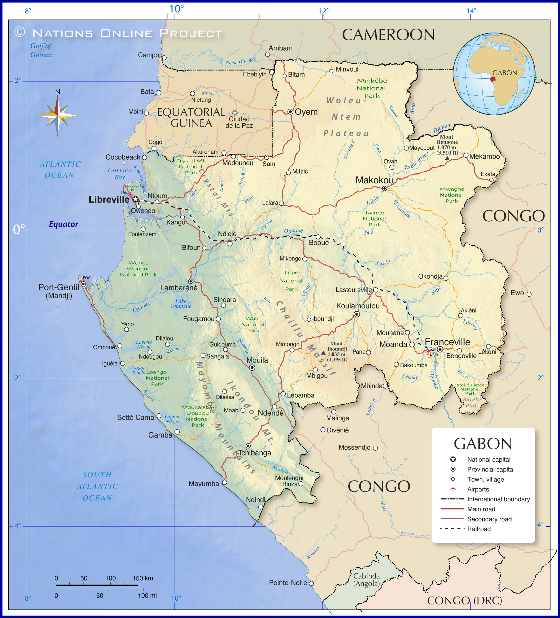
The map shows Gabon, officially the Gabonese Republic (French: République gabonaise), a tropical country in western equatorial Africa, bordering the Atlantic Ocean south of the Bight of Biafra (Bight of Bonny) and the Gulf of Guinea. It borders
Equatorial Guinea and
Cameroon to the north and the
Republic of the Congo to the east and south.
With an
area of
about 268,000 km², Gabon is somewhat larger than the
United Kingdom or slightly smaller than the
U.S. state of
Colorado.
Compared to the size of its territory, Gabon is very sparsely
populated, with just 2.4 million people (in 2023). About 80% of the Gabonese live in urban centers. The country's capital and largest city is
Libreville, home to more than half of the country's population. The main port and economic center is Port-Gentil.
Spoken
languages are French (official) and West African Bantu languages, mainly Fang and Myene. The main religion is Christianity. About 80 % of the population (53 % of whom are Catholic) profess one of the Christian denominations, 10 % Islam (mainly Sunni), and the rest other religions.
More about Gabon
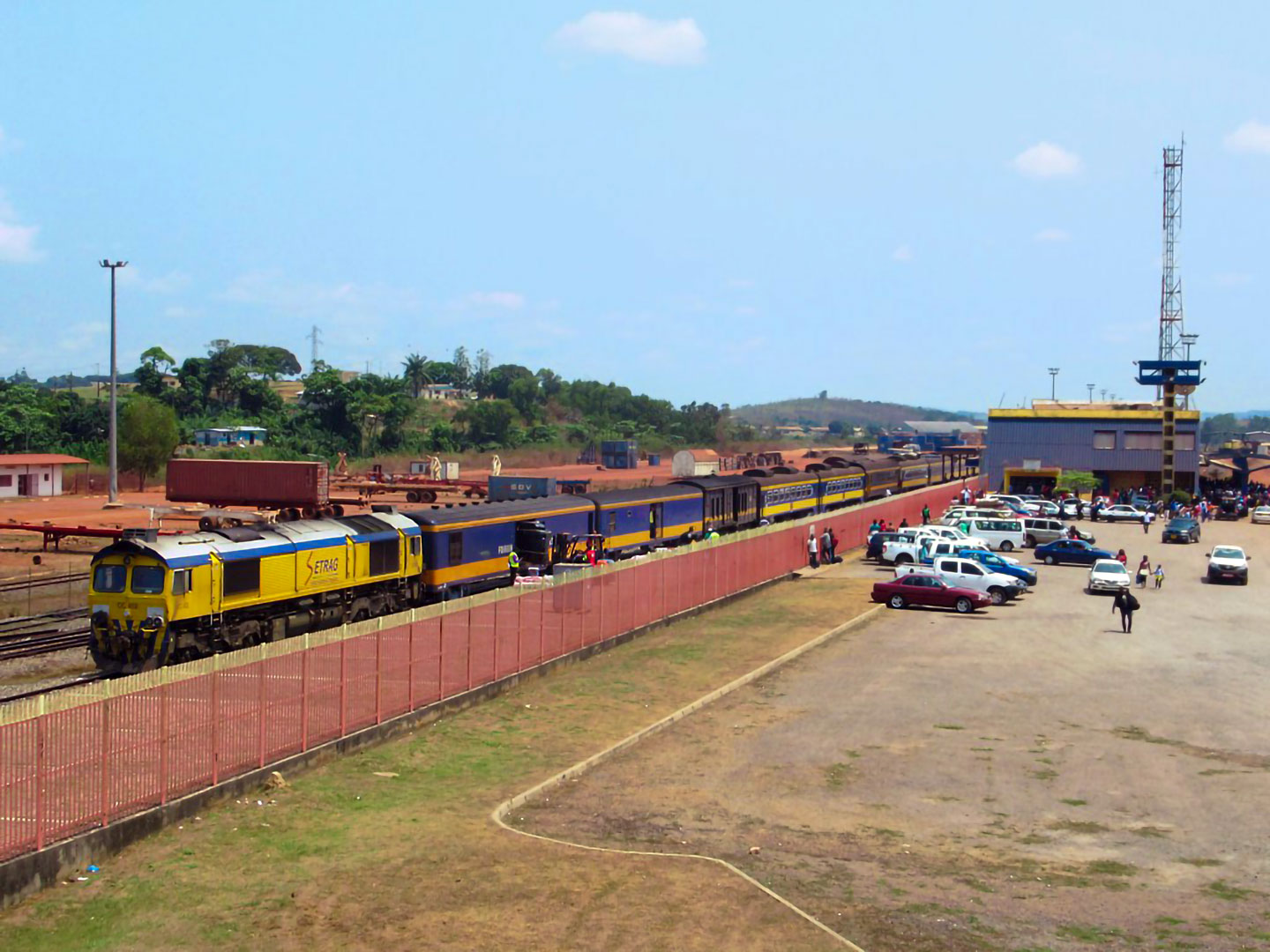 Franceville train station. The Trans-Gabon Railway is the only railroad line in Gabon. The 670 km long single-track line runs from the deepwater port at Owendo south of Libreville in the northwest to Franceville in the southeast. The railroad line serves various urban centers, such as Ndjolé, Booué, Lastoursville and Moanda.
Photo: David Stanley
Gabon is located in the west of the Central African Equatorial Belt and has an 800 km coastline on the Atlantic Ocean to the west.
Cities
The capital and largest city is
Libreville, home to more than half of the country's population. Other urban centers are
Port-Gentil (Mandji), a major seaport and the center for Gabon's petroleum industry;
Franceville, the city at the (M)passa River, is the railway terminus of the Trans-Gabon Railway, the country's only railway line.
Oyem, the capital of the Woleu-Ntem Province, and
Moanda, a manganese mining town.
Lambaréné, the town is known for the Albert Schweitzer Hospital, built by the German doctor in the early 20th century to treat tropical diseases.
Topography
Gabon's terrain offers coastal plains, a hilly interior and plateau regions, interspersed with low mountain ranges such as the Chaillu Massif and the Mayombe Mountains; savannas in the east and south. The landscape gradually descends towards the coastal plains in the west. The coastline consists largely of sandy beaches, estuaries, and mangrove ecosystems, especially in the deltas of major rivers.
Mountains
The
Chaillu Massif mountain range in south-central Gabon forms the country's main watershed.
The country's highest mountains are
Mont Bengoué (1,070 m) in the Ogooué-Ivindo Province in the northeast and
Mont Iboundji (1,035 m.) in the Chaillu Massif.
Congolian rainforests
Gabon is one of the most forested countries in the world. Tropical rainforests cover over 88% of its territory, and over 10% of Gabon's area is protected parkland.
[UNDP] Most of the country is covered by tropical moist broadleaf forests. It has two main rainforest ecoregions: the
Atlantic Equatorial coastal forests in the west and the
Northwestern Congolian lowland forests in the east. Additionally, there are two minor ecoregions, the
Central African mangroves on its western coast and the
Western Congolian forest-savanna mosaic in the country's southeastern part (Haut-Ogooué).
[WP]
Along the coast are the country's rich offshore oil and gas fields.
Gabon is among the top five oil producers in sub-Saharan Africa and has about two billion barrels of proven crude oil reserves.
[EIA] [RG]
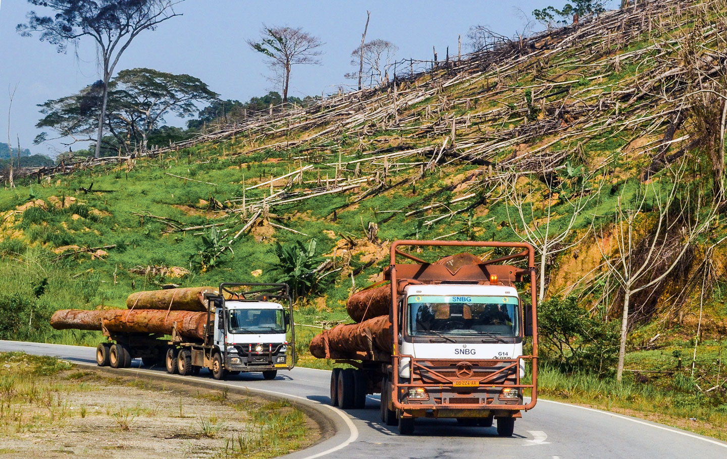 Logging of primary forests in Gabon. The oil industry that fuels 45% of its economy is facing decline; a self-styled 'Green Gabon' wants to ramp up other industries while maintaining its forest cover above 85%. [REUTERS]
Photo: jbdodane
Thanks to its oil and mineral resources and a relatively small population, Gabon is one of the more prosperous African countries, therefore able to preserve and protect its pristine rainforests with their rich biodiversity.
Rivers
The most important river in Gabon is the
Ogooué; its watershed drains nearly the entire country, parts of Cameroon and the Republic of Congo. The river rises in the Republic of Congo and flows north into Gabon; it crosses the country from the southeast to its mouth in the
Gulf of Guinea (Atlantic Ocean) in the west, to the south of
Port-Gentil. Because of rapids, the river is navigable only from
Ndjole to the sea. Numerous tributaries feed the Ogooué; important tributaries are the Ngounié, the Ivindo, the Okano, the Lolo and the Sébé.
Gabon's National Parks
There are 13 national parks in Gabon, all established in 2002 when then-President
Omar Bongo created the National Agency for National Parks. Among them is the forested coastal terrain of the
Loango National Park, known as 'Africa's Last Eden.' The park shelters diverse wildlife, from gorillas and hippos to whales.
Lopé National Park consists mostly of rainforest, but the park contains the last remnants of grass savannas in the north.
Akanda National Park, north of Libreville, is known for its mangroves and tidal beaches.
Climate
Due to its location on the equator, Gabon has both a tropical monsoon and a tropical savanna climate, depending on the region. Temperatures are hot and humid throughout the year, moderated by the northward-flowing
Benguela Current.

