About Turkey
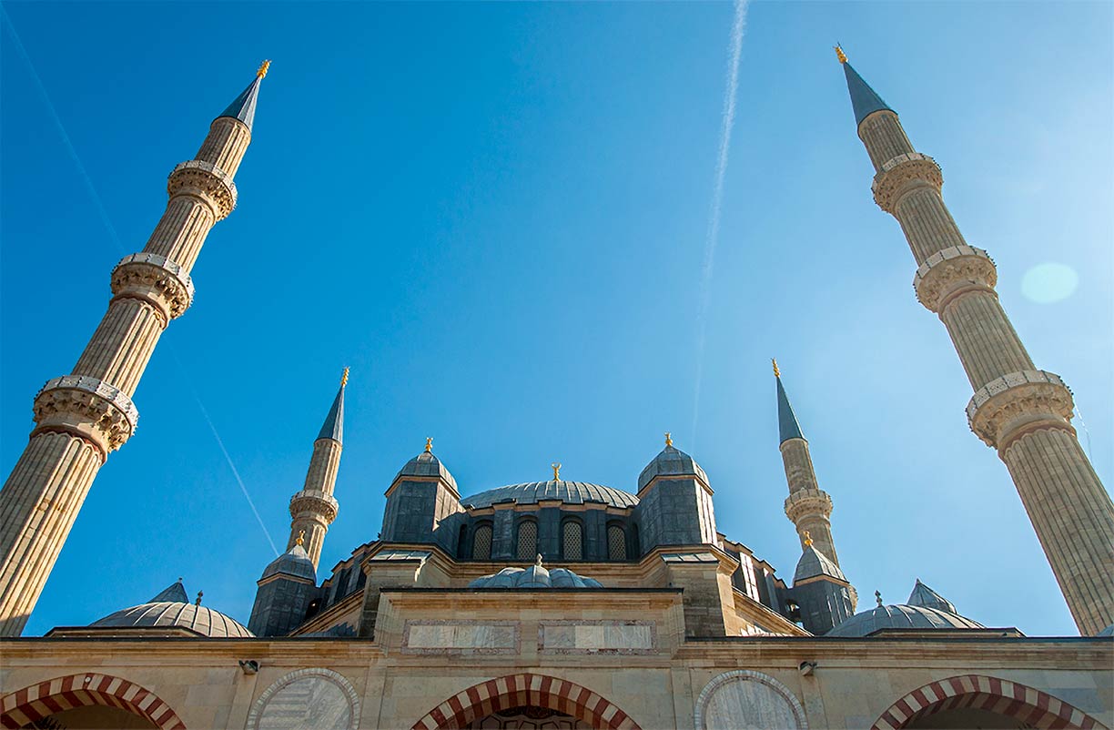
 Selimiye Mosque in the city of Edirne. The Selimiye Mosque is one of the most famous architectural legacies of the Ottoman Empire. The mosque was built between 1568 and 1574. The Selimiye Mosque and its Social Complex
  is a UNESCO World Heritage Site.
Image: Ava Babili
The satellite view and the map show Turkey a country in
Western Asia on the Anatolian peninsula with the
Mediterranean Sea to the south, the Aegean Sea in the west, and the Black Sea in the north.
The country occupies a small enclave in southeastern Europe on the
Balkan Peninsula (East Thrace) which is separated from the mainland by the Bosporus, the Sea of Marmara, and the Dardanelles.
Turkey shares international borders with
Armenia,
Azerbaijan,
Bulgaria,
Georgia,
Greece,
Iran,
Iraq, and
Syria.
It shares maritime borders with
Cyprus,
Egypt, Northern Cyprus,
Romania,
Russia, and
Ukraine.
The country occupies an
area of 783,562 km², compared it is more than twice the size of
Germany or slightly smaller than the U.S. states of
Texas and
Louisiana combined.
Turkey has a
population of 78,741,000 inhabitants (in 2015), the largest city is
 Istanbul
, the national capital is
 Ankara
,
spoken languages are Turkish
(official), Kurdish, and Arabic.
Turkey's main geographical features
Mountain Ranges:
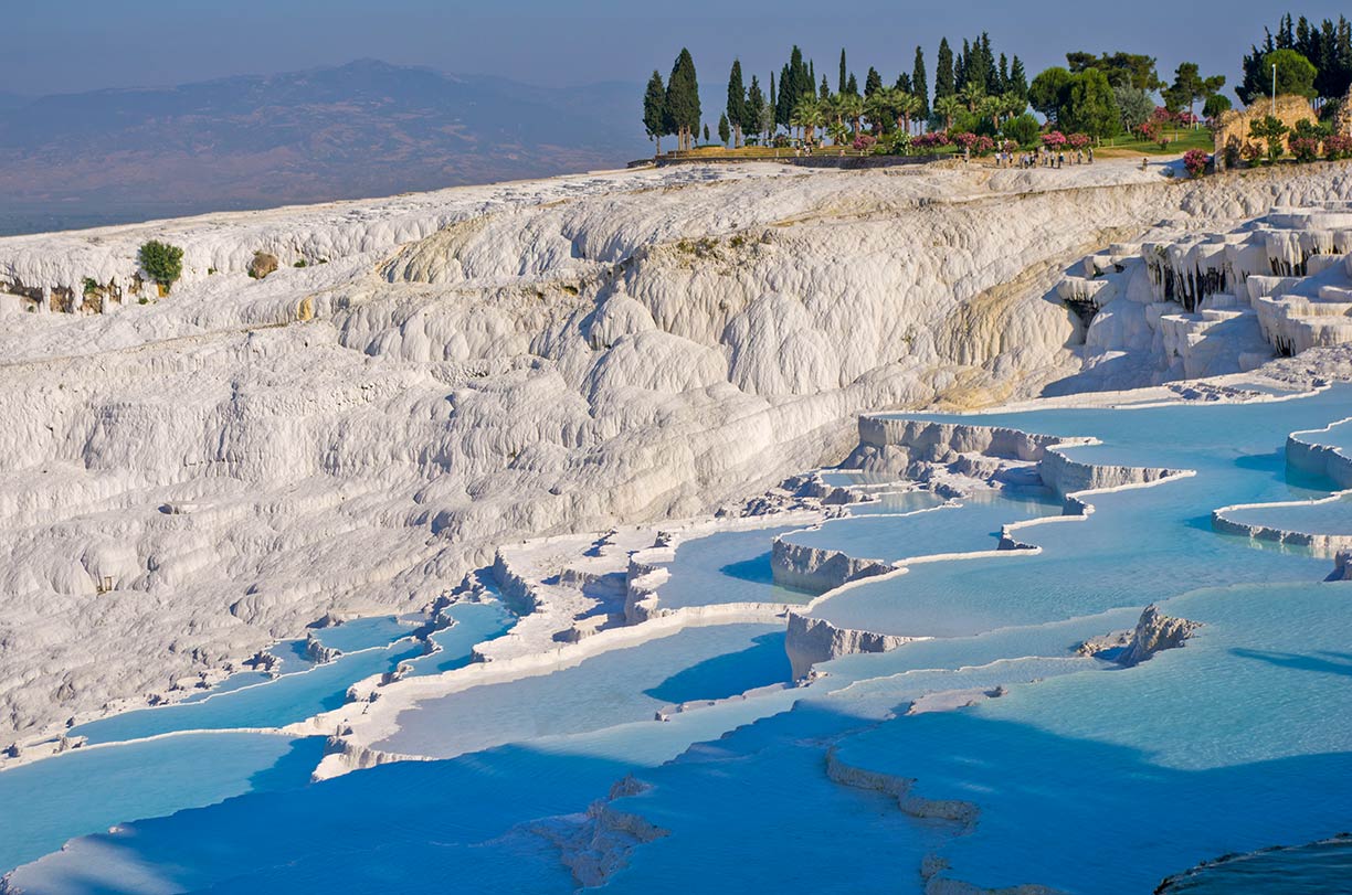
 Hierapolis-Pamukkale - Pamukkale (Cotton Palace), calcite-laden waters have created an unreal landscape, made up of mineral forests, petrified waterfalls and a series of terraced basins. Pamukkale and the nearby thermal spa of Hierapolis, built by the kings of Pergamon, are a UNESCO World Heritage Site
  .
Image: Antoine Taveneaux
The
Taurus Mountain range in southern Turkey divides the central Anatolian Plateau from the Mediterranean coastal region.
The
Pontic Mountains is a mountain range in the northeast of the country in northern Anatolia along the southern coast of the Black Sea.
Volcanos:
Mount Ararat, the dormant volcano near the border with Armenia and Iran is the highest peak in Turkey with an elevation of 5,137 m (16,854 ft).
Mount Erciyes, a massive stratovolcano south of the city of Kayseri.
Lakes:
Lake Van (Van Gölü), in Eastern Turkey is the largest lake in the country.
Lake Tuz (Tuz Gölü), the salt lake in the Central Anatolia Region is Turkey's second largest lake.
Lake Uluabat, shallow freshwater lake near Bursa.
Highlands:
Armenian Highlands, a land-locked plateau east of the
Anatolian plateau and north of Lake Van, the central region of historical Armenia.
Rivers:
Kızılırmak, the 'Red River,' also known as the Halys River, with a length of 1,350 km it is the longest river in Turkey; it empties into the Black Sea. The Taurus Mountains in Turkey are the source of two of the most important rivers of Mesopotamia,
Euphrates, and
Tigris. The
Seyhan River is the longest river in Turkey that flows into the
Mediterranean Sea.
National Parks:
Uludağ National Park, situated 36 km south of Bursa is the highest area in western Anatolia, within are the ancient mountains of Mysian Olympus and Bithynian Olympus; it is a popular center for winter sports.
Peninsula:
Gallipoli Peninsula, located in Turkish Thrace, the European part of Turkey, between the Thracian Sea (Aegean Sea) in the west and the Dardanelles strait in the east.
Islands:
Imbros (Gökçeada) in the Aegean Sea is the largest island of Turkey. Marmara is an island in the Sea of Marmara. The island was known in ancient times for the mining of white marble. The marble of the Pergamon altar comes from the island.
Tenedos (Bozcaada), is the third largest Turkish island located in the northeastern part of the Aegean Sea.
Historical places:
Hisarlik is the modern name for an ancient site on the coast of Turkey where the the Dardanelles merge with the Aegean Sea. It is believed to be the site of ancient
Troy.
Mount Nemrut is a mountain in Adiyaman Province, on its summit is a royal tomb-sanctuary, the mausoleum of Antiochus I from the Hellenistic period in the 1st century BC. 8-9 m tall statues flank the tomb.
Nemrut Dağ 
is a UNESCO World Heritage Site.
Myra was an ancient Greek town in Lycia with two necropoleis of Lycian rock-cut tombs and a Greek amphitheater. The bishop of Myra was Saint Nicholas.
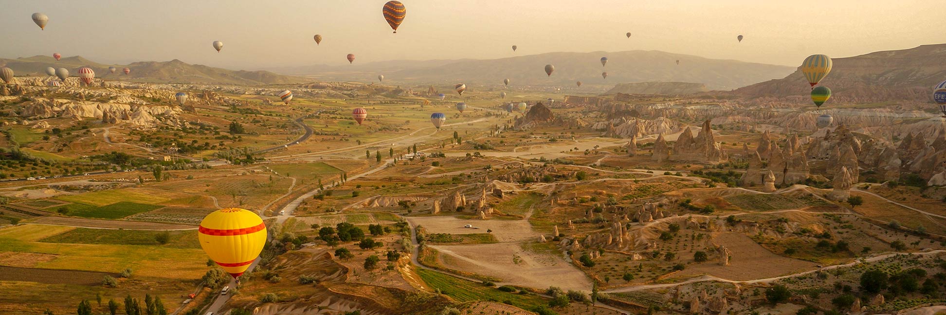
Göreme is a town in Cappadocia, famous for the "fairy chimney" rock formations. The
Göreme National Park and the Rock Sites of Cappadocia 
is a UNESCO World Heritage Site.
The page shows a map of Turkey with cities, and towns, expressways, main roads, and streets.
To find a location use the form below.


