Nations Online
All Countries in the World
Nations Online All Countries in the World | |
Home  |
___ Satellite View and Map of Italy (Italia) |
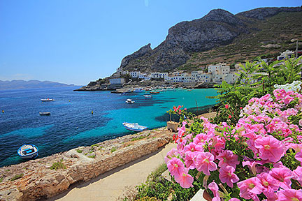
Searchable Map of Italy using Google Earth Data Italy is a country in south eastern Europe, located on the Apennine Peninsula, which is jutting south from the Alps south east into the central Mediterranean Sea. Italy is a country in south eastern Europe, located on the Apennine Peninsula, which is jutting south from the Alps south east into the central Mediterranean Sea. Italy's distinct shape, resembling a kicking boot, makes it easy to recognize it on maps or even from space. Two of the largest Mediterranean islands belong to the country: Sardinia in west and Sicily in south. Border countries are Austria, France, Holy See (Vatican City), San Marino, Slovenia, and Switzerland, Italy shares maritime borders with Albania, Algeria, Croatia, Greece, Libya, Malta, Montenegro, Spain, and Tunisia. With an area of km² of 301,318 km² (116,340 sq. mi.), Italy is four-fifth, or 80% the size of Japan or slightly larger than the U.S. state of Arizona. Italy has a population of more than 60 million people (in 2016), capital city is Rome (Italian: Roma). Major cities are Florence, Milan, Naples, and Venice. Spoken language is Italian. Satellite view is showing Italy with international borders, regions (regioni) boundaries, the national capital The map shows Italy with cities, towns, expressways, main roads and streets. |
|
|
To find a location type: street or place, city, optional: state, country. |
Local Time Italy:
Friday-April-26 17:49
Standard Time Zone (CET): UTC/GMT +1 hoursCEST in use from end of March until end of October: time zone offset: UTC/GMT +2 hours |
|
φ Latitude, λ Longitude (of Map center; move the map to see coordinates): , |
||||||
| Sorry! Google's pricing policy has made it impossible for us to continue showing Google Maps. We apologize for any inconvenience. Google Map: Searchable map and satellite view of the Italian Republic, Italy (Italia). |
Bookmark/share this page |
|||||
|
|
||||||
| More about Italy: Landmarks: Cities: Country: Continent: |
Current Weather Conditions Rome
|
Related Consumer Information: |
||||
| Countries and Territories of Europe | ||||||
Map Help [ show ] |
||||||
One World - Nations Online .:. let's care for this planet Promote that every nation assumes responsibility for our world. Nations Online Project is made to improve cross-cultural understanding and global awareness. More signal - less NOISE |
| Site Map
| Information Sources | Disclaimer | Copyright © 1998-2023 :: nationsonline.org |