Nations Online
All Countries in the World
Nations Online All Countries in the World | |
Home  |
___ Satellite View and Map of Montenegro |
 Budva, view from Gospoština, the city at the coast of the Mediterranean Sea is one of the major tourist destinations in Montenegro. Image: Bratislav Tabaš |
About Montenegro Map view is showing the country in Southeastern Europe bordering the Adriatic Sea. Countries with international borders to Montenegro are Albania, Bosnia and Herzegovina, Croatia, and Serbia. Map view is showing the country in Southeastern Europe bordering the Adriatic Sea. Countries with international borders to Montenegro are Albania, Bosnia and Herzegovina, Croatia, and Serbia.The country occupies an an area of 13,812 km² making it slightly smaller than half the size of Belgium, or slightly smaller than the U.S. state of Connecticut. The country has a population of 622,000 people (in 2015). The largest city and capital is 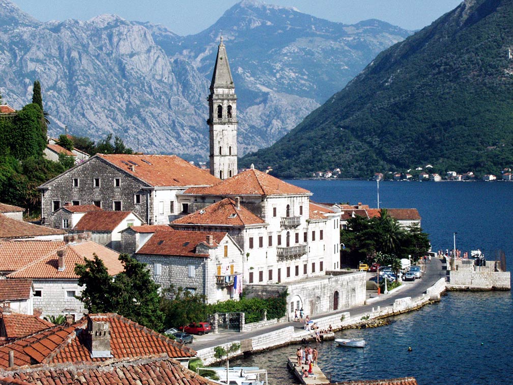 Perast, a town on the Bay of Kotor in Montenegro. Image: Janusz Recław The map shows Montenegro with cities, towns, expressways, main roads and streets. To find a location use the form below. To view just the map, click on the "Map" button. |
|
| To find a location type: street or place, city, optional: state, country. | Local Time Montenegro:
Sunday-April-28 09:41
Standard Time Zone (CET): UTC/GMT +1 hourCEST (Daylight Saving Time) in use from end of March until end of October. Time zone offset: UTC/GMT +2 hours |
|
φ Latitude, λ Longitude (of Map center; move the map to see coordinates): , |
||||||
| Google Maps: Searchable Map of the Republic of Montenegro. |
Bookmark/share this page |
|||||
| More about Montenegro Rep.: Cities: Country: Continent: Political Map of the Mediterranean Region. Political Map of the Balkans. |
Weather Conditions Podgorica
|
Related Consumer Information:
|
||||
Maps of other Countries in Southern Europe Albania Map, Croatia Map, Cyprus Map, Greece Map, Italy Map, Macedonia Map Portugal Map, Serbia Map, Slovenia Map, Spain Map, Turkey Map, Vatican City State Map Searchable Maps of other Countries in Southern Europe Albania, Bosnia and Herzegovina, Croatia, Cyprus, Greece, Italy, Macedonia Montenegro, Portugal, Serbia, Slovenia, Spain, Turkey, Vatican City State Profiles of other Countries in Southern Europe Albania, Bosnia and Herzegovina, Croatia, Cyprus, Greece, Italy, Macedonia Montenegro, Portugal, Serbia, Slovenia, Spain, Turkey, Vatican City State |
||||||
 |
||
One World - Nations Online .:. let's care for this planet Made to improve cross-cultural understanding, global awareness, and cultivating a cosmopolitan consciousness. |
 |
|
| Site Map
| Information Sources | Disclaimer: Privacy Policy, etc. | Contact:
[email protected]
Copyright © 1998-2017 :: nationsonline.org | ||
