Nations Online
All Countries in the World
|
One Planet Nations Online All Countries in the World | |
Home  |
___ Satellite View and Map of Croatia (Hrvatska) |
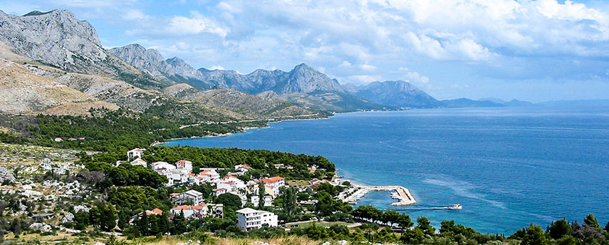
 A bay of the Adriatic Sea at Blato, Živogošće, Croatia. Image: totyahu |
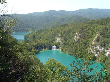
About Croatia Satellite view is showing the Southern European country bordering the Adriatic Sea in east. Croatia, officially the Republic of Croatia, was formerly (until 1991) a constituent republic of Yugoslavia. Countries with international borders to Croatia are Bosnia and Herzegovina, Hungary, Montenegro, Serbia, and Slovenia; Croatia shares a maritime border with Italy in the Adriatic Sea. Satellite view is showing the Southern European country bordering the Adriatic Sea in east. Croatia, officially the Republic of Croatia, was formerly (until 1991) a constituent republic of Yugoslavia. Countries with international borders to Croatia are Bosnia and Herzegovina, Hungary, Montenegro, Serbia, and Slovenia; Croatia shares a maritime border with Italy in the Adriatic Sea. Plitvice Lakes National Park is Croatia's largest national park and a UNESCO World Heritage Site. Image: Gaetano56 Mount Dinara (1,831 m; 6,007 feet) in the Dinaric Alps, one of the three major mountain ranges on the Balkan Peninsula, is the country's highest point. Major rivers are the Sava and the Danube. The country is divided in mainland Croatia and Insular Croatia which consists of over thousand islands and islets in the Adriatic Sea, largest islands are Cres and Krk. Especially the coastal areas and Insular Croatia are popular tourist destinations like Hvar, a port town and a summer resort, Korčula an island with medieval towers and walls, Brač, the Croatian island is best known for its white-pebble beach; Zlatni Rat (Golden Cape or Golden Horn), a favored windsurfing site near the resort and harbor town of Bol. Other islands known as tourist hot-spots are Mljet, Lokrum, an islet close to the city of Dubrovnik; the Brijuni Islands; Zrće, the long pebble beach on the island of Pag; and Šipan (Sipano) the largest of the Elaphiti Islands. The country has a population of 4,225,000 people (in 2015), largest city and the national capital is The map shows Croatia with cities, towns, expressways, main roads and streets. To find a location use the form below. To view just the map, click on the "Map" button. |
|
| To find a location type: street or place, city, optional: state, country. |
Local Time Zagreb:
Sunday-April-28 02:10
Standard Time Zone (CET): UTC/GMT +1 hourCEST (Daylight Saving Time) in use from end of March until end of October. Time zone offset: UTC/GMT +2 hours |
One World - Nations Online .:. let's care for this planet Promote that every nation assumes responsibility for our world. Nations Online Project is made to improve cross-cultural understanding and global awareness. More signal - less NOISE |
| Site Map
| Information Sources | Disclaimer | Copyright © 1998-2023 :: nationsonline.org |