Nations Online
All Countries in the World
Nations Online All Countries in the World | |
Home  |
___ Satellite View and Map of the City of Palmas - Tocantins |
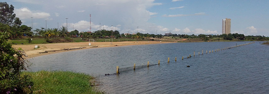 Tocantins river bank, Palmas, Tocantins. Image: Tgasrio |
About the City of Palmas Satellite view is showing Palmas, largest city and the capital of Tocantins, the newest of the Brazilian states, situated between the Amazon Rainforest and the coastal savanna. The city is located in the center of Satellite view is showing Palmas, largest city and the capital of Tocantins, the newest of the Brazilian states, situated between the Amazon Rainforest and the coastal savanna. The city is located in the center of 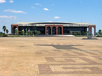 Araguaia Palace, Tocantins' seat of government located in Palmas. Image: Jorge Today the city has a population of almost 250,000 people (census 2012). Palmas is unhurriedly developing to the economic and administrative center of Tocantins and thus its economy is mainly based on a variety of (administrative) services, some industry and a little agriculture. It is home to a Museum of History and Geography, a Modern Art Museum, and the Federal University of Tocantins. For tourists the city is a gateway to the nearby Taquarussu, an ecotourism destination which is famous for its waterfalls and a stunning natural environment. Tocantins lies within the Cerrado, Brazil's vast tropical savanna ecoregion with a tropical savanna climate. Palmas is considered the hottest state capital with high average temperatures. There is a dry winter season from May to October and a season with more rain from December to April. The Map shows a city map of Palmas with expressways, main roads and streets and the location of Palmas Airport named Palmas–Brigadeiro Lysias Rodrigues Airport (IATA Code: PMW) which is by road about 13 km (8 mi) south of downtown Palmas. |
|
| To find a location type: street or place, city, optional: state, country. |
Local Time Palmas:
Friday-July-17 06:38
Time zone: Brasilia Time (BRT): UTC/GMT -3 hours |
|
φ Latitude, λ Longitude (of Map center; move the map to see coordinates): , |
||||||
| Google Earth: Searchable map/satellite view of the City of Palmas, Tocantins, Brazil. City Coordinates: 10°11′S 48°20′W |
Bookmark/share this page |
|||||
| More about Brazil: Cities - background notes and a searchable map/satellite view of other Brazilian cities: Largest cities in Brazil: Other Cities: Aracaju, Belém, Boa Vista, Campo Grande, Cuiabá, Florianópolis, Goiânia, João Pessoa, Macapá, Maceió, Natal, Porto Alegre, Porto Velho, Recife, Rio Branco, São Luís, São Paulo, Teresina, Vitória Country: Continent: |
Current Weather Conditions Palmas Weather station at Palmas airport
External Links: Palmas (official website) Wikipedia: Palmas Wikipedia entry: Palmas |
Explore more:
Related Consumer Information:
|
||||
Other Cities in South America: Asunción (Paraguay) - Bogotá D.C. (Colombia) - Brasilia, Rio de Janeiro, São Paulo, Salvador, (all Brazil) - Buenos Aires (Argentina) - Caracas (Venezuela) - Cayenne, Kourou (both French Guiana) - Georgetown (Guyana) - La Paz, Sucre (both Bolivia) - Lima (Peru) - Montevideo (Uruguay) - Paramaribo (Suriname) - Quito (Ecuador) - Santiago (Chile) |
||
Map Help [ show ] |
||
One World - Nations Online .:. let's care for this planet Promote that every nation assumes responsibility for our world. Nations Online Project is made to improve cross-cultural understanding and global awareness. More signal - less NOISE |
| Site Map
| Information Sources | Disclaimer | Copyright © 1998-2024:: nationsonline.org |

