Advertising

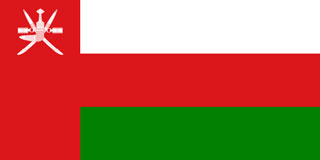
Oman Flag detail
Home Earth Continents Asia Oman Country Profile Map of Oman

Maps Index

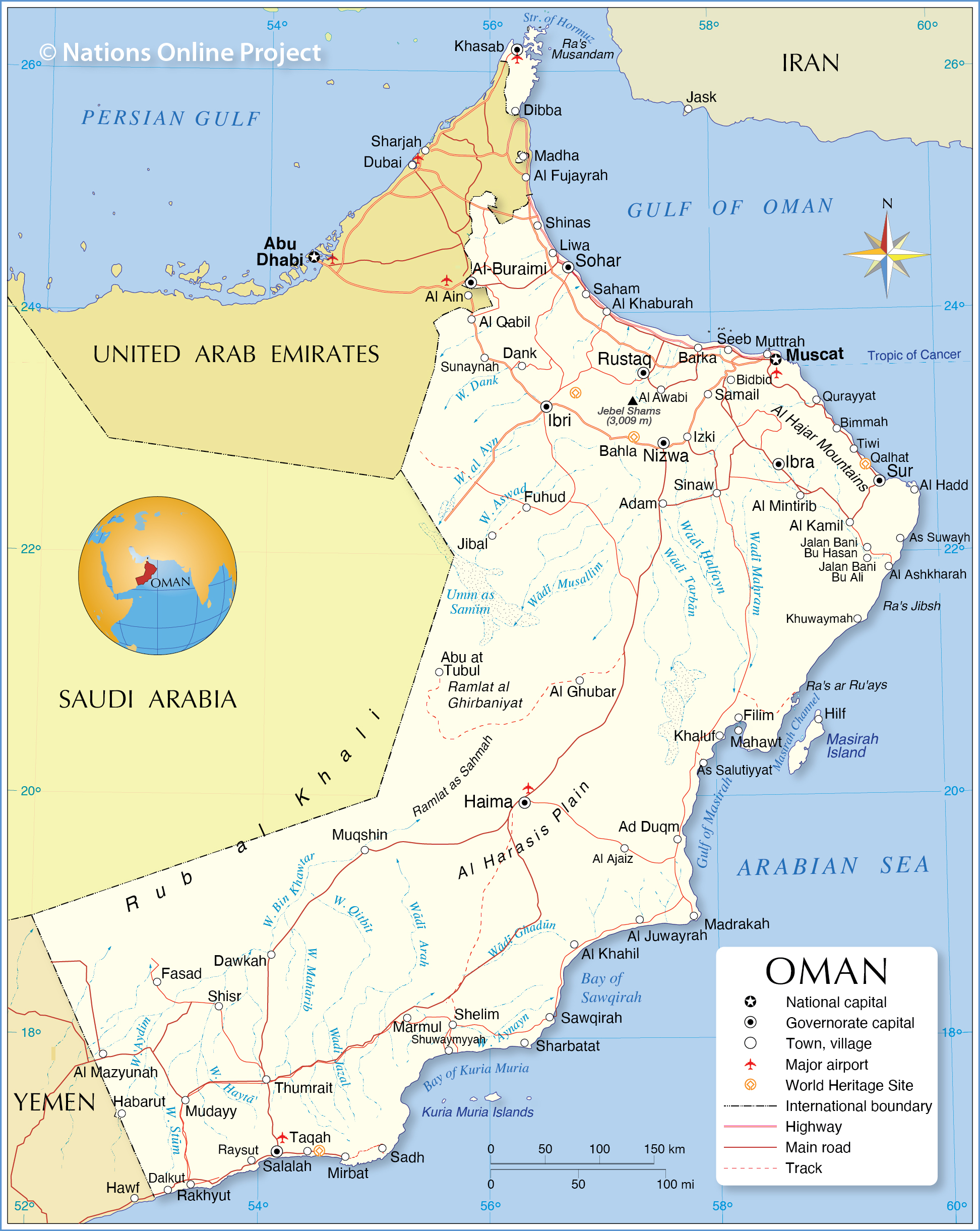
Map of Oman, Arabian Peninsula


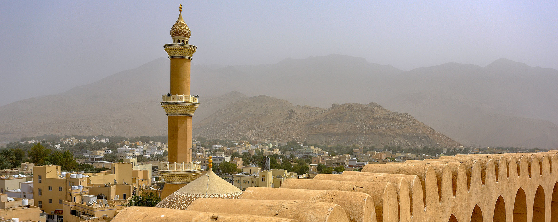
Minaret of the Friday Mosque, and part of Nizwa Fort in Nizwa, Oman
The minaret of the Friday Mosque, seen from the Nizwa Fort, Nizwa, Oman.
Image: Martin Falbisoner

About Oman


Oman Flag
The map shows Oman, a sultanate in the south-eastern corner of the Arabian Peninsula.
Oman borders Saudi Arabia, United Arab Emirates, and Yemen; it shares maritime borders with Iran and Pakistan. The country is bounded by the Arabian Sea and the Gulf of Oman; at the Musandam Peninsula it borders the Strait of Hormuz and the Persian Gulf.

With an area of 309,500 km², the sultanate is slightly smaller than Poland, or somewhat larger than the US state of Arizona.

Oman has a population of 4.7 million people (in 2019, Omanis 2.6 million (56%); Expatriates 2 million (44%)). The capital and largest city is Muscat (pop. more than 600,000). Spoken languages are Arabic (official) and Swahili.


Map of Oman

Political Map of Oman showing cities, roads, and World Heritage Sites
Political Map of Oman

The map shows Oman and surrounding countries with international borders, the national capital Muscat, major cities, main roads, the location of World Heritage Sites, and major airports.

You are free to use above map for educational purposes (fair use), please refer to the Nations Online Project.

 
The map shows the location of following cities, towns:

Governorates and governorate capitals
The Sultanate of Oman is divided into eleven governorates (muhafazah).

1. Ad Dakhiliyah: Nizwa; 2. Ad Dhahirah: Ibri; 3. Al Batinah North: Sohar; 4. Al Batinah South: Rustaq; 5. Al Buraimi: Al-Buraimi; 6. Al Wusta: Haima (Hayma); 7. Ash Sharqiyah North: Ibra; 8. Ash Sharqiyah South: Sur; 9. Dhofar (Ẓufār): Salalah; 10. Muscat: Muscat; 11. Musandam: Khasab;

Other cities and towns in Oman
Abu at Tubul, Ad Duqm, Adam, Al Ajaiz, Al Ashkharah, Al Awabi, Al Ghubar, Al Hadd, Al Juwayrah, Al Kamil, Al Khaburah, Al Khahil, Al Mazyunah, Al Mintirib, Al Qabil, As Salutiyyat, As Suwayh, Bahla, Barka, Bidbid, Bimmah, Dalkut, Dank, Dawkah, Dibba, Fasad, Filim, Fuhud, Habarut, Haima (Hayma), Hilf, Izki, Jalan Bani Bu Ali , Jalan Bani Bu Hasan, Jibal, Khaluf, Khuwaymah, Liwa, Madha, Madrakah, Mahawt, Marmul, Mirbat, Mudayy, Muqshin, Muttrah, Nizwa, Qalhat, Qurayyat, Rakhyut, Raysut, Sadh, Saham, Samail, Sawqirah, Seeb, Sharbatat, Shelim, Shinas, Shisr, Shuwaymyyah, Sinaw, Sunaynah, Taqah, Thumrait, and Tiwi.



Bookmark/share this page
  Instagram button

Weather Conditions Muscat:

MUSCAT WEATHER
 

Advertisements:


Political Maps of other Countries in the Middle East:
Bahrain Map, Cyprus Map, Egypt Map, Iran Map, Iraq Map, Israel Map, Jordan Map, Lebanon Map, Qatar Map, Saudi Arabia Map, Syria Map, Turkey Map, United Arab Emirates Map, Yemen Map 

Searchable Maps of other Countries in Western Asia and Middle East:
Armenia | Azerbaijan | Bahrain | Cyprus | Georgia | Iraq | Israel | Jordan | Kuwait | Lebanon | Oman | Palestinian territories | Qatar | Saudi Arabia | Syria | Turkey | United Arab Emirates | Yemen

Cities in Western Asia and the Middle East Region:
Abu Dhabi | Aden | Alexandria | Amman | Ankara | Baghdad | Baku | Beirut | Damascus | Doha | Dubai (City) | Jerusalem | Kuwait (City) | Luxor | Manama | MeccaMuscat | Nazareth | Nicosia | Port Said | Riyadh | Sanaa | Sharm el-Sheikh | Suez | Tehran | Tel Aviv
up