More about Iran
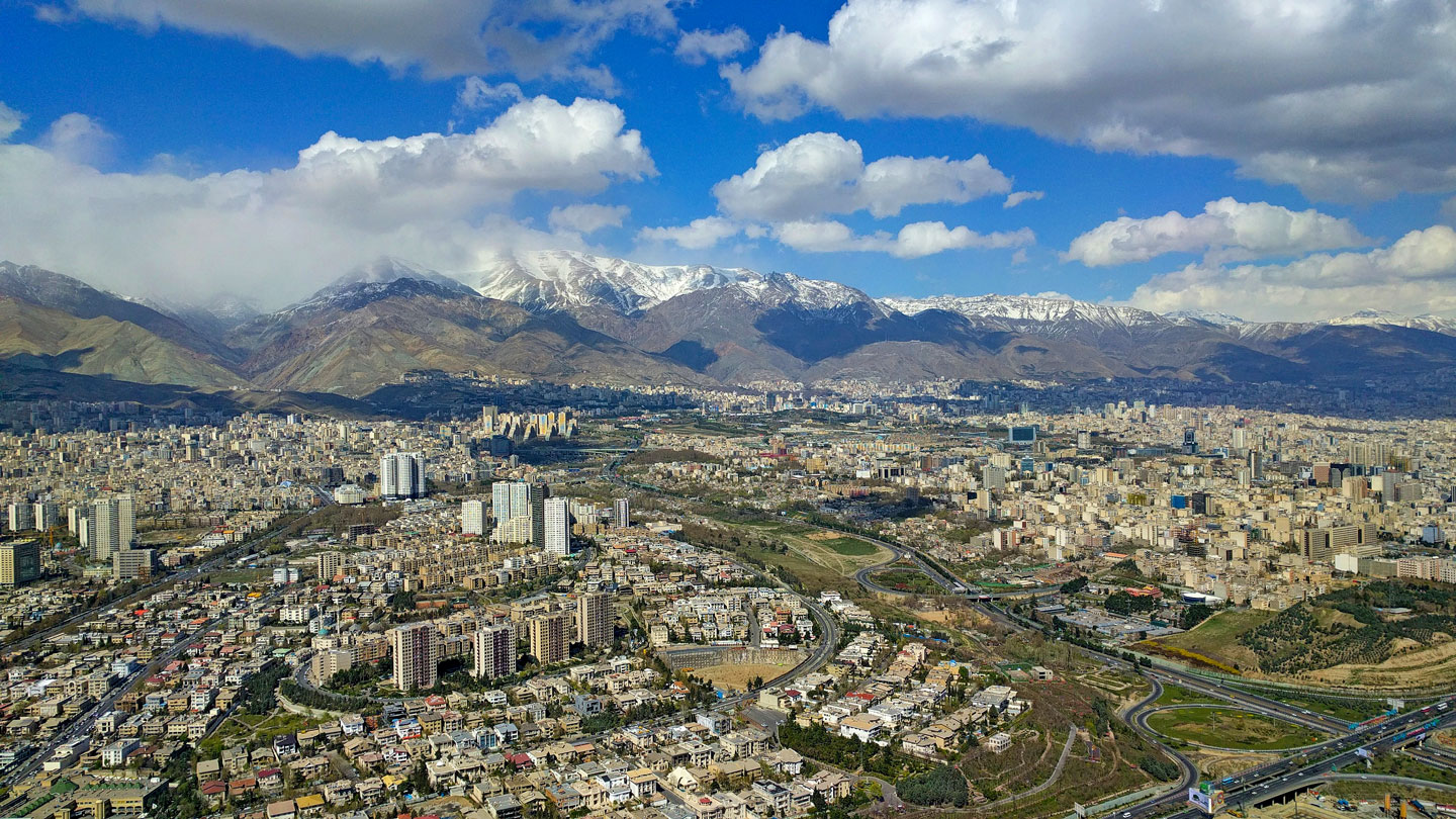 Aerial view of Tehran, with the Alborz mountain range in the background.
Photo: daniyal62
Persia was a monarchy until 1979, when
Mohammad Reza Pahlavi, the last Persian Shah (king), was overthrown in a popular uprising headed by
Ayatollah Ruhollah Khomeini, an Iranian Shiʿi cleric. Today, the country's political system is an unusual combination of an Islamic theocracy with partly democratic structures.
Geography of Iran
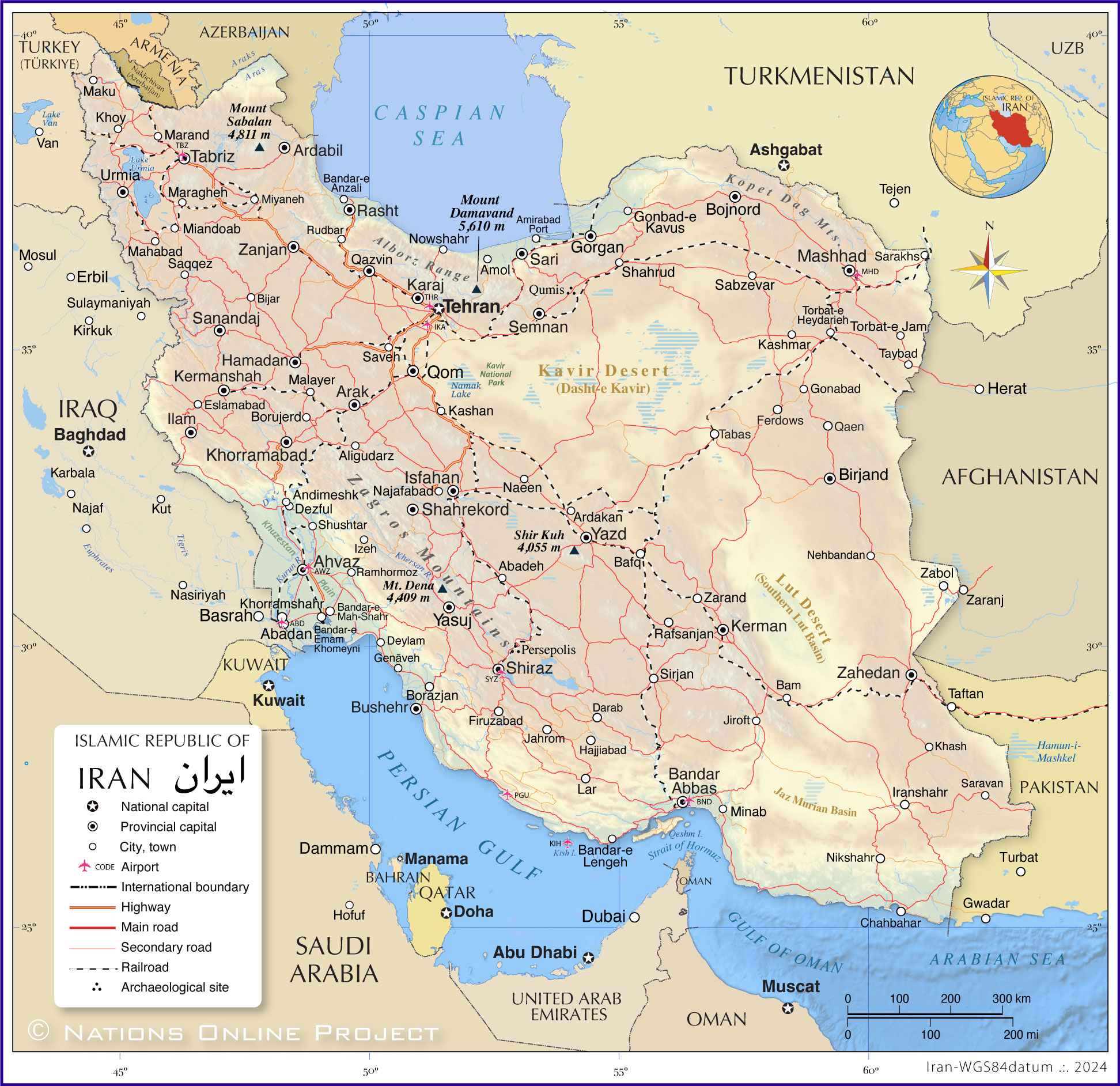
The landscape offers high altitudes (mean elevation: 1,305 m), rugged mountain ranges, barren desert basins and the coastal areas on the Persian Gulf, the Strait of Hormuz, the Gulf of Oman and the Caspian Sea.
Iranian Plateau
The country occupies a plateau surrounded by mountains. The upland with an average elevation of 900 m is known as the
Iranian Plateau (also Persian Plateau). The geological formation in Western and Central Asia extends from the Armenian Highlands and the Caucasus Mountains in the northwest, the Caspian Sea and the Kopet Dag Mountains in the north to the shores of the Persian Gulf, the Strait of Hormuz and the Gulf of Oman in the south, and from the Zagros Mountains in the west to the Indo-Gangetic Plain on the Indian subcontinent in the east.
Seismic activities
The northeastern part of Iran is located on the
Eurasian tectonic plate in an area known as the
Persia-Tibet-Burma Orogeny, a vast mountain-building region. The southwestern portion, a broad strip of Iran's coastal region along the Persian Gulf, is part of the
Arabian Plate.
Ongoing collisions of the Arabian and Indian tectonic plates with the Eurasian plate have created several major faults across the country, making Iran one of the most seismically active countries in the world.
Coasts
In the south, Iran has a 1700 km long coastline on the
Persian Gulf, an arm of the
Arabian Sea. In the north, the country is bounded by the 600 km long southern coast of the
Caspian Sea, a relatively shallow sea and the world's largest inland body of water.
Mountains
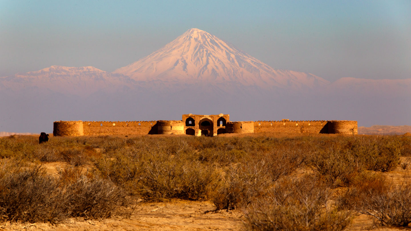 View of the historical Dayr-e Gachin caravanserai in Qom desert in the center of Kavir National Park; Mount Damāvand, the country's highest mountain, in the background.
Photo: Darabad andromeda (Mehdi akbari)
The Zagros Mountains are a massive mountain chain that stretches across the western and southwestern parts of the country, creating a natural barrier between the
Mesopotamian alluvial plain (Euphrates and Tigris) in Iraq in the west and the
Iranian plateau in the east. Some of the peaks of the Zagros Mountains reach heights of over 4,000 meters (13,000 ft.), like
Mount Dena (Kuh-E Dinar), the highest peak in the mountain range at 4,409 meters.
Elburz Mountains
The Elburz mountain range, also known as the Alborz Massif, runs along the southern coast of the Caspian Sea. It is home to
Mount Damāvand, a possibly only dormant volcano and Iran's highest peak at 5,610 meters, about 70 km northeast of Tehran.
Kopet Dag
Kopet Dag is a mountain range in northeastern Iran on the border with Turkmenistan. The 650-kilometer-long mountain range, also known as the Turkmen Khorasan Mountains, is a continuation of the Alborz mountain range.
Central Deserts
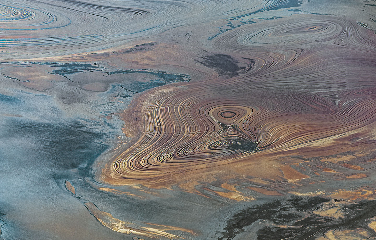 Aeolian erosion on a colossal scale in the desert landscape of the Dasht-e Kavir.
Photo: Ninara
Between the mountain ranges lie vast desert basins: the
Dasht-e Kavir, the Great Salt Desert (which is almost twice the size of Switzerland), and the somewhat smaller
Dasht-e Lut (Emptiness Desert). The
Lut Desert, or Dasht-e-Lut, is a UNESCO World Heritage Site.
The basins are known as the
Central Persian Desert Basins, an ecoregion in central Iran covered by arid steppes and deserts extending into northwestern Afghanistan. The landscape is characterized by hot sand-and-gravel deserts and large salt flats. The region stretches across the
Central Iranian Plateau, is surrounded by mountain ranges and has no outlet to the sea. The area features marshes, seasonal lakes, dry steppes, and semi-deserts. The ecoregion has a an arid steppe climate with hot summers and cool to mild winters.
Rivers & Lakes
Most rivers in Iran are seasonal relatively short, shallow streams; the only navigable river is the
Karun (Karoun) River in the west of the country. The 725 km long river rises in
Zard-Kuh, a sub-range of the central Zagros Mountains; the river flows through Ahvaz and Abadan and empties into the Persian Gulf. The country's largest lake is
Lake Urmia. The endorheic lake in the northwest is one of the largest saltwater lakes in the world.
Regions of Iran
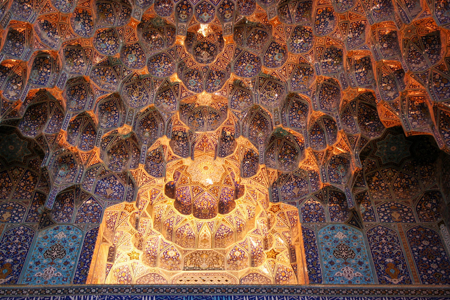 Detail of the interior of the Imam Mosque in Isfahan.
Photo: Ninara
Iran is divided into five regions and thirty-one provinces. The five administrative regions are Tehran, Isfahan, Tabriz, Kermanshah, and Mashhad.
The province capitals are: Ahvaz, Arak, Ardabil, Bandar Abbas, Birjand, Bojnord, Bushehr, Gorgan, Hamadan, Ilam, Isfahan, Karaj, Kerman, Kermanshah, Khorramabad, Mashhad, Qazvin, Qom, Rasht, Sanandaj, Sari, Semnan, Shahr-e Kord, Shiraz, Tabriz, Tehran, Urmia, Yasuj, Yazd, Zahedan and Zanjan.
Climate
Due to its topography, Iran has different climates, with hot and dry summers and quite cold winters. The coastal areas are subtropical and humid, while the central plateaus are arid. The mountainous regions receive heavy snowfall during winters.
Major Cities
Iran's largest cities are
Tehran, the capital of Iran, is located in the foothills of the Alborz Mountains. It replaced Isfahan as the capital of Persia in 1788.
Mashhad, the nation's second-most populous city and the capital of Razavi Khorasan Province, is located in the northeast of the country, near the borders with Turkmenistan and Afghanistan. In ancient times, Mashhad was an important oasis along the Silk Road.
Isfahan is an industrial city in central Iran. It was the capital of Persia from 1598 until 1722.
Tabriz, the capital of East Azerbaijan Province in northwestern Iran, lies at the center of an active volcanic region. It is one of the historical capitals of Persia. The city is famous for its handicrafts, including hand-woven carpets and jewelry.
Shiraz, the capital of the Fars province, is a gateway to Persepolis, the ruined 6th-century-BC ceremonial capital of Persia under the Achaemenid dynasty.
Ahvaz, the capital of Khuzestan province, is an industrial city on the Karun River with a population of about 1.2 million people.
Qom, the capital of Qom province, is considered sacred in Shiite Islam; the city is home to the shrine of
Fatimah bint Musa, the sister of Ali al-Ridha (Imam Reza), a descendant of the Islamic prophet
Mohammed, the founder of Islam.
Sanandaj is the capital of the Iranian province of Kurdistan. Around 450,000 people live in the city, the majority of whom are Kurds. The city is recognized by UNESCO as a
Creative City of Music.
Transportation
Major airports
Iran's 10 largest airports by number of passengers.
1.
Mehrabad International Airport, Tehran (IATA code: THR)
2.
Mashhad International Airport, Mashhad (IATA code: MHD)
3.
Imam Khomeini International Airport, Tehran (IATA code: IKA)
4.
Kish International Airport, Kish (IATA code: KIH)
5.
Shiraz International Airport, Shiraz (IATA code: SYZ)
6.
Ahwaz International Airport, Ahwaz (IATA code: AWZ)
7.
Isfahan International Airport, Isfahan (IATA code: IFN)
8.
Tabriz International Airport, Tabriz (IATA code: TBZ)
9.
Bandar Abbas International Airport, Bandar Abbas (IATA code: BND)
10.
Abadan International Airport, Abadan (IATA code: ABD)
Major ports
Major port cities are:
Persian Gulf
Bandar Abbas is the chief port of Iran and the largest port on the coast of the Persian Gulf.
Chabahar Port on the Gulf of Oman is Iran's only deepwater port; it consists of two separate ports, Shahid Kalantari and Shahid Beheshti.
Caspian Sea
Bandar-e Anzali is the oldest and most important port on the Caspian Sea and a major tourist destination.
Amirabad Port near Behshahr is Iran's largest port on the Caspian Sea; the multipurpose facility handles oil, containers, dry bulk and RORO (Roll-on/roll-off).
Noshahr Port is a multipurpose facility and includes the Noshahr Special Economic Zone.

