Nations Online
All Countries in the World
Nations Online All Countries in the World | |
Home  |
___ Satellite View and Map of the City of Beirut (بيروت,) |
About Beirut
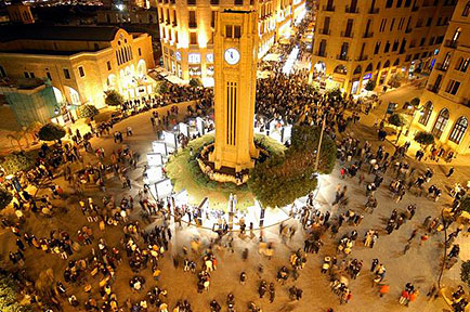 Nejmeh square, downtown Beirut. Image: Yoniw The city is located between the Mount Lebanon range and the Mediterranean coast on a triangular peninsula, in west-central Lebanon. Beirut might have a population of about 1.8 to 2.1 million inhabitants in its metropolitan area. Spoken language is Arabic. 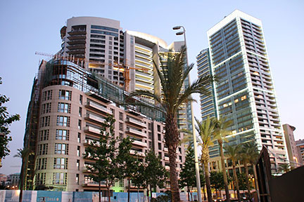 Downtown, Seafront Beirut. Image: A.K.Khalifeh Some points of interest: Beirut Central District (Beirut's core), Mohammad Al-Amin Mosque, National Museum of Beirut (archaeology museum), Sursock Museum (contemporary art), Beirut Art Center (more contemporary art), American University of Beirut - Archaeological Museum (flint stones and pottery), Jeita Grotto (9 km of limestone caves), René Moawad Garden (public park). The map shows a city map of Beirut with expressways, main roads and streets, zoom out to find the location of Beirut Rafic Hariri International Airport (IATA code: BEY) about 9 km (5.6 mi) south of the city center. To find a location use the form below. To view just the map, click on the "Map" button. |
|
To find a location type: street or place, city, optional: state, country. |
Local Time Beirut:
Friday-April-26 06:56
UTC/GMT +2 hoursDaylight saving time from end of March till end of October UTC/GMT +3 hours. |
One World - Nations Online .:. let's care for this planet Promote that every nation assumes responsibility for our world. Nations Online Project is made to improve cross-cultural understanding and global awareness. More signal - less NOISE |
| Site Map
| Information Sources | Disclaimer | Copyright © 1998-2023 :: nationsonline.org |

