Nations Online
All Countries in the World
Nations Online All Countries in the World | |
Home  |
___ Satellite View and Map of the City of Venice (Venezia), Italy
|
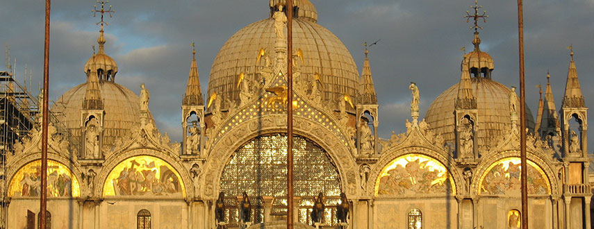 Basilica di San Marco (St Mark's Basilica), one of the best known examples of Italo-Byzantine architecture. Image: Georg Maria Vormschlag |
About Venice Satellite view showing Venice, the world famous city in northeastern Satellite view showing Venice, the world famous city in northeastern The city is built on 118 small islands which are separated by canals and linked by bridges and boat traffic. Formerly a city state, the Republic of Venice was a major maritime power during the Middle Ages and Renaissance, and a staging area for the Crusades. The city grew in power and importance after the sack of Constantinople (Istanbul) by crusading forces in 1204, a campaign orchestrated by the Venetians. 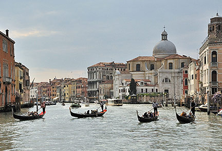 The classical Venetian boat, the Gondola on one of the many canals in Venice. Image: Saffron Blaze Venice was also a major center for the arts in the 13th century up to the end of the 17th century, competing with Florence. And so today, Venice is host to the Venice Biennale, a major contemporary art exhibition, the Venice Biennale of Architecture and the Venice Film Festival. The city being one of the world's greatest and most beautiful cities of art, and one of the most important tourist destinations in the world with more than 3 million international visitors a year. The city has a population of about 270,000 inhabitants, about 60,000 people live in historic Venice. Just zoom in to see St. Mark's Square with Saint Mark's Basilica. The map shows a city map of Venice with expressways, main roads and streets, and the location of Venice Marco Polo Airport (IATA code: VCE) located on the Italian mainland north of the city. To find a location use the form below. |
|
| To find a location type: street or place, city, optional: state, country. |
Local Time Venice:
Tuesday-April-16 20:07
Standard Time Zone (CET): UTC/GMT +1 hourCEST (Daylight Saving Time) in use from end of March until end of October: time zone offset: UTC/GMT +2 hours |
One World - Nations Online .:. let's care for this planet Promote that every nation assumes responsibility for our world. Nations Online Project is made to improve cross-cultural understanding and global awareness. More signal - less NOISE |
| Site Map
| Information Sources | Disclaimer | Copyright © 1998-2023 :: nationsonline.org |

