Nations Online
All Countries in the World
Nations Online All Countries in the World | |
Home  |
___ Satellite View and Map of the City of Tirana (Tiranë), Albania |
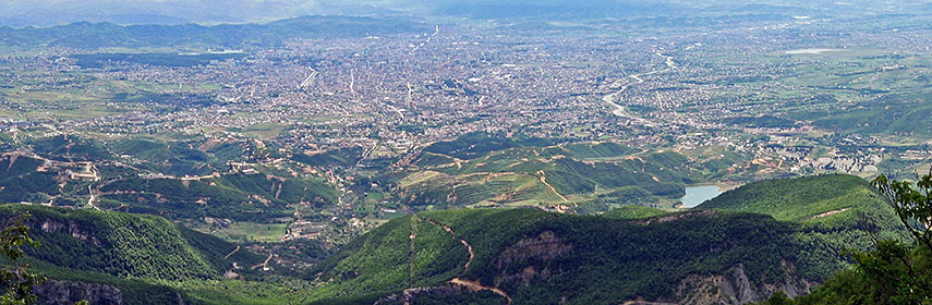 Panoramic view of Tirana from Mount Dajt. |
About Tirana Satellite view is showing Tirana (Tiranë), largest city, capital of Tiranë district and the national capital of the Satellite view is showing Tirana (Tiranë), largest city, capital of Tiranë district and the national capital of the 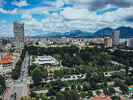 Tirana's Rinia Park. Image: Kj1595 Today Tirana has a population of about 610,000 people, the municipality of Tirana (metropolitan area) has a total population of 801,000 (2015 census). Spoken language is Albanian. The map shows a city map of Tirana with expressways, main roads and streets, zoom out to find the location of Rinas International Airport (IATA code: TIA) about 18 km (11 mi) by road via SH2 and Rruga e Aeroportit/SH60, northwest of the city. To find a location use the form below. |
|
| To find a location type: street or place, city, optional: state, country. |
Local Time Tirana:
Friday-April-26 21:22
Standard Time Zone (CET): UTC/GMT +1 hourCEST (Daylight Saving Time) in use from end of March until end of October: time zone offset: UTC/GMT +2 hours |
One World - Nations Online .:. let's care for this planet Promote that every nation assumes responsibility for our world. Nations Online Project is made to improve cross-cultural understanding and global awareness. More signal - less NOISE |
| Site Map
| Information Sources | Disclaimer | Copyright © 1998-2023 :: nationsonline.org |

