Nations Online
All Countries in the World
Nations Online All Countries in the World | |
Home  |
___ Satellite View and Map of the City of Manama (Al-Manāmah) |
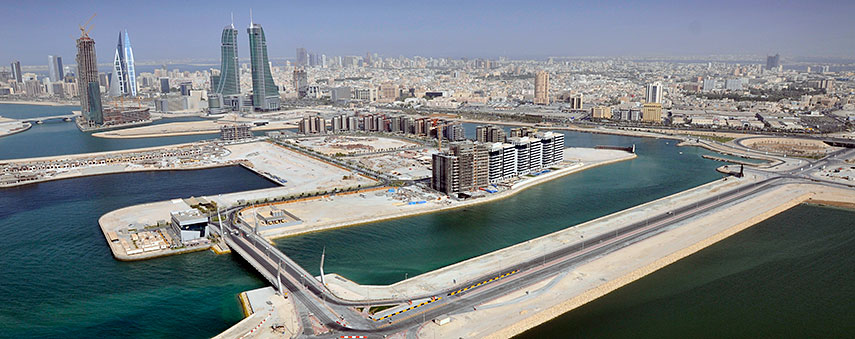 North Manama with view of the construction site of the Bahrain Financial Harbour project. North Manama with view of the construction site of the Bahrain Financial Harbour project.Image: Majed Othman Almajed |
About ManamaManama is the country's largest city and the national capital of 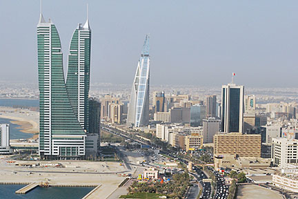 Manama Central Business District with Bahrain's tallest twin-towers of Bahrain Financial Harbour (BFH), a large-scale commercial development project. Image: Jayson De Leon Along the northern coast of Manama is the Central Business District of the city, many of the city's important hotels, office buildings, shops and restaurants are located there. The map shows a city map of Manama with expressways, main roads and streets, zoom out to find the location of Bahrain International Airport (IATA code: BAH), about 11 km (7 miles) by road (via Khalifa Al Khabeer Highway) northeastern the the city center. To find a location use the form below. |
|
| To find a location type: street or place, city, optional: state, country. |
Local Time Manama:
Saturday-April-27 05:01
Time zone: Arabia Standard Time (AST) :: UTC/GMT +3 hours |
|
φ Latitude, λ Longitude (of Map center; move the map to see coordinates): , |
||||||
| Google Earth: Searchable Map and Satellite view of Manama, Bahrain. City Coordinates: 26°13′N 50°35′E |
Bookmark/share this page |
|||||
| More about Bahrain: Bahrain key statistical data. External Links Manama (official website in Arabic) Bahrain International Airport Gulf Digital News Local news. Wikipedia: Manama |
Weather Conditions Manama:
|
Related Consumer Information:
|
||||
Searchable Maps of Cities in the Middle East Region: Abu Dhabi | Aden | Alexandria | Amman | Ankara | Baghdad | Baku | Beirut | Damascus | Doha | Dubai (City) Jerusalem | Kuwait (City) | Luxor | Manama | Mecca | Muscat | Nazareth | Nicosia | Port Said | Riyadh Sanaa | Sharm el-Sheikh | Suez | Tehran | Tel Aviv |
||||||
Map Help [ show ] |
||||||
One World - Nations Online .:. let's care for this planet Promote that every nation assumes responsibility for our world. Nations Online Project is made to improve cross-cultural understanding and global awareness. More signal - less NOISE |
| Site Map
| Information Sources | Disclaimer | Copyright © 1998-2023 :: nationsonline.org |

