Nations Online
All Countries in the World
Nations Online All Countries in the World | |
Home  |
___ Satellite View and Map of Cairo (Al-Qāhirah), Egypt |
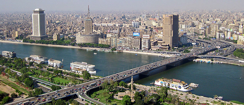 Cairo at the Nile River. Image: Rjruiziii |
About the City of Cairo Satellite View is showing Cairo, the national capital of Satellite View is showing Cairo, the national capital of The city is situated at the Nile river in the northeast of the country, about 170 km (100 mi) south of Egypt's Mediterranean Sea coast. Cairo was built in the tenth century on the remains of former capitals -- the remains of the ancient Roman fortress of Babylon and the original site of Fustat, the first Arab settlement in Egypt (7th century AD). Cairo has since its foundation been a center of political power and cultural life. Cairo is nicknamed "The City of a Thousand Minarets", simply because of the predominance of Islamic architecture. Today the city has a population of almost 7 million inhabitants, about 19 million people live in its metropolitan area. Official language is Arabic. 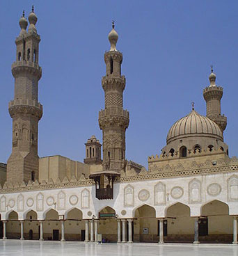 Inside Al-Azhar Mosque, Cairo. The mosque is associated with Azhar University, the chief center of Arabic literature. Located in Cairo is the oldest, largest and most famous film and music industries in the Arab World. Egyptian Museum (extensive collection of Egyptian Antiquities) Khan el-Khalili (the bazaar district), Al-Azhar Park (public park), The Hanging Church in Coptic Cairo (one of the oldest churches in Egypt), Giza Necropolis (pyramids), Gezira Island (with Cairo Tower and Egyptian Opera House), Museum of Islamic Art - MIA (world-renowned collection of Islamic art from Islam’s Golden Era), Muizz Street (one of the oldest streets in Cairo offers the greatest concentration of medieval architecture in the Islamic world), Cairo Citadel (medieval Islamic fortification on Mokattam hill) the citadel contains the Mosque of Muhammad Ali (the Alabaster Mosque). Just zoom in (+) to see Tahrir (liberation) Square, the focal point of the 2011 Egyptian uprise against president Hosni Mubarak. Have a look at the Pyramids in south west of Cairo. The Map shows a city map of Cairo with expressways, main roads and streets, zoom out to (-) find Cairo International Airport (IATA code: CAI) located in northeast. |
|
| To find a location type: street or place, city, optional: state, country. |
Local Time Egypt:
Wednsday-April-24 01:53
Standard time zone is Eastern European Time (EET): UTC/GMT +2 hoursEgypt does not observe Daylight Saving Time (DST) since 2011 |
One World - Nations Online .:. let's care for this planet Promote that every nation assumes responsibility for our world. Nations Online Project is made to improve cross-cultural understanding and global awareness. More signal - less NOISE |
| Site Map
| Information Sources | Disclaimer | Copyright © 1998-2023 :: nationsonline.org |

