Nations Online
All Countries in the World
Nations Online All Countries in the World | |
Home  |
___ Satellite View and Map of the City of Skopje (Скопје), Republic of Macedonia (FYROM) |
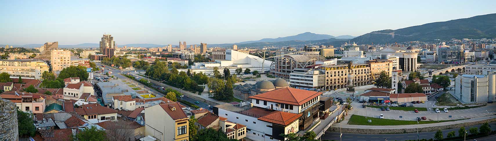 Skopje panorama from Skopje Fortress, in the background left the Macedonian Radio-Television headquarters, in center the Macedonian Opera and Ballet House, on the right the Archaeological Museum near the Stone Bridge. The bridge across the Vardar River connects Macedonia Square, in the center of Skopje, with the Old Bazaar. Image: Marcin Szala |
About Skopje Satellite view is showing Skopje (Скопје), largest city and the national capital of the Satellite view is showing Skopje (Скопје), largest city and the national capital of the 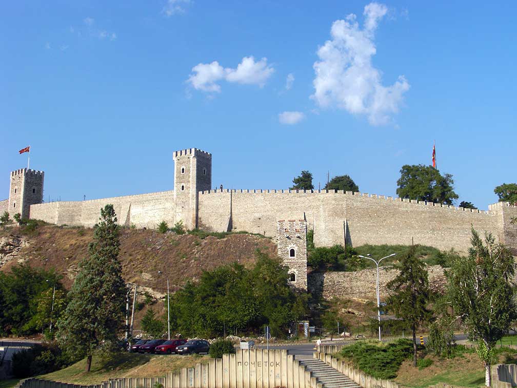 Skopje Fortress (Kale), the iconic bastion, formerly a fortified city, is located in the old town of Skopje. Image: Yemc Today Skopje is the primate city, a principal city of the Republic of Macedonia and the center of governmental power, it is the political, cultural, and economic hub for the country and the center of higher education. Skopje is the country's largest city with a population of 540,000 inhabitants (in 2012), this is more than one-forth of the entire population of the Republic of Macedonia. Most widely spoken language is Macedonian (official). The city is home to the Government of the Republic of Macedonia and the Ss. Cyril and Methodius University, the first state University in the Republic of Macedonia, founded in 1949. Just zoom in to see the heart of Skopje, with the Stone Bridge over the Vardar River, the Triumphal Arch (Triumfalna Kapija), Alexander the Great fountain, Mother Teresa Square, the Holocaust Museum, the Skopje Fortress (Kale), Macedonian opera and ballet, and the Museum of Macedonia. The map shows a city map of Skopje with expressways, main roads and streets, zoom out to find the location of Skopje's Alexander the Great Airport (IATA code: SKP), located about 22.5 km (14 mi) by road (via Boulevard Alexander the Great and A4), southeast of the city. To find a location use the form below. |
||
| To find a location type: street or place, city, optional: state, country. |
Local Time Skopje:
Tuesday-April-16 22:47
Standard Time Zone (CET): UTC/GMT +1 hourCEST (Daylight Saving Time) in use from end of March until end of October: time zone offset: UTC/GMT +2 hours |
|
One World - Nations Online .:. let's care for this planet Promote that every nation assumes responsibility for our world. Nations Online Project is made to improve cross-cultural understanding and global awareness. More signal - less NOISE |
| Site Map
| Information Sources | Disclaimer | Copyright © 1998-2023 :: nationsonline.org |

