Nations Online
All Countries in the World
Nations Online All Countries in the World | |
Home  |
___ Satellite View and Map of Burundi |
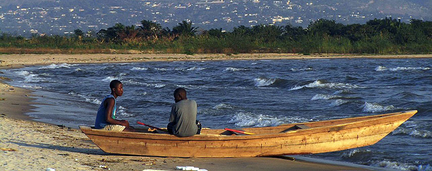 Fishermen at Lake Tanganyika. Image: Francesca Ansaloni |
About Burundi Burundi is a small landlocked country in east-central Africa with a shoreline at the northern edge of Lake Tanganyika, the largest rift lake in Africa. With an area of 27,834 km² Burundi is somewhat smaller than half the size of Croatia, or slightly smaller than the U.S. state of Maryland. Burundi is a small landlocked country in east-central Africa with a shoreline at the northern edge of Lake Tanganyika, the largest rift lake in Africa. With an area of 27,834 km² Burundi is somewhat smaller than half the size of Croatia, or slightly smaller than the U.S. state of Maryland. Burundi is bordered by the Democratic Republic of the Congo, Rwanda, and Tanzania. Large parts of Burundi's landscape are mountainous with elevations between 770 m and up to 2,670 m, the terrain is dropping to a flat plateau in east. Highest point is Mount Heha (2,670 m) within the Burundi Highlands mountain range. The country has a population of 10.75 million people, ethnic groups are 85% Hutu and 14% Tutsi. Capital city is Bujumbura. Official languages are French and Kirundi, a Bantu language spoken by people in Burundi and neighboring parts of Tanzania and Congo-Kinshasa, as well as in Uganda. The map shows Burundi with national parks, game reserves, cities and towns, expressways, main roads and streets. To find a location use the form below. |
|
| To find a location type: street or place, city, optional: state, country. |
Local Time Burundi:
Monday-June-29 19:33
Time Zone: Central Africa Time (CAT) GMT/UTC +2 |
One World - Nations Online .:. let's care for this planet Promote that every nation assumes responsibility for our world. Nations Online Project is made to improve cross-cultural understanding and global awareness. More signal - less NOISE |
| Site Map
| Information Sources | Disclaimer | Copyright © 1998-2024:: nationsonline.org |

