Nations Online
All Countries in the World
Nations Online All Countries in the World | |
Home  |
___ Searchable Map and Satellite View of the City of Antananarivo, Madagascar |
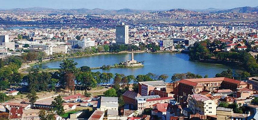 Lake Anosy in the center of Antananarivo. Image: Sascha Grabow |
About Antananarivo Satellite view is showing Antananarivo (formerly Tananarive, nickname: Tana), the national capital of Satellite view is showing Antananarivo (formerly Tananarive, nickname: Tana), the national capital of The city is located almost in the geographical center of the island, 160 km away from Madagascar's eastern coast at the Indian Ocean, and 210 km southwest of Toamasina (Tamatave), the island's chief port. Established in the 17th century, it was for a long time the capital of the Hova rulers, descendants of immigrants from South East Asian. It became the center of the Merina kings in 1794 and was controlled by them until 1895, when it fell to France. Madagascar became independent in 1960 and Antananarivo its capital. Today the city has a population of about 1.4 million inhabitants. Spoken languages are Malagasy and French. Antananarivo is the seat of the government of Madagascar and is home to the Senate, the National Assembly, the Supreme Court and the Presidential Office. Some attractions in the city are, the Rova Palace complex, formerly the royal city of the Kingdom of Imerina, and later the seat of the Kingdom of Madagascar. Andafiavaratra Palace, the former late 19th century residence of Prime Minister Rainilaiarivony. Andravoahangy market, the open-air market is the largest in the city. The Tsimbazaza Zoo, a botanical garden with a zoo. The map shows a city map of Antananarivo with expressways and main roads, zoom out to find the location of Antananarivo International Airport (Ivato; IATA code: TNR) about 24 km (15 mi) by road (via Route 4) north of the city. To find a location use the form below. To view just the map, click on the "Map" button. |
|
| To find a location type: street or place, city, optional: state, country. | Local Time Madagascar:
Sunday-July-26 20:32
East African Time (UTC/GMT +3 hours)
|
One World - Nations Online .:. let's care for this planet Promote that every nation assumes responsibility for our world. Nations Online Project is made to improve cross-cultural understanding and global awareness. More signal - less NOISE |
| Site Map
| Information Sources | Disclaimer | Copyright © 1998-2024:: nationsonline.org |

