Nations Online
All Countries in the World
Nations Online All Countries in the World | |
Home  |
___ Satellite View and Map of the City of Asmara (Asmera) |
About AsmaraThe city was somtimes called Piccola Roma, for its well-preserved colonial Italian architecture. Asmara and the rest of the country was occupied by Italy in 1889 and the city was made the capital of Italian Eritrea. Today Asmara has a population of about 650,000 inhabitants. Spoken languages are Tigre and Cushitic. The map shows a city map of Asmara with expressways, main roads and streets, zoom out to find the location of Asmara International Airport (IATA code: ASM) about 5 km (3 mi) south of the city. To find a location use the form below. To view just the map, click on the "Map" button. |
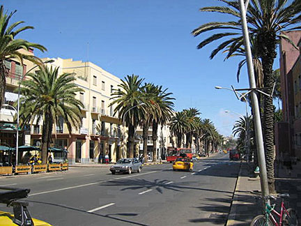 Boulevard in downtown Asmara. Image: KH Bookmark/share this page |
| To find a location type: street or place, city, optional: state, country. |
Local Time Eritrea:
Monday-July-6 19:17
UTC/GMT +3 hours |
One World - Nations Online .:. let's care for this planet Promote that every nation assumes responsibility for our world. Nations Online Project is made to improve cross-cultural understanding and global awareness. More signal - less NOISE |
| Site Map
| Information Sources | Disclaimer | Copyright © 1998-2024:: nationsonline.org |

