About European Russia
Russia, officially the Russian Federation (Rossiyskaya Federatsiya), is the world's largest country. It occupies a significant part of the northern portion of the Eurasian continent.
Russia is a transcontinental country, a state which is situated on more than one continent.
Russia spans the northern part of the Eurasian continent; 77% of Russia's
area is in
Asia, the western 23% of the country is located in
Europe. European Russia occupies almost 40% of the total area of Europe.
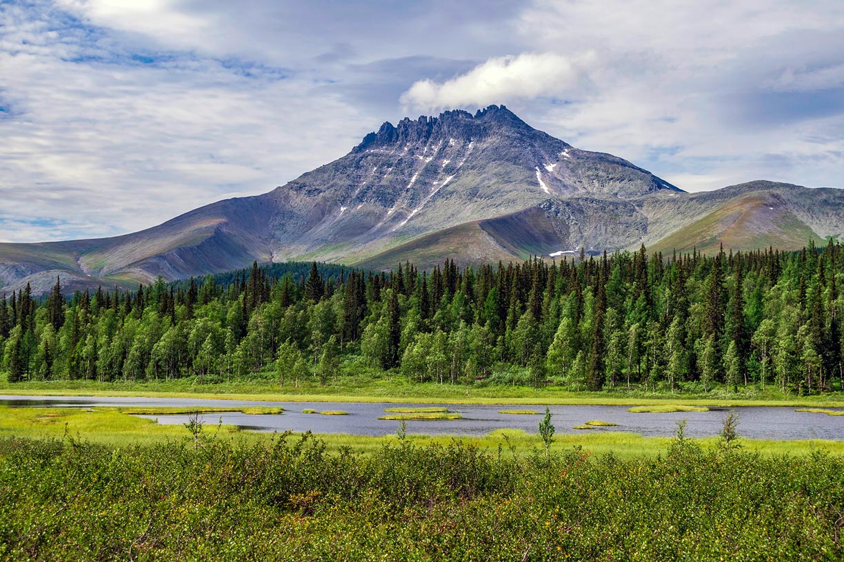 Manaraga Mountain (1,662 m), a peak in the Yugyd Va National Park. The largest national park in Europe is located on the western slopes of the Ural Mountains, the dividing line between Europe and Asia.
Image: Aleksandr Chazov
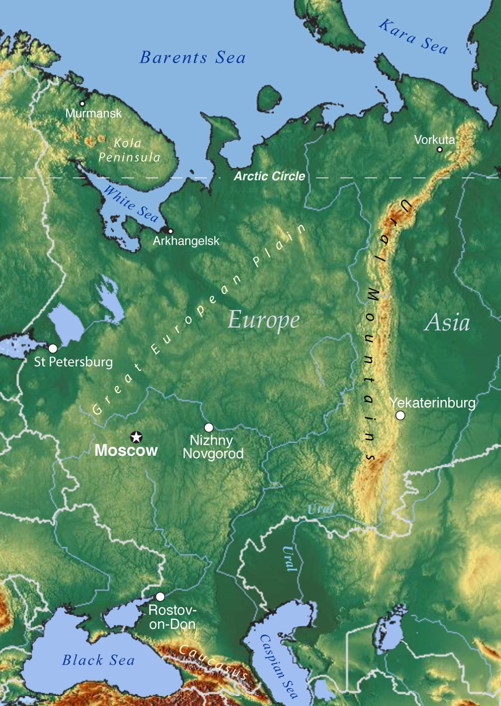
By convention, the line of demarcation between Western Asia and the European part of the 'supercontinent' of Eurasia is along the Ural Mountain range, the Ural River, the slopes of the Caucasus Mountains, and the Turkish Straits.
European Russia (or Western Russia) is situated in
Eastern Europe on the East European Plain, the eastern part of the
Great European Plain, the largest mountain-free landform in Europe; only some hills and highlands are interspersed within.
The region is bordered to the north by the
White Sea, the
Barents Sea, and the
Kara Sea, all arms and bays of the Arctic Ocean.
In the west, Russia is bordered by
Norway,
Finland, and a small part of the
Baltic Sea (at the Gulf of Finland). It borders the
Baltic states of
Estonia,
Latvia, and
Lithuania (at Kaliningrad) in the west; in the southwest, it is bordered by
Belarus and
Ukraine; there is also a border with
Poland (at Kaliningrad Oblast).
Furthermore, it borders
Georgia,
Azerbaijan, and
Kazakhstan. Western Russia also has coastlines on the
Black Sea and the
Caspian Sea in the southwest.
More about European Russia
Area
The vast area of European Russia stretches from the Arctic Ocean in the north to the Caucasus Mountains in the south and from the Baltic Sea in the west to the Ural Mountains in the east. The European part of Russia covers an
area of 3,960,000 km², making it somewhat larger than
India, or about half the size of the
Contiguous United States.
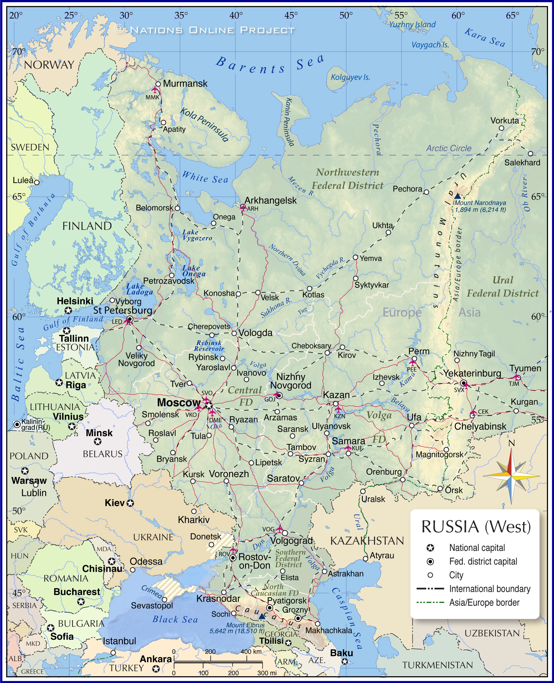
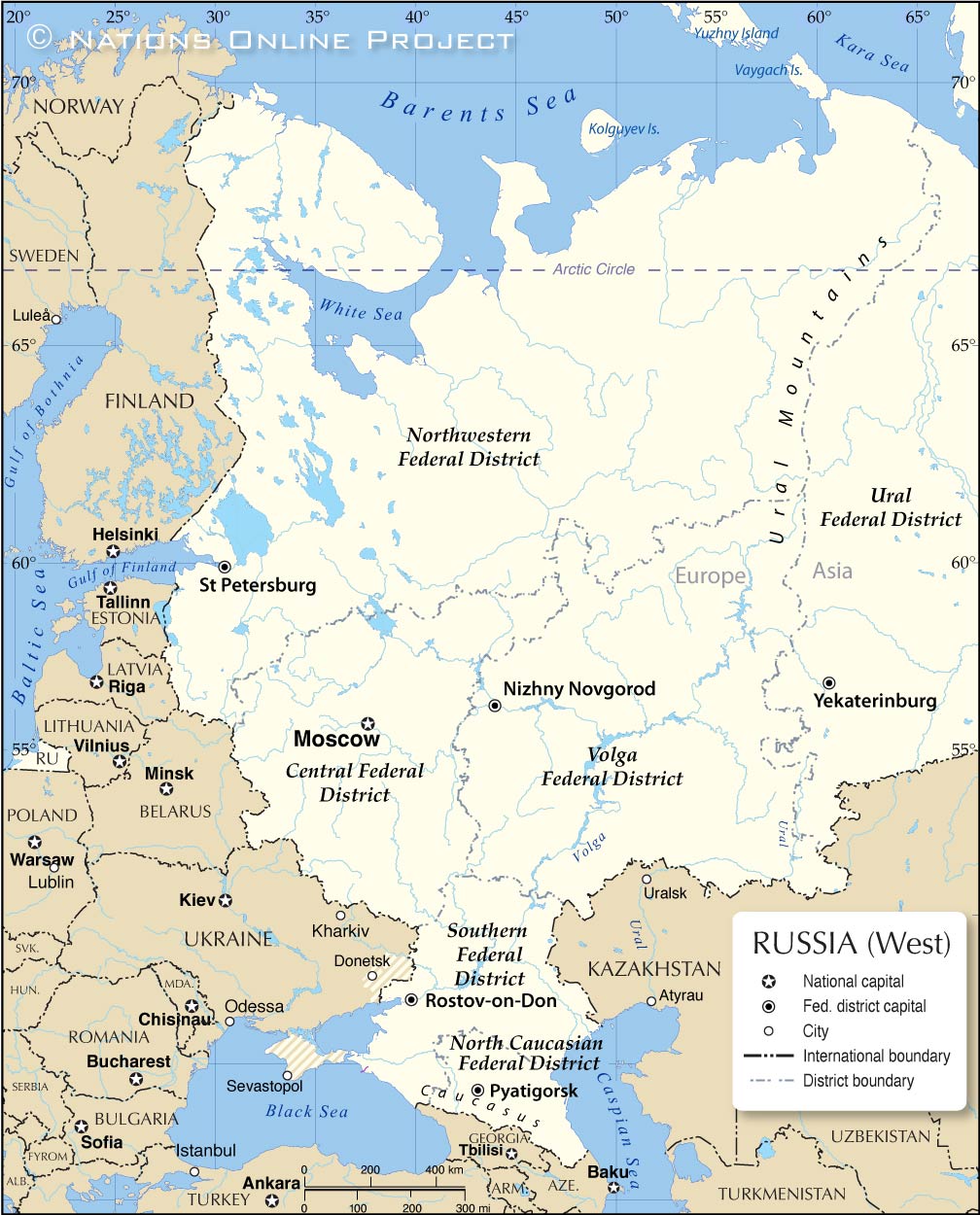 Map of Western Russia with administrative divisions. There are five federal districts in the European part of the Russian Federation.
Image: kk nationsonline.org
Russia is divided into eight
federal districts (okrugs), five of which are located in Western Russia. The federal districts are groups of
federal subjects, the constituent entities of Russia and the top-level political divisions according to the Constitution of Russia.
In contrast, the federal districts are an additional administrative structure. Each federal district is headed by a representative appointed and authorized by the President of Russia. These representatives (usually called governors or presidents) exercise a control function over the heads of the subjects of the Federation.
Russia's federal districts were established by President
Vladimir Putin in 2000 to help the federal government control the then 89 federal subjects across the country.
Federal Districts
- The Central Federal District (CEN) is the most populous district in Russia, with nearly 40 million inhabitants. It is located in the west and borders Belarus and Ukraine, and Moscow is its administrative core.
- The Volga Federal District (PRV) in the east is predominantly located in Europe; the capital is Nizhny Novgorod (formerly known as Gorky).
-
The Northwestern Federal District (SZA) has an area of 1,687,000 km², which is slightly larger than three times the area of France. Its administrative center is St. Petersburg, formerly known as Leningrad.
- The Southern Federal District (JUZ) lies between Ukraine and Kazakhstan; it is bounded in the southwest by the Black Sea and in the southeast by the Caspian Sea. Its administrative capital is Rostov-on-Don, a port city on the Don River.
- The North Caucasus Federal District (SKA), created in 2010, is located in southwestern Russia in the North Caucasus. The district is home to the autonomous republics of Dagestan and Chechnya; it borders Georgia and Azerbaijan to the south and is bounded by the Caspian Sea to the east; its administrative center is Pyatigorsk.
Landscape
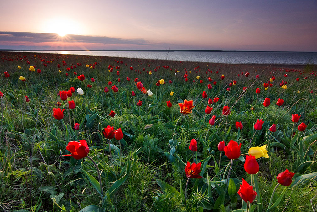 Tulips in a protected area of Russia in Iki-Burulsky District in the Republic of Kalmykia. Tulipa suaveolens is one of the most typical spring flowers of the Eurasian Steppe.
Image: Deingel
The northern portion of Russia lies within the
Arctic Circle. The region includes the Kola Peninsula, parts of the Arkhangelsk Oblast, the Komi Republic, and the Nenets Autonomous Okrug, home to the Nenets people. The landscape is dominated by
Tundra, the treeless marshy steppe of the north.
Southward of the Arctic Circle, above 60 degrees north latitude, the landscape is dominated by
Taiga, the swampy coniferous forest of high northern latitudes with a mix of spruces, larches, pines and birch trees in the north giving way southward to broad-leaved trees.
The center of the
East European Plain is covered by temperate broadleaf and mixed forests; the mostly flat plain is here and there disrupted by some hills and highlands, known as the Smolensk-Moscow Upland, the Central Russian Upland, the Volga Hills, and the Northern Hills.
Since modern times, the plain has been extensively developed for agriculture. The primary grains are wheat, barley and rye, and 'industrial' crops such as sunflower seeds, sugar beets, and potatoes.
In the south of Western Russia extends the
Western Steppe (Pontic–Caspian Steppe), the western part of the vast Eurasian Steppe belt is a broad fertile band of treeless, grassy plains with savannas and shrublands, situated to the north of the Black Sea, the Sea of Azov, the Caucasus mountain range and the semidesert along the northern shore of the Caspian Sea. The Western Steppe begins near the mouth of the Danube River and extends northeast almost to
Kazan and then east to the southern tip of the Ural Mountains.
Ural Mountains
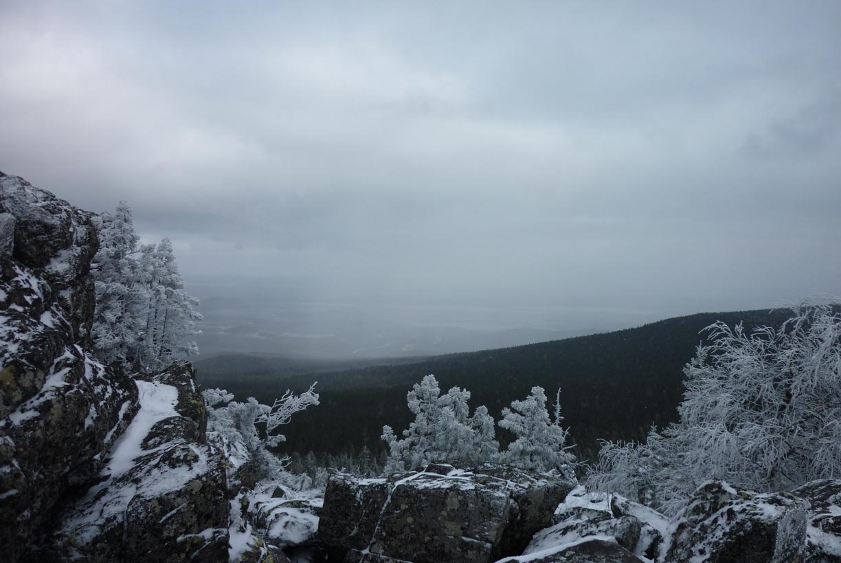 Winter landscape on top of Mount Kachkanar in the central Ural mountain range.
Image: Copper Kettle
The
Ural Mountains are a mountain range stretching over 2,100 km (1,300 mi) from the
Kara Sea (Arctic Ocean) in the north to northwestern Kazakhstan (Mugodzhar Hills) in the south. The natural barrier dividing the Eurasian continent is considered the
border between Europe and Asia. The highest peak of the Ural Mountains is
Mount Narodnaya at 1,895 m.
Ice Age
Geomorphic processes shaped Western Russia's mostly flat landscape during the
Pleistocene Epoch (i.e., about 2.6 million to 11,700 years ago, commonly known as the Ice Age), a period of repeated glaciations.
Continental-sized ice sheets covered most of Northern Europe; their movements scoured and abraded the plain's surface, eroded mountains to their bases and rendered the whole landscape flat. After the last glacial period, the melting ice left behind a lot of water. European Russia has many freshwater lakes, especially in the northwest and on the Kola Peninsula; almost all were created by glacial erosion.
Rivers and Lakes
Western Russia's largest lakes are
Lake Ladoga, the largest lake located entirely in Europe, and
Lake Onega, Europe's second-largest lake. The
Rybinsk Reservoir or Rybinsk Sea is a human-made reservoir and the northernmost point of the Volga river. Other major lakes are Lake Peipus (shared with
Estonia), Lake Beloye (the White Lake), Lake Vygozero, Lake Kovdozero, and Lake Segozero.
Major rivers in Western Russia
-
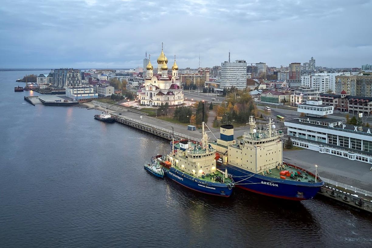 The Northern Dvina embankment of Arkhangelsk with the rebuilt Archangel Michael Cathedral in the center and the icebreakers "Dikson" and "Kapitan Kosolapov" in front of Arkhangelsk' marine passenger terminal.
Image: Gennadiy Shtalbaum
- The Northern Dvina is formed by the confluence of the Yug and Sukhona rivers in the North Russian Plain near Veliky Ustyug, the mouth of the river is in the Dvina Bay of the White Sea (Arctic Ocean) near Arkhangelsk.
- The 857 km long Mezen is one of the biggest rivers of European Russia. It rises in the Timan Ridge and flows into the Mezen Bay of the White Sea.
- The Moskva is a 470 km long river that flows through Russia's capital Moscow, which was named after it.
- The Neva is a 74 km long river connecting Lake Ladoga with the Gulf of Finland (Baltic Sea). The Neva is the only outflow of Lake Ladoga and played a vital role in the history of St. Petersburg and the region.
- The Ural is a river originating in the southern Ural Mountains, flowing through Russia and Kazakhstan and emptying into the Caspian Sea; the river is considered part of the border between Europe and Asia.
- The White Sea-Baltic Canal consists of a system of rivers, lakes and canals that eventually connects the White Sea of the Arctic Ocean with the Gulf of Finland (Baltic Sea).
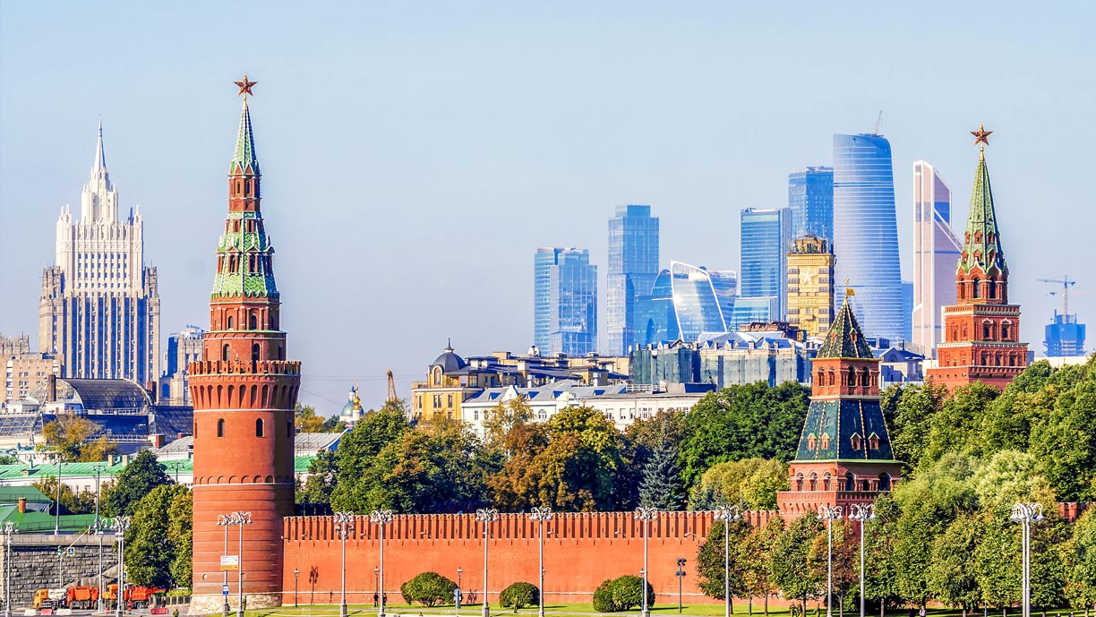 View of central Moscow from Sofiyskaya Embankment with the famous building of the Ministry of Foreign Affairs of Russia (left), the southwest corner of the Kremlin Wall (Vodovzvodnaya Tower), and the high-rises of the Moscow International Business Center (Moscow-City, Presnensky District) in the background.
Image: dimbar76
European Russia has a
population of 113 million people (in 2020), making it the most populous country in Europe. About 77% of Russia's total population lives west of the Ural Mountains. Therefore, almost all of Russia's largest cities are in the western part of the country. These cities are important social, political, economic, industrial and cultural centers.
The most populated cities in Russia
The most populous city in Russia is
Moscow (pop. 12,2 million), the second-largest city is
Saint Petersburg (pop. 5.5 million), a major seaport and former capital of imperial Russia (until the Russian Revolution in 1918).
Other major cities with more than one million people are
Nizhny Novgorod; until 1990, it was known as Gorky, an important economic hub and a major center of river tourism in Russia.
Kazan is a port on the River Volga; it is also the capital and largest city of the Republic of Tatarstan.
Samara, known until 1991 as Kuybyshev, is a port and an industrial city at the Samara Bend of the Volga river opposite the wooded Zhiguli Mountains. It is the capital of the Oblast of the same name.
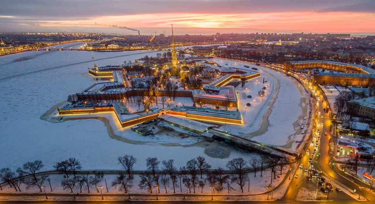 Aerial view of Peter and Paul Fortress on Hare Island (Zayachy Is.) in the Neva River, the original citadel of St. Petersburg. Today, the star fortress is the main site of the State Museum of the History of St. Petersburg.
Image: Lev Karavanov
is a port city at the Volga-Don Shipping Canal, is one of the largest cities in the European part of the Russian Federation. The capital of the Rostov Oblast is known as the "Gateway to the Caucasus."
Ufa is the capital of the Republic of Bashkortostan; the city lies at the confluence of the Ufa and the Belaya rivers, about 100 km west of the Ural mountains.
Perm, the easternmost metropolis in Europe, is an industrial city and a transportation hub. The city is situated in the Ural foothills on the Kama River, a 1,800 km long major tributary of the Volga.
Volgograd was formerly known as Stalingrad, an industrial city and the administrative and economic center of Volgograd Oblast. The city is located on the lower Volga.
The cities of
Chelyabinsk, the administrative center of Chelyabinsk Oblast, and
Yekaterinburg, the capital of the Ural Federal District, are technically in Asia, but they belong to the European Russian economic zone.
Murmansk is a port city on the Kola Peninsula with more than 300,000 inhabitants; it is by far the largest city north of the Arctic Circle. Murmansk and Severomorsk, 20 km to the north, are important bases for the Russian Northern Fleet.
Vorkuta is a coal-mining town with a population of about 70,000 people; it is the easternmost city in Europe.


