More about the Black Sea
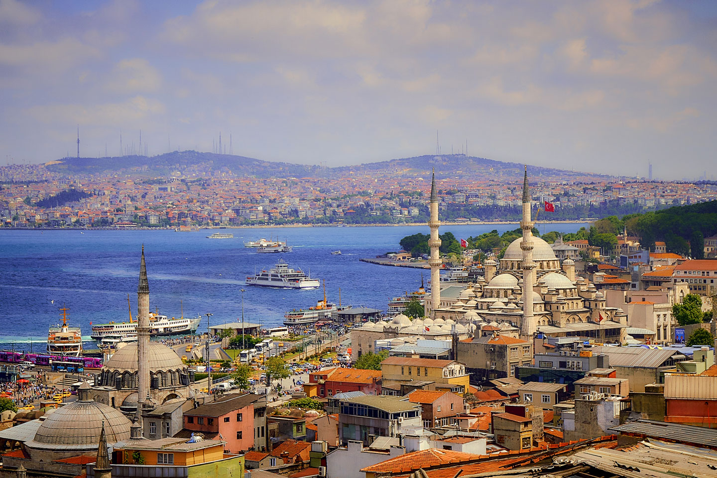
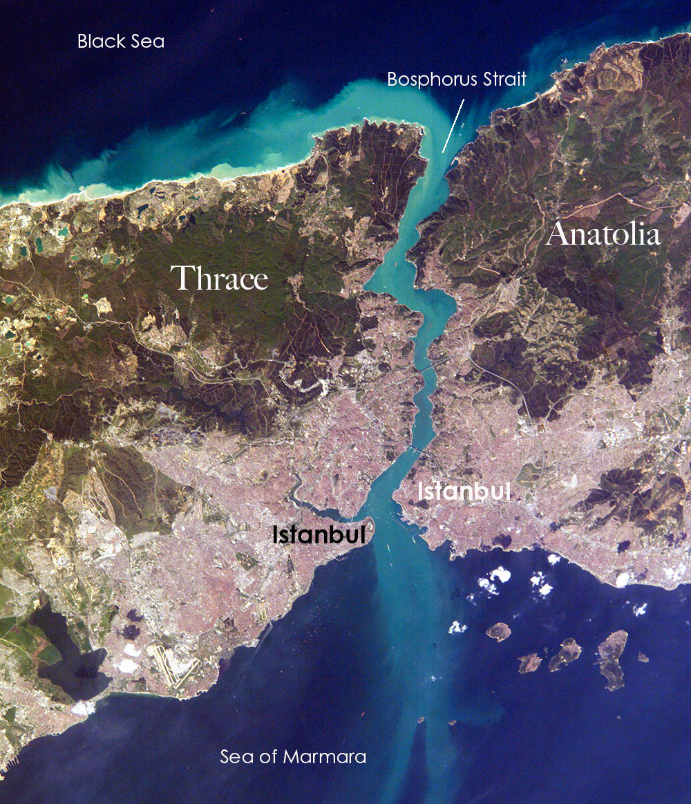 Istanbul, Turkey's metropolis of more than 15 million, lies on both sides of the winding, 30-kilometer-long Bosphorus Strait, which connects the Mediterranean Sea via the Sea of Marmara (south) with the Black Sea (north). The Bosphorus Strait separates Europe (Thrace, left) from Asia (Anatolia, right). Three bridges, a road tunnel, the Eurasia Tunnel under the Bosporus and several ferry connections link Turkish Thrace with the Anatolian peninsula.
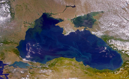
Photo: ISS NASA
Earth's mountain-building machinery formed the Black Sea basin several million years ago. Large-scale movements of the Earth's crust uplifted the mountain ranges that divided the ancient
Tethys Ocean into several water basins, such as the
Paratethys Ocean. The megalake of the late Miocene was probably the largest lake in Earth's history and extended from the region east of the Alps across Central Europe to Central Asia. Its remnants include the Black Sea, the Sea of Azov, the Caspian Sea and the Aral Sea.
[1] [2] [3]
During the last great ice age, which ended about 25,000 years ago, the Black Sea was a large freshwater lake. The
Bosphorus, the connection to the Mediterranean Sea - and to saline water - was presumably formed about 6,500 to 7,500 years ago.
[4]
Noah's Flood
It has been speculated that events in the Black Sea 7,500 years ago provide the background for the myth of Noah's Flood and the surviving Babylonian flood myths (Gilgamesh flood myth). The Black Sea deluge hypothesis proposed a catastrophic inflow of seawater from the Mediterranean Sea into the freshwater of the Black Sea after the last ice age.
[5] [6] [7]
Mount Ararat, traditionally associated with the mountain where Noah's Ark came to rest at the end of the Flood, is located 300 km (200 mi) inland from Turkey's Black Sea coast near the border with Armenia.
The Argonauts
The utterly inhospitable sea (Póntos Áxeinos) was the scene of the quest for the
Golden Fleece by a band of fifty mortals and demigods, including Hercules, two seers and a sorceress.
The fearless Greek superheroes, the
Argonauts, had the task of bringing home the precious hide of a ram from the world's end. At that time, the end of the world was somewhere in the Caucasus (Colchis).
[8]
Greek colonization
In the 6th century BCE, the coastal strips around the Black Sea were colonized by Archaic Ionian Greeks.
With the colonization, the Greek name for the Black Sea changed from the
inhospitable sea (Póntos Áxeinos) to Pontus Euxinus (Euxine Sea) - the hospitable sea.
Ancient Silk Road
When Marco Polo traveled the Silk Road in the 13th century, the trade route had already existed for more than a thousand years. Marco Polo used the Black Sea route on his return trip from China to visit Constantinople (now Istanbul).
[9]
The maritime city-state of
Genoa (Liguria, Italy) had started to form colonies of Ligurians in the Eastern Mediterranean and the Black Sea in the second half of the 13th century.
[10]
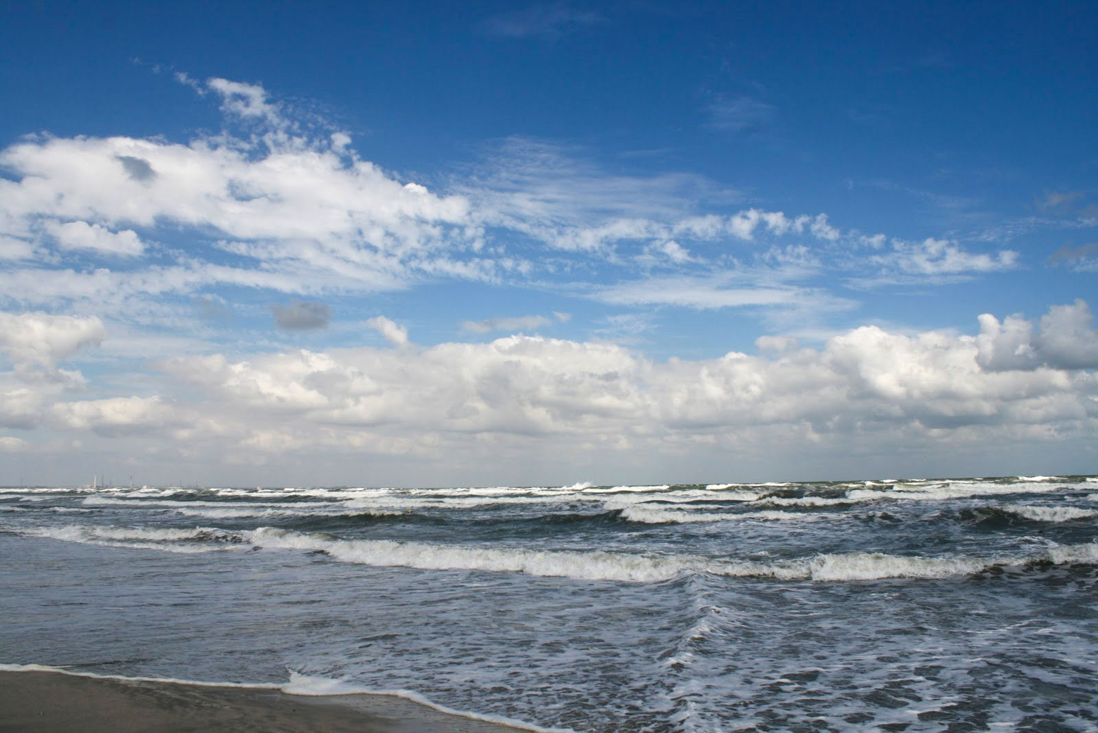 There are a number of explanations for why the Black Sea is called the Black Sea. Choppy water of the Black Sea near Constanța, Romania.
Image: Sb2s3
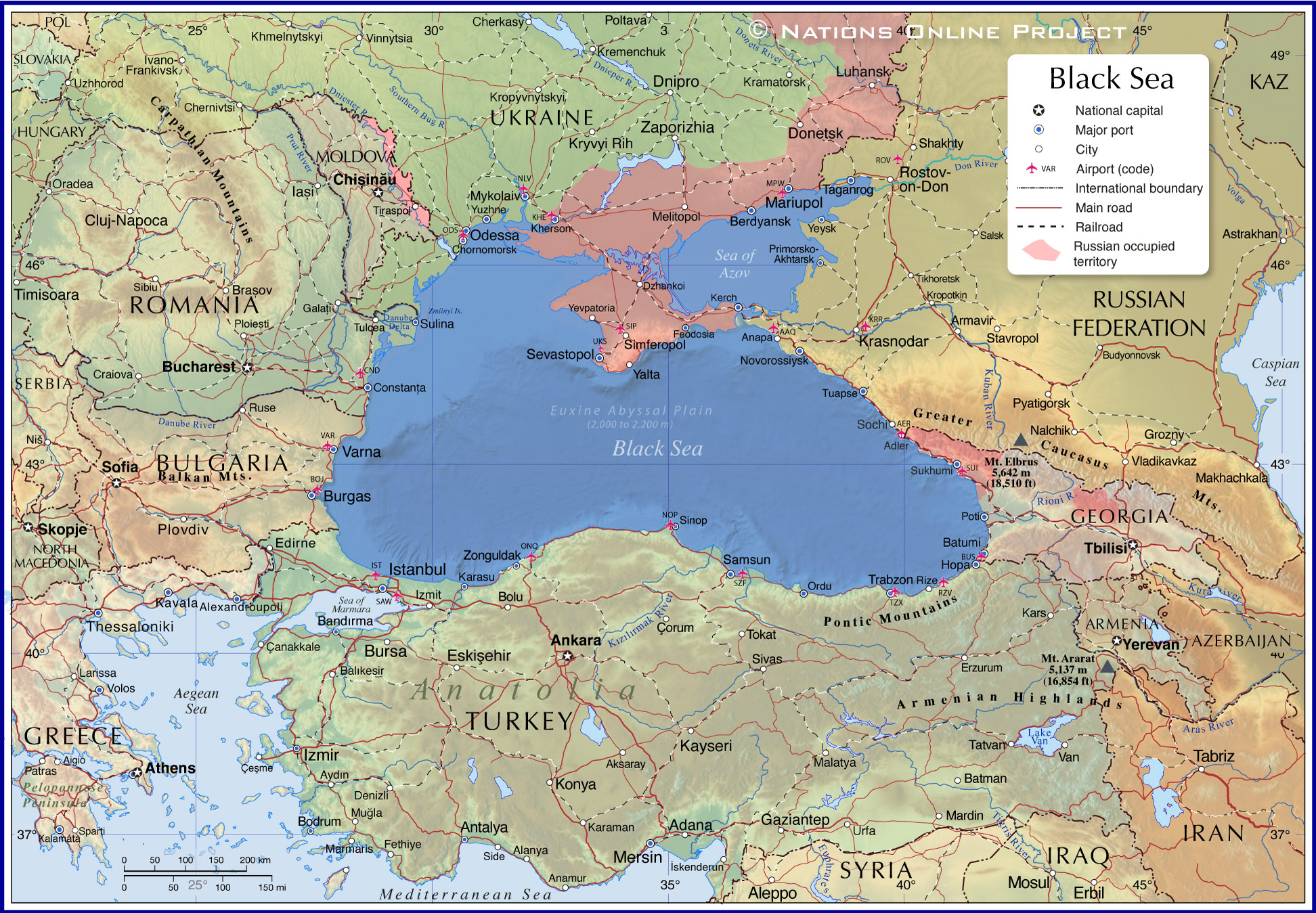
- The Black Sea is a major body of water that has only one outlet, the Bosporus Strait. The Bosporus, an approximately 30 km (20 mi) long waterway, connects the Black Sea with the Mediterranean Sea (via the Sea of Marmara and the Dardanelles Strait).
- The Black Sea is one of several seas named after a color.
- Due to an extended continental shelf, the northern part of the Black Sea is relatively shallow, with depths of up to 200 meters.
The Euxine Abyssal Plain of the Black Sea is a shallow seabed area with depths ranging from 2,000 to 2,200 m. The deepest measured point of the Black Sea at 2,216 m is located south of Yalta (Crimea).
In contrast, the adjacent Sea of Azov, connected to the Black Sea by the Strait of Kerch, is the shallowest sea in the world, with a maximum depth of barely 15 meters. [11]
- The Black Sea is connected to the Mediterranean Sea by two narrow straits, the Bosporus, which opens to the Sea of Marmara (Turkey), and the Dardanelles Strait (Strait of Gallipoli), which connects to the Aegean Sea. From there, the Suez Canal through the Red Sea and the Strait of Gibraltar provide access to the major shipping lanes of the world's oceans.
- The Istanbul Canal is a canal planned by the Turkish government for shipping. It is to run parallel to the Bosporus in the western part of Istanbul and connect the Black Sea with the Sea of Marmara. [WP]
-
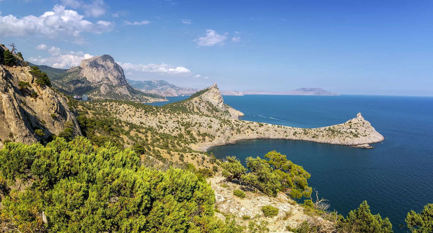 The Black Sea at Cape Kapchik (Мыс Капчик) of the Crimean peninsula to the south of the resort town of Novyi Svit.
Image: Alexander Rudnyi
- The Black Sea has experienced the worst environmental degradation of all of the world's oceans. The situation has become so severe that it has affected the health, well-being, and standard of living of the people in the immediate area. [14] [15]
No wonder, all the coastal states are not exactly known for their commitment to environmental protection. In the Environmental Performance Index - EPI, they rank among 180 countries as follows: Romania (30), Bulgaria (41), Ukraine (52), Georgia (103), Russia (112), and Turkey (172). The EPI ranks 180 countries on climate change performance, environmental health, and ecosystem vitality (from 1, best, to 180, worst). [16]
Geographical features of the Black Sea
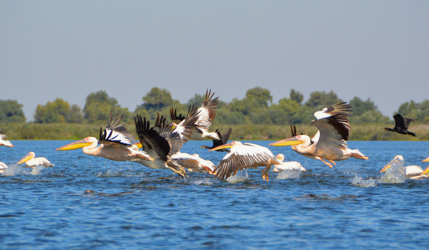 Pelicans in the Danube Delta in Romania. The largest and best preserved of Europe's deltas is a UNESCO World Heritage Site.
Image: Alex Keshavjee
The Black Sea lies at the crossroads between Europe and Asia, bounded by the relatively flat Eastern Balkans to the west, the East European Plain (Russian Plain) to the north and northwest, the mountainous Caucasus to the east, and the Anatolian Peninsula, also known as Asia Minor, to the south.
From West to East, from the Bulgarian beaches near Burgas to the coast of Georgia, which is about the widest part of the Black Sea, it is 1,150 km (720 miles).
The distance from the Ukrainian port city of Odesa to the Bosphorus Strait in the south is about 600 km (370 mi). The distance from the southern tip of Crimea to the coast of Kastamonu province (Turkey) is 265 km (165 miles).
One of the major geographical features of the Black Sea is the
Crimean Peninsula, which would almost be an island if it were not connected to the mainland by the narrow
Isthmus of Perekop. At 27,000 km², Crimea is about the size of
Massachusetts or slightly larger than the state of
Israel.
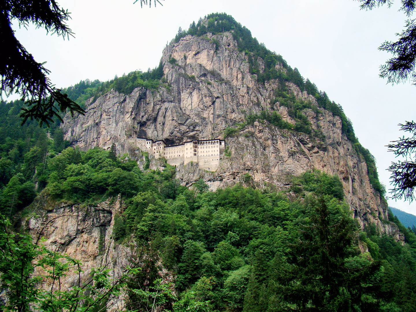 Sumela Monastery, a former Greek Orthodox monastery from the Byzantine period, was built on a rocky outcrop in a cliff in the eastern part of the Pontic Mountains, about 50 km south of the port city of Trabzon, Turkey.
Image: Bjørn Christian Tørrissen
The Black Sea receives water from a 2-million-square-kilometer drainage basin that covers about one-third of the area of mainland Europe.
[UN Atlas]
Several large rivers flow into the Black Sea, such as the
Danube, the
Dnieper, the
Dniester, the
Southern Bug, the Russian
Don and the Kuban rivers, Western Georgia's Rioni river, and the Turkish Kızılırmak and Sakarya rivers.
A system of inland waterways, the
Unified Deep Water System of
European Russia (UDWS), connects the Black Sea with the
Caspian Sea, the
Baltic Sea and the White Sea.
[WP]
The Black Sea is connected to the North Sea via the Danube and the Rhine-Main-Danube Canal.
Islands
In proportion to its size, the Black Sea is sparsely endowed with islands and archipelagos. There are about ten small islands; the most famous today is Snake Island (
Zmiinyi Island), located 35 km off the coast of southeastern Ukraine.
Mountains
Major mountain ranges bordering the Black Sea are the mountains of southern Crimea, the
Crimean Mountains, the Caucasus Mountains, a mountain range between the Black Sea and the Caspian Sea, the
Pontic Mountains (Kaçkar Dağları) in northern Anatolia, and the
Strandzha, a low mountain range in southeastern Bulgaria and Turkey (East Thrace).
The highest mountains are
Mount Kaçkar at 3,937 m in the Pontic Alps,
Mount Ararat at 5,137 m, a dormant volcano in the Armenian highlands, and
Mount Elbrus in the Caucasus Mountains at 5,642 m, the highest and most prominent peak in Russia and Europe.


