Nations Online
All Countries in the World
|
One Planet Nations Online All Countries in the World | |
Home  |
___ Satellite View and Map of Malta (Republic of Malta; Maltese: Repubblika ta' Malta) |
 Panorama of Valletta, Malta. Image: Patrick Subotkiewiez |
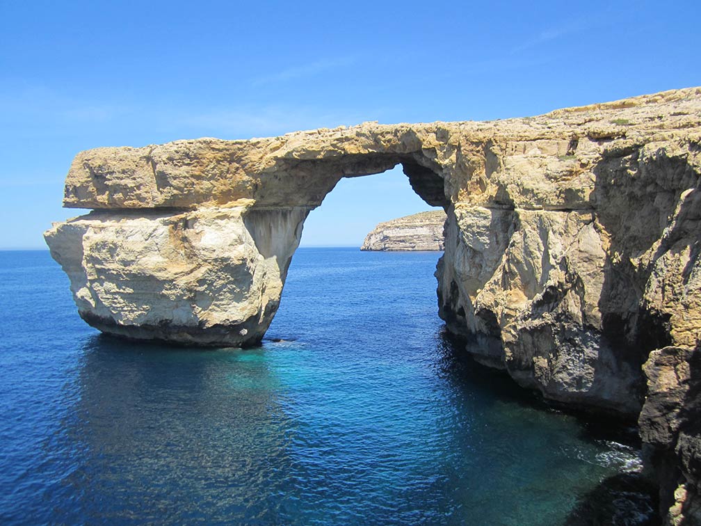
About Malta Malta is a small archipelago in the Mediterranean Sea, it is one of the smallest countries in Europe with an area of just 316 km² (122 sq mi). Malta is a small archipelago in the Mediterranean Sea, it is one of the smallest countries in Europe with an area of just 316 km² (122 sq mi).  The Azure Window, a natural limestone arch and a famous tourist spot on the Maltese island of Gozo. Image: Luca Aless Because of its strategic location and its natural harbors in the center of the Mediterranean Sea, the islands were the playground for many warring interest groups. Phoenician traders were among the first to occupy Malta, followed by the Greeks, and in the 6th century B.C. by the Carthaginians. Rome captured the island in 218 B.C.. In 1522 the Knights of the Hospital of Saint John of Jerusalem, a medieval Roman Catholic military order, were forced to surrender and driven from Rhodes by the Ottoman Empire, the Holy Roman Emperor Charles V gave them sovereignty over Malta. The Knights founded Valletta and defended it successfully against the Turks in 1565. The Knights' reign ended when Napoleon captured Malta in 1798, but the British Royal Navy was able to initiate a blockade of Malta and ended French occupation of Malta. In 1814, as part of the Treaty of Paris, the island officially became a part of the British Empire. Today Malta has a population of 429,000 people, it is in the Top10 of the most densely populated countries, capital city of Malta is Valletta on the island of Malta. Official languages are Maltese and English. The Map shows Malta with cities and towns, main roads and streets, Malta International Airport (IATA code: MLA) is located 5 km (3.1 mi) southwest of Valletta City. To find a location use the form below. To view just the map, click on the "Map" button. |
| To find a location type: street or place, city, optional: state, country. |
Local Time Malta:
Wednsday-May-1 07:01
Standard Time Zone (CET): UTC/GMT +1 hourCEST (Daylight Saving Time) in use from end of March until end of October. Time zone offset: UTC/GMT +2 hours |
One World - Nations Online .:. let's care for this planet Promote that every nation assumes responsibility for our world. Nations Online Project is made to improve cross-cultural understanding and global awareness. More signal - less NOISE |
| Site Map
| Information Sources | Disclaimer | Copyright © 1998-2023 :: nationsonline.org |