About West Bengal
The satellite view and the map show West Bengal. The state is located in eastern India; it borders
Bangladesh in the east,
Nepal to the northwest, and
Bhutan in the north. The Indian states of
Assam and
Sikkim are situated to the north and northeast,
Odisha in the southwest,
Jharkhand and
Bihar in the west. West Bengal extends for 620 km (385 mi) from the foothills of the Himalaya mountains in the north to the Ganges Delta in the south. West Bengal covers an
area of 88,752 km², compared, the state is somewhat smaller than
Portugal, or slightly smaller than the US state of
Maine.
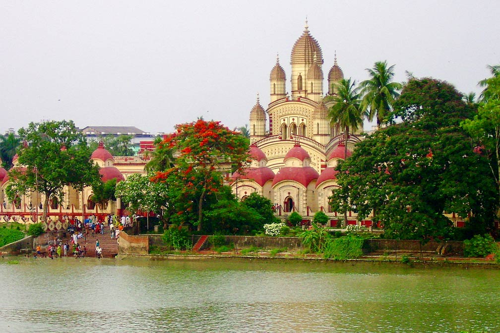 Dakshineswar Kali Temple, the Hindu temple with shrines to Krishna and Vishnu is located at the Hooghly River (Ganga) in Dakshineswar, north of Kolkata.
Image: Asis K. Chatterjee
In 1947, Bengal, the geopolitical, cultural and historical region north of the Bay of Bengal, was partitioned along religious lines, the eastern part became the Islam dominated Dominion of
Pakistan (now Bangladesh), the western part became a part of India.
The territory of West Bengal has two natural geographic regions. At its border to Sikkim in the north, are the mountainous landscapes of the Himalaya and the Himalayan foothills. Major rivers in this region are the Teesta, the Jaldhaka, and the Torsha, all tributaries of the Jamuna River (Brahmaputra); the Mechi river forms sections of India's border with Nepal.
In the south, there is the fertile Gangetic Plain, watered and drained by many rivers and their tributaries and distributaries. Major rivers are the Damodar, the Hooghly (Ganga), and the Ajay river. The Ganges flows through the narrow middle part of the state and forms further downstream a short section of India's border with Bangladesh.
Population
West Bengal has a population of about 95 million people.
Kolkata is the capital, the main (river) port, and the primate city of the state
with a population of 5.2 million inhabitants. The city was known until 2001 as Calcutta. Other major cities in West Bengal are Asansol, Siliguri, Durgapur, Malda (English Bazar) and Bardhaman (Burdwan).
Spoken languages are Bengali 85%, and Hindi 7%, Nepali is the official language in three Hill Sub-divisions of the Darjeeling District. Main religions are Hinduism (71%) and Islam (27%).
West Bengal Points of Interest
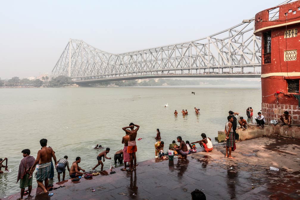 Howrah Bridge (Rabindra Setu) over the Hooghly River, seen from Chotelal Ki Ghat in Kolkata.
Image: Bernard Gagnon
is considered to be India´s cultural capital; it offers many attractions making a visit worthwhile.
Dakshineswar Kali Temple is a Hindu temple with shrines to Krishna and Vishnu located at the Hooghly River (Ganga) in Dakshineswar north of Kolkata.
140 km northwest of Kolkata is
Bishnupur; the town is famous for its terracotta temples built in the 17th and 18th centuries. The
Temples at Bishnupur 
are on the World Heritage tentative list of the UNESCO.
Santiniketan, part of Bolpur-Santiniketan, is home to the Visva-Bharati University, one of India's most renowned places of higher learning.
Poush Mela is an annual fair and festival marking the harvest season, held in Santiniketan, a small university town founded by the father of Rabindranath Tagore, Bengal's famous poet and Nobel laureate.
Gauḍa (Gaur) is a ruined city on India's border to Bangladesh. The former citadel is located near the town of Farakka in the Malda district.
In the North
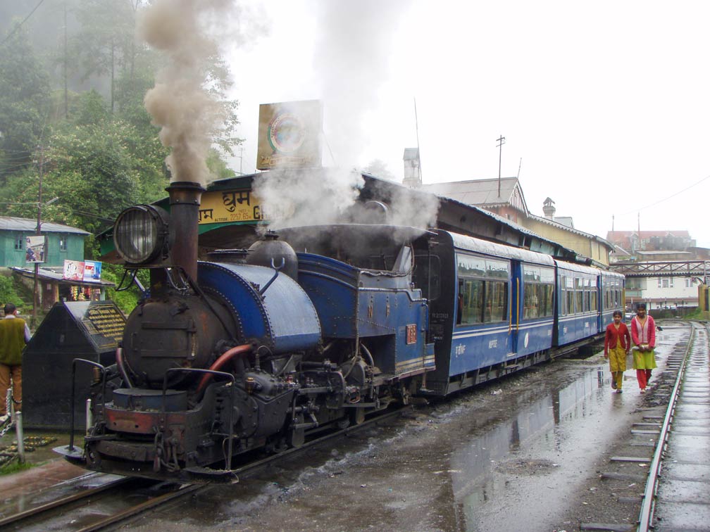 Darjeeling Himalayan Railway, also known as the "Toy Train". The train runs between New Jalpaiguri and Darjeeling, the railway was opened in 1879.
Image: Sheep"R"Us
, Happy Valley Tea Estate is a tea garden and Darjeeling's second oldest tea estate.
Bengal Dooars is West Bengal's portion of the alluvial floodplains in northeastern India, the grassy landscape of the Terai is a lowland at the foothills of the eastern Himalayas close to the border with Bhutan. Within the fertile plains are several national parks and wildlife sanctuaries, like Gorumara National Park, Chapramari Wild Life Sanctuary, and the Buxa Tiger Reserve along the Jayanti River. The
Gorumara National Park in the Dooars region is known for its population of Indian rhinos.
Darjeeling Himalayan Railway, also known as the "Toy Train." Three
Mountain Railways of India are listed in UNESCO's list of World Heritage Sites, the Darjeeling Himalayan Railway was the first and is still the most outstanding example of a hill passenger railway.
Neora Valley National Park is a pristine undisturbed natural habitat in the Kalimpong hills, just southeast of Sikkim, home to many birds, the Red Panda, and the elusive Clouded leopard. The park is in large parts inaccessible, making it an adventurous place for the nature lovers. The nearest town is Kalimpong, a hill station at an elevation of 1,250 m. The
Neora Valley National Park 
is on UNESCO's tentative list.
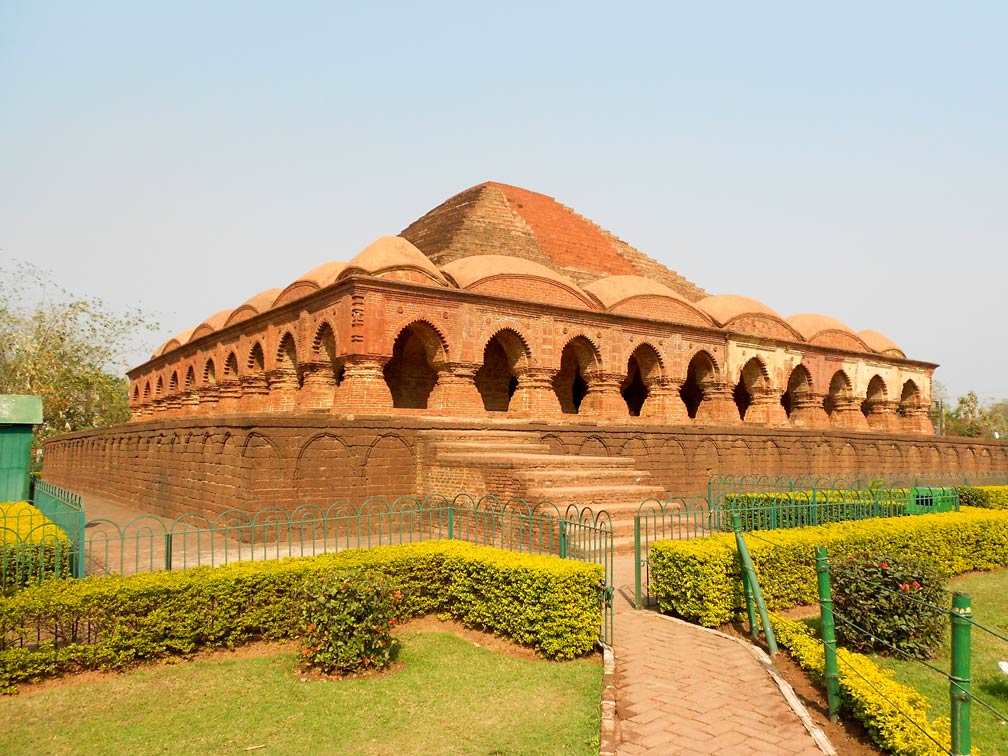 The pyramid of Rasmancha is one of the famous terracotta buildings in Bishnupur north west of Kolkata. The former temple was built in the beginning of the 17th century by Bir Hambir, the 49th ruler of the Malla dynasty.
Image: Arpan.chottu
(3636 m; 11,930 ft), is the highest peak in West Bengal, situated on the border with Nepal. The summit offers a view of four of the five highest mountains in the world,
Everest, Kanchenjunga, Lhotse, and Makalu.
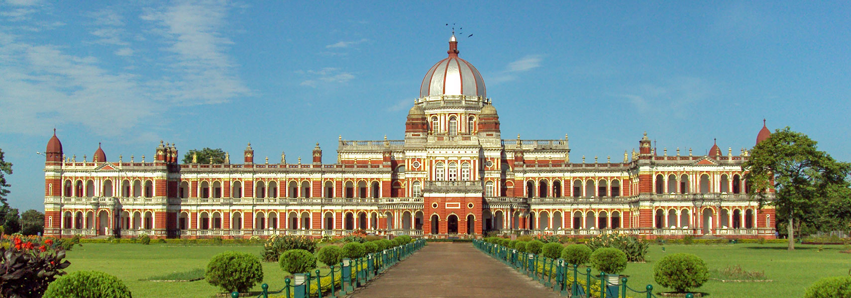
Cooch Behar Palace is an Italian Renaissance style palace in Cooch Behar; it was the residence of Nripendra Narayan (1862 – 1911), Maharaja of Koch Bihar.
In the South
The Ganges Delta and the Sundarbans
The Sundarbans in the delta of the Ganges, Brahmaputra, and Meghna rivers are the world's largest area of mangrove forests. The delta is a complex network of river distributaries, tidal waterways, mudflats, swampland, and many small deltaic islands.
Sundarbans National Park,

is the Indian portion of the World Heritage Site, more than half of the mangrove forests are in India, the rest is in Bangladesh. Bangladesh has its own World Heritage Site named
The Sundarbans 
.
Sea Beaches can be found at the coastal strip of West Bengal, like the seaside resort village of
Mandarmani.
The laid back delta islands of
Bakkhali and
Sagar (Ganga Sagar) are a religious spot for Hindu pilgrims (be aware of snakes).
Digha, the seaside resort town at the northern end of the Bay of Bengal is the most popular sea resort in West Bengal. To the east of Digha lies
Tajpur, a coastal town which is still relatively underdeveloped.
 A view of Darjeeling and the Happy Valley Tea Estate, it is Darjeeling's second oldest tea estate.
Image: Michael Janich
The map shows West Bengal with borders, cities, and towns, expressways, main roads, and streets, and the location of Calcutta's
Netaji Subhas Chandra Bose International Airport (
IATA code: CCU) and the location of
Bagdogra Airport (
IATA code: IXB) in North Bengal.
To find a location use the form below.

