Nations Online
All Countries in the World
Nations Online All Countries in the World | |
Home  |
___ Satellite View and Map of the City of Lahore, Pakistan |
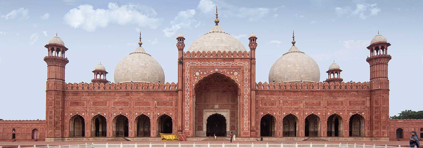 Badshahi Masjid, the royal mosque in the Walled City of Lahore is a magnificent example of Indo-Islamic Mughal architecture of the 17th century, it is the second largest mosque in Pakistan. Image: Zaki Imtiaz |
About Lahore Satellite view is showing Lahore, second largest city of Satellite view is showing Lahore, second largest city of 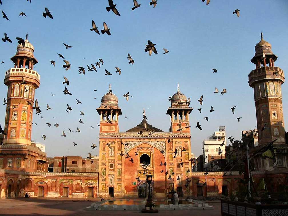 Wazir Khan Mosque, the almost 400 year old mosque was built during the reign of the Mughal Emperor Shah Jehan. Image: Sulaimandaud It was in Lahore that Pakistan's independence declaration was made in 1929. In this time Lahore was the largest city and the cultural center of the northern Indian subcontinent. 5,5 million people live in Lahore (census 1998) and it has an estimated population of 8 million living in its metropolitan area (2013). It is one of the most densely populated cities in the world. Spoken languages are Punjab; Urdu, English in use. Other Major Cities in Pakistan are the capital city Islamabad and the seaport of Karachi. Some points of interest in Lahore: Walled City of Lahore, the interior city in the northwestern part of Lahore was fortified by a city wall during the Mughal era. Fort (Shahi Qila) and Shalamar Gardens, masterpieces from the time of the Mughal civilization in the 16th century, today a UNESCO World Heritage Site Gulshan-e-Iqbal Park, in Allama Iqbal Town, is one of the largest parks and a recreational space in Lahore, on 27 March 2016, a bomb blast occurred in the parking area just outside the exit gate deliberately targeting Christians celebrating Easter Day, killing at least 69 people and wounding around 300. The map shows a city map of Lahore with expressways, main roads and streets, Allama Iqbal International Airport (IATA code: LHE) is located in a distance of about 14 km (9 mi) by road (via Aziz Bhatti Road) south east from the center of the city. |
|
| To find a location type: street or place, city, optional: state, country. |
Local Time Lahore:
Wednsday-April-24 18:58
UTC/GMT +5 hours |
|
φ Latitude, λ Longitude (of Map center; move the map to see coordinates): , |
||||||
| Google Maps: Searchable map/satellite view of Lahore, Punjab, Pakistan. City Coordinates: 31°32′59″N 74°20′37″E |
Bookmark/share this page |
|||||
| More about Pakistan: Cities: Country: Pakistan key statistical data. Continent: World: |
Lahore Weather Conditions:
External Links: Lahore (official web site) Punjab Gateway Portal of Government of the Punjab. Daily Times Local news. Wikipedia: Lahore |
Explore More:
Related Consumer Information:
|
||||
| Other Cities in South-Central Asia: Almaty, Ashgabat, Astana, Baku, Bishkek, Colombo, Dhaka, Dushanbe, Kabul, Kathmandu, Male, New Delhi, Tashkent, Tehran, Thimphu |
||||||
Map Help [ show ] |
||||||
One World - Nations Online .:. let's care for this planet Promote that every nation assumes responsibility for our world. Nations Online Project is made to improve cross-cultural understanding and global awareness. More signal - less NOISE |
| Site Map
| Information Sources | Disclaimer | Copyright © 1998-2023 :: nationsonline.org |

