Advertising

India Flag detail
Home Earth Continents Asia India Country Profile States and Union Territories of India Google Earth Dadra & Nagar Haveli Map

___ Satellite View and Map of Dadra and Nagar Haveli (दादरा और नगर हवेली), India


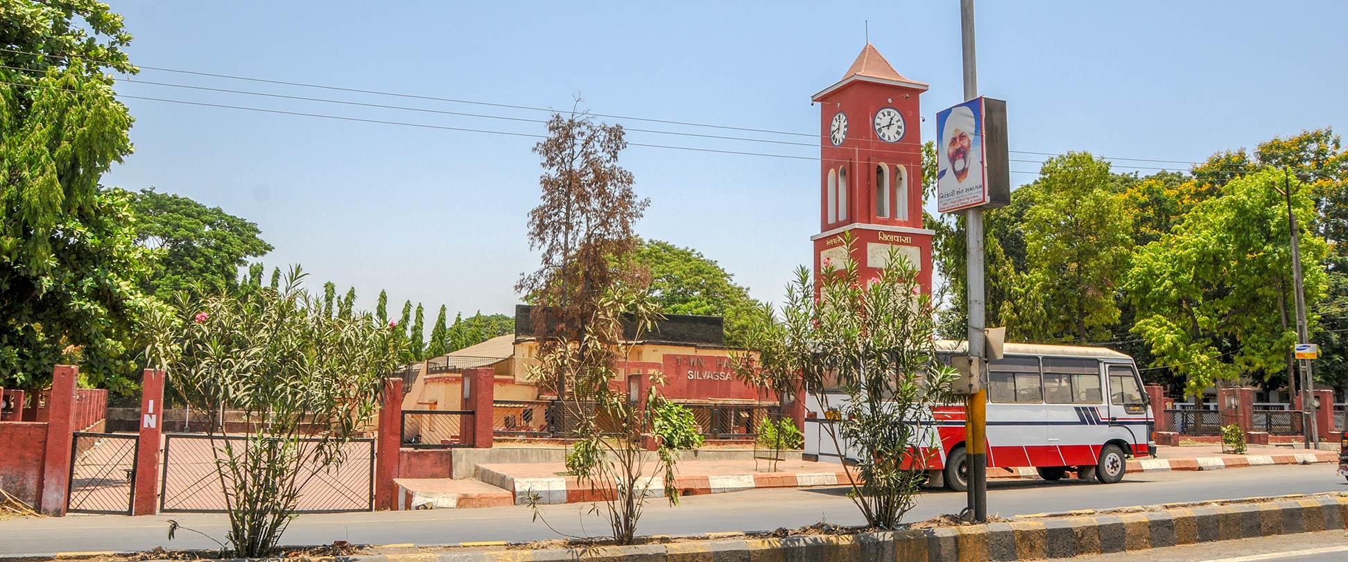
Town hall and clock tower of Silvassa, capital of UT Dadra and Nagar Haveli
A street in front of the town hall and the clock tower of Silvassa, administrative capital of the Union Territory of Dadra and Nagar Haveli in India.
Image: Sharada Prasad

About Dadra and Nagar Haveli


Seal of India
Satellite view and map of Dadra and Nagar Haveli. The landlocked Indian Union Territory lies about 150 km north of Mumbai in Western India, located between the mountain range of the Western Ghats and India's coastline at the Arabian Sea.


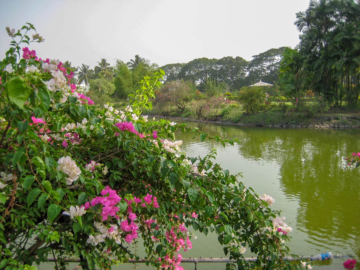
Vanganga Gardens and Lake, Gujarat
Flowering bougainvillea and a floating plastic bottle in Vanganga gardens and lake. Vanganga Garden is actually in Gujarat at the administrative border between the Indian state and the UT of Dadra and Nagar Haveli, about 8 km north west of Silvassa.
Image: Raman Patel
The former Portuguese colony borders the Indian states of Maharashtra and Gujarat. Dadra is an enclave within Gujarat, a few kilometers to the north of Nagar Haveli.

The combined area of the union territory amounts to 491 km² (190 sq mi), compared this is about one fifth the size of Luxembourg, or slightly smaller than three times the size of Washington D.C.

The union territory has a population of estimated 400,000 people (2018). Dadra and Nagar Haveli's capital and largest city is Silvassa. The industrial urban center on the east bank of the Daman Ganga River has a population of about 100,000 inhabitants. Spoken languages are Gujarati, Marathi, Hindi, English, and Portuguese. Hinduism is the dominant religion. Nearest international airport is Chhatrapati Shivaji International Airport in Mumbai.

The map shows Dadra and Nagar Haveli with borders, cities and towns, expressways, main roads and streets.


To find a location use the form below.

Sorry! Google's pricing policy has made it impossible for us to continue showing Google Maps. We apologize for any inconvenience.

Google Map: Searchable map and satellite view of Dadra and Nagar Haveli, India.

φ Latitude, λ Longitude (of Map center; move the map to see coordinates):

,


Bookmark/share this page
  Instagram button
More about India

Landmarks:
Taj Mahal
Satellite view of the famous mausoleum.

Cities:
Information and searchable map/satellite views of
Delhi
Chandigarh
Chennai
Hyderabad
Kolkata
Mumbai

Country:
Searchable map/satellite view of India
Map of India
Administrative Map of India
Political Map of Northern India and the Kashmir region
Searchable location map of India's airports
India Country Profile
India in numbers
India Key Statistical Data.

States and Union Territories of India

Continent:
Map of Southeast Asia
Map of Asia


External Links:
Dadra & Nagar Haveli
Official website

Department of Tourism
Official Tourism Website of the Department of Tourism, U.T of Dadra & Nagar Haveli, Silvassa.

Silvassa Online
Silvassa portal.

Wikipedia: Dadra & Nagar Haveli
Wikipedia entry Dadra & Nagar Haveli
 
Weather Conditions Dadra and Nagar Haveli:

SILVASSA WEATHER

Advertisements:


States of India:
Andhra Pradesh, Arunachal Pradesh, Assam, Bihar, Chhattisgarh, Goa, Gujarat, Haryana, Himachal Pradesh, Jammu & Kashmir, Jharkhand, Karnataka, Kerala, Madhya Pradesh, Maharashtra, Manipur, Meghalaya, Mizoram, Nagaland, Odisha, Punjab, Rajasthan, Sikkim, Tamil Nadu, Telangana, Tripura, Uttarakhand, Uttar Pradesh, West Bengal

Google Maps of India's Union Territories:
Andaman and Nicobar Islands, Chandigarh, Dadra & Nagar Haveli, Daman & Diu, Lakshadweep, Puducherry

Major Cities in South-Central Asia:
Almaty, Ashgabat, Astana, Baku, Bishkek, Colombo, Dhaka, Dushanbe, Islamabad, Kabul, Karachi, Kathmandu, Lahore, Lhasa, Male, Samarkand, Tashkent, Tehran, Thimphu

Map Help [ show ]
up