About Hyderabad
The satellite view shows Hyderabad, primate city and the capital of India's
Telangana state. It is the fourth most populous city in
 India
India (after Delhi, Mumbai, and Bangalore). Hyderabad also serves as the capital of
Andhra Pradesh for the time being.
The city is located in the northern part of the Deccan (Telangana) Plateau in the southwestern part of Telangana state on the banks of the Musi River. The tributary of the Krishna River divides the historic old city from the new city.
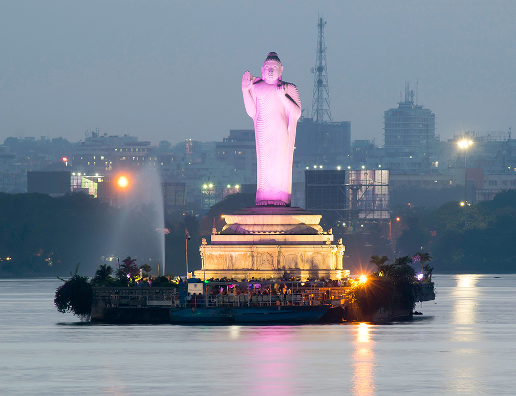 Buddha statue on the 'Rock of Gibraltar,' an artificial island in the Hussain Sagar lake in Hyderabad.
Image: © Nikhilb239
Excavations revealed that the site where the city stands today is inhabited since at least 2500 years.
In the third century B.C the region was part of the Maurya Empire, which was later replaced by the Satavahana dynasty. A variety of Buddhist, Muslim, and Hindu kingdoms ruled the area during the next centuries.
Around 1590, Muhammad Quli Qutb Shah, ruler of Qutb Shahi dynasty, chose the site nearby the overcrowded fortress of Golconda, to build a new city which became generally known as Bhagyanagar (City of Gardens). The new seat of the empire was also known as Baghnagar, the Garden City, and the 'City of Pearls', because of its pearl trade.
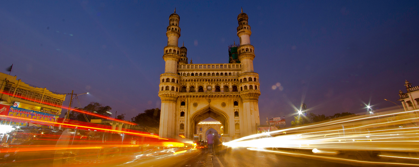
The Charminar mosque was one of the first structures to be built in Hyderabad.
From the 16th until the early 18th centuries, Golconda and Hyderabad were the focal points of the global diamond trade.
Today Hyderabad is India's fourth largest city with a population of about 7 million people, more than 8 million people live in its metropolitan area (est. 2017). Spoken
languages are Telugu and Urdu, Bengali, English, and Hindi.
The city's economy is based on
service, traditional manufacturing, the knowledge sector, especially the IT sector, and a growing tourism industry.
Hyderabad Points of Interest
The old fortress of Golconda, a former diamond-trading center and capital of the Qutb Shahi dynastic.
The Charminar, the 16th-century mosque with its four arches and four minarets, is the city's iconic landmark.
Badshahi Ashurkhana near the Charminar. The heritage site built shortly after the mosque. The Shia mourning place is famous for its tile work.
Hussain Sagar Lake is a heart-shaped urban lake with a giant Buddha statue in the southern corner. Chowmahalla
Bazaars
Hyderabad's markets are the places if you look for a peregrine shopping experience, find bridalwear, fabrics, jewelry, bangles, and spices:
Laad Bazaar (Choodi Bazaar), is the old market near the Charminar.
The Begum Bazaar is the largest commercial market in the city, and Sultan Bazaar is selling women's clothes and silverware.
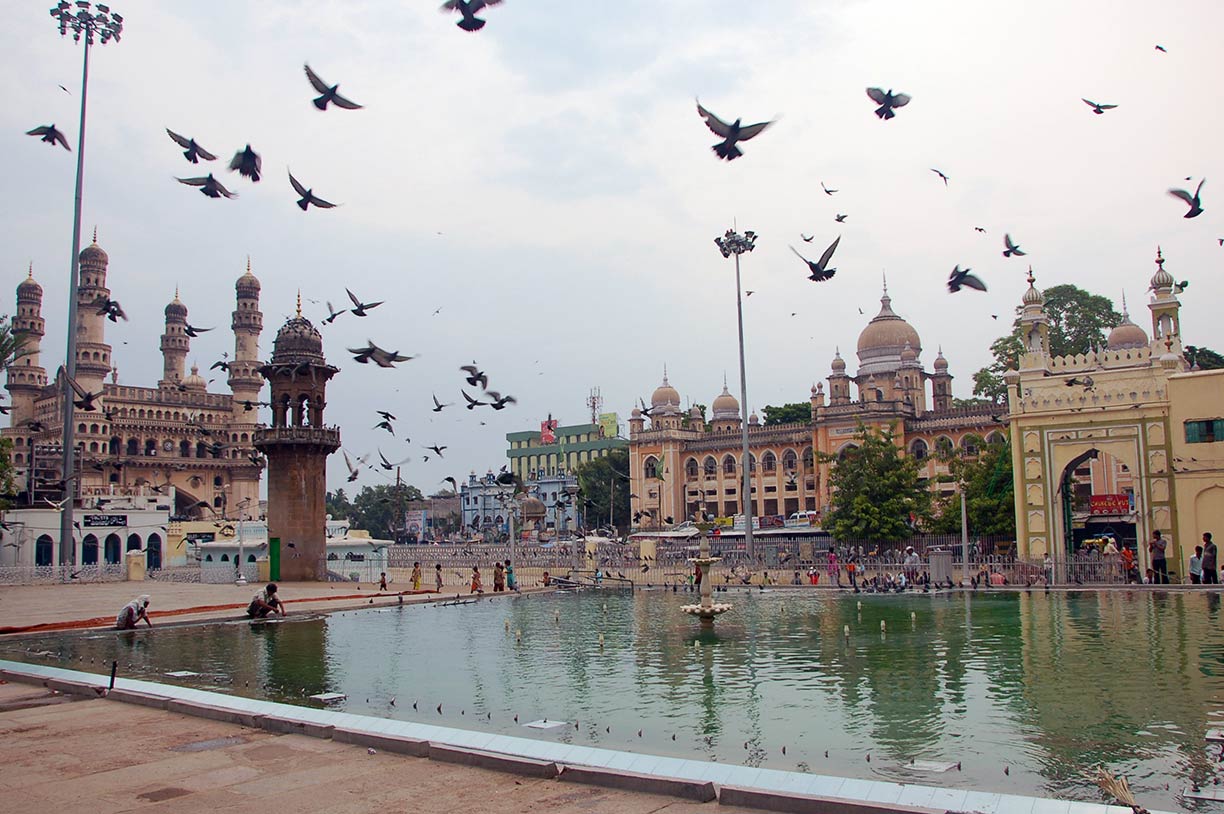 View of Charminar from Makkah Masjid, Hyderabad.
Image: Tristan Clarke
(
www.salarjungmuseum.in), is a huge museum with a collection of classical art from Asia and Europe displayed in 38 galleries. The museum also has a famous Quran collection.
Chowmahalla Palace the Persian-style palaces were the official residence of the Nizams (rulers) of Hyderabad
The heart of Chowmahalla Palace is the Khilwat Mubarak, the durbar hall where the nizams held their ceremonies.
Department of Heritage Telangana (
heritage.telangana.gov.in) a portal to the rich heritage of Telangana. Museums, exhibitions, monuments, and more.
Just zoom in (+) to see Charminar. The "Four minarets" mosque is one of Hyderabad's major tourist attractions and among the most recognized buildings in India.
The Map shows a city map of Hyderabad with expressways, main roads and streets, and the location of
Rajiv Gandhi International Airport 
(
IATA code: HYD) located in Shamshabad, about 24 km (16 mi) by road (via NH 44) southwest of Hyderabad's Old City.
To find a location use the form below.

