Advertising

India Flag detail
Home Earth Continents Asia India Country Profile States and Union Territories of India Google Earth Mizoram Map

___ Satellite View and Map of Mizoram (मिज़ोरम), India


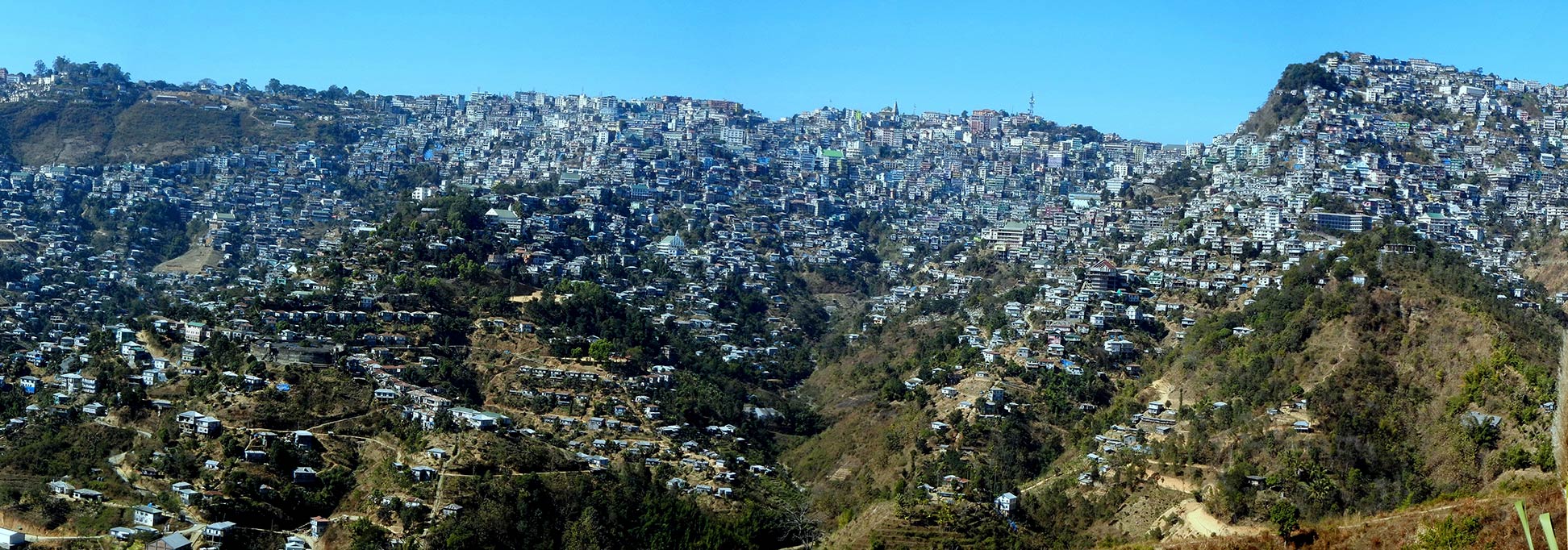
Aizawl, the administrative center of Mizoram
View of Aizawl, the administrative center of Mizoram. Like many towns in the state, the city occupies several hilltops.
Image: Coolcolney

About Mizoram


Mizoram Seal
Satellite view is showing the Indian state of Mizoram. The landlocked state is located in Northeast India, bordered in west by Chittagong Hill Tracts (Chittagong Division) of Bangladesh, in south and east by the Chin State of Myanmar, to the north by the Indian states of Tripura, Assam, and Manipur.
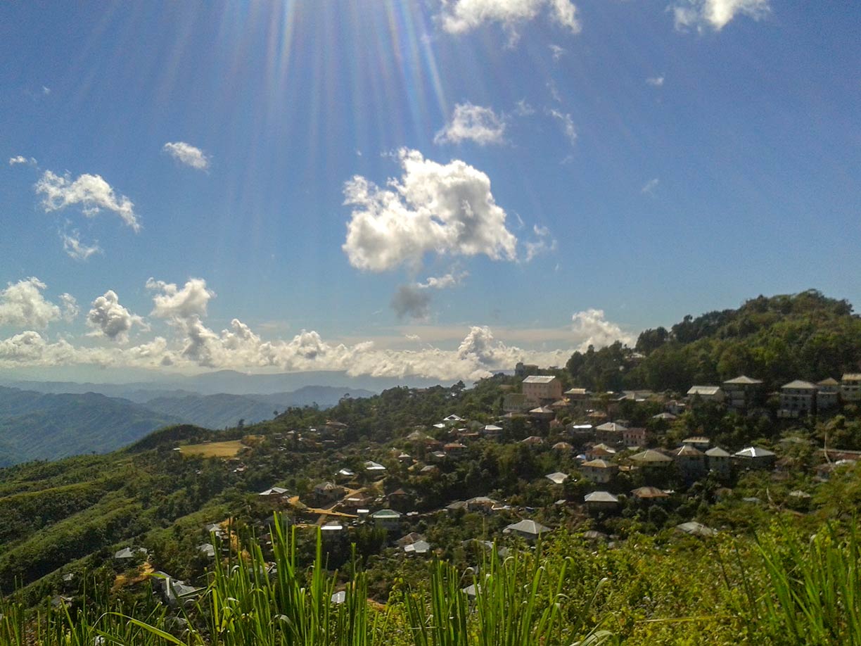


The hill town of Lunglei in Mizoram
The hill town of Lunglei (Lungleh) in the south-central part of Mizoram state.
Image: Vikas Talwar
 
Mizoram is in a mountainous region, it was previously part of Assam until 1972, and became the 23rd State of the Indian Union in February 1987.


The state is called the "Land of the Mizo People"; it covers an area of 21,087 km² (8,142 sq mi), compared, it is about half the size of Denmark, or slightly smaller than New Jersey.

Mizoram's landscape offers hill ranges, valleys, rivers, and lakes. About 90% of the state is forested.

Mizoram has a population of about 1 million people. Largest city and capital is Aizawl (Aijal). Other major towns are Champhai, Khawbung, Thenzawl, and Lunglei.

Official language is Mizo (also known as Lushai), a Tibeto-Burman language, and English. Due to extensive missionary work over the first half of the 20th century, the main religion is Christianity (87%).

The map shows a map of Mizoram with borders, cities, and towns, expressways, main roads, and streets, and the location of Lengpui Airport (IATA code: AJL ).

To find a location use the form below.

 
Sorry! Google's pricing policy has made it impossible for us to continue showing Google Maps. We apologize for any inconvenience.

Google Map: Searchable map and satellite view of Mizoram state, India.

φ Latitude, λ Longitude (of Map center; move the map to see coordinates):

,


Bookmark/share this page
  Instagram button
More about India

Landmarks:
Taj Mahal
Satellite view of the famous mausoleum.

Cities:
Information and searchable map/satellite views of
Delhi
Chandigarh
Chennai
Hyderabad
Kolkata
Mumbai

Country:
Searchable map/satellite view of India
Map of India
Administrative Map of India
Political Map of Northern India and the Kashmir region
Searchable location map of India's airports
India Country Profile
India in numbers
India Key Statistical Data.

States and Union Territories of India

Continent:
Map of Southeast Asia
Map of Asia


External Links:
Mizoram
Official government website.

Mizoram Tourism
Official Mizoram tourism website.

Wikipedia: Mizoram

 
Current Weather Conditions Mizoram:

AIZAWL WEATHER

Advertisements:


States of India:
Andhra Pradesh, Arunachal Pradesh, Assam, Bihar, Chhattisgarh, Goa, Gujarat, Haryana, Himachal Pradesh, Jammu & Kashmir, Jharkhand, Karnataka, Kerala, Madhya Pradesh, Maharashtra, Manipur, Meghalaya, Mizoram, Nagaland, Odisha, Punjab, Rajasthan, Sikkim, Tamil Nadu, Telangana, Tripura, Uttarakhand, Uttar Pradesh, West Bengal

Google Maps of India's Union Territories:
Andaman and Nicobar Islands, Chandigarh, Dadra & Nagar Haveli, Daman & Diu, Lakshadweep, Puducherry

Major Cities in South-Central Asia:
Almaty, Ashgabat, Astana, Baku, Bishkek, Colombo, Dhaka, Dushanbe, Islamabad, Kabul, Karachi, Kathmandu, Lahore, Lhasa, Male, Samarkand, Tashkent, Tehran, Thimphu

Map Help [ show ]
up