Advertising

India Flag detail
Home Earth Continents Asia India Country Profile States and Union Territories of India Google Earth Arunachal Pradesh Map

___ Satellite View and Map of Arunachal Pradesh (अरुणाचल प्रदेश), India


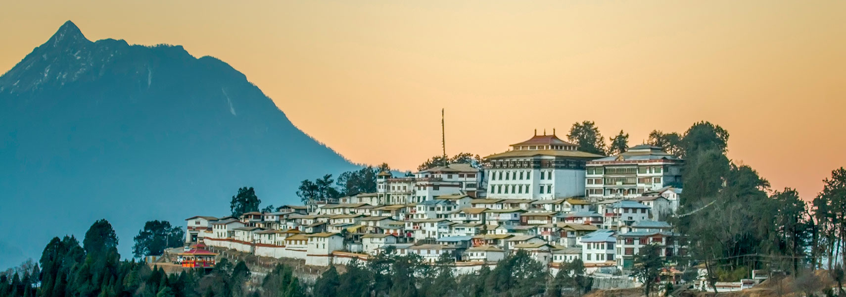
Tawang Monastery in Tawang, India
Tawang Monastery in Arunachal Pradesh, close to the Tibet Autonomous Region border, in the valley of the Tawang-chu river. It is the largest Buddhist monastery in India.
Image: Vikramjit Kakati

About Arunachal Pradesh


Seal of Arunachal Pradesh

 
Satellite view is showing Arunachal Pradesh, one of India's 29 states. It is the nation's easternmost state, stretching from the foothills of the Himalayas to the plains of Brahmaputra valley.
The "land of the rising sun" is bordered by Tibet (China) in the north, Myanmar (Burma) in north-east, Bhutan in south-west, the Indian state of Assam in south, and the Indian state of Nagaland in south-east.
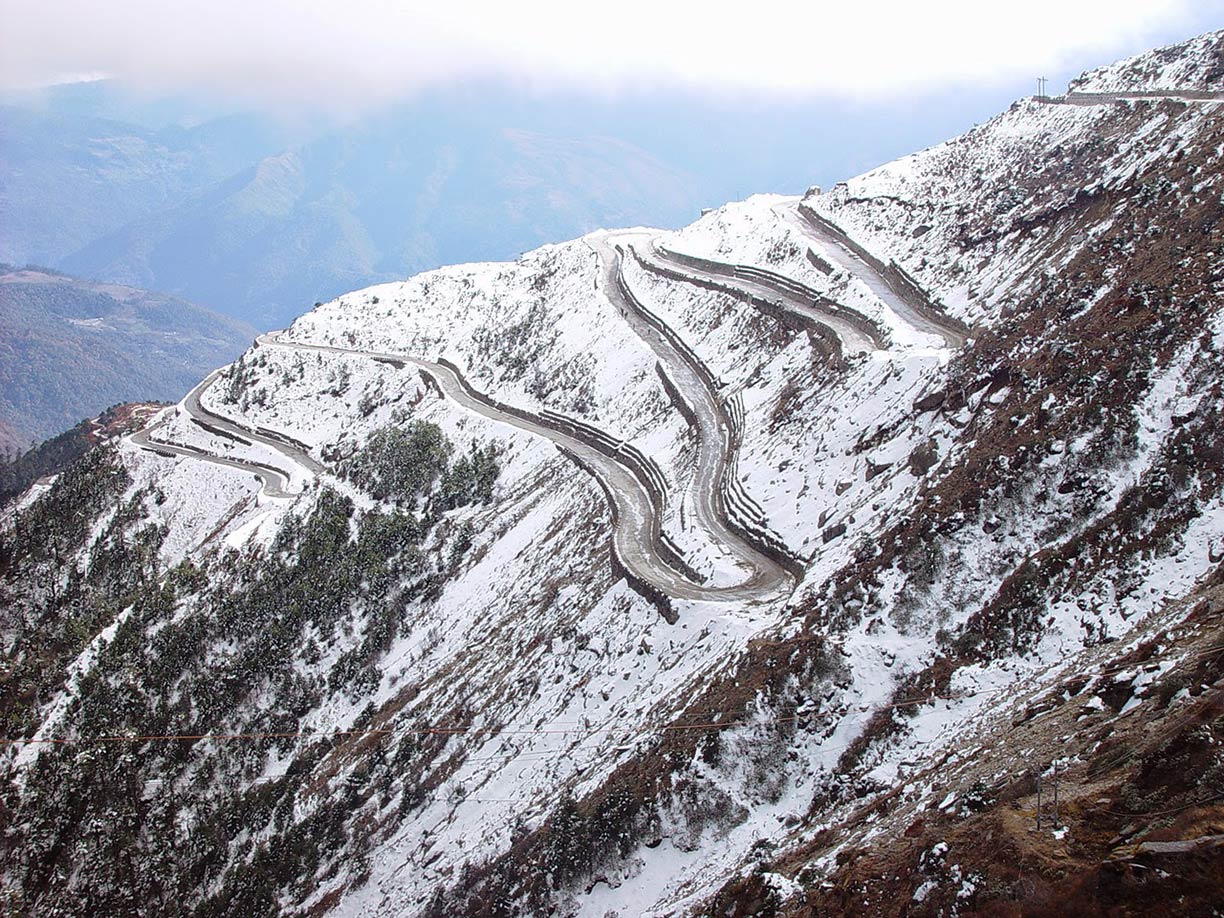


Switchbacks in Himalayas, Arunachal Pradesh
Road in the Himalayas, Arunachal Pradesh, India
Image: rajkumar1220
 
Arunachal Pradesh is in one of the regions disputed between India and China. China regards the entire territory of Arunachal Pradesh as Chinese territory, occupied by India.

With an area of 83,743 km² (32,333 sq mi) the state is about the size of Austria, or slightly larger than the US state of South Carolina.

Almost 1.4 million people live in Arunachal Pradesh (2011 census), most of them are of Tibeto-Burman origin. An increasing number of migrants have reached Arunachal Pradesh over the last decades from various parts of India and other countries; the influx created a serious identity crisis among the indigenous populations. [1]


Capital city of the state is Itanagar. Spoken languages are Hindi, Deori, Assamese, English, and many local native languages.

The existing state owned airports in Arunachal Pradesh are small and not in operation. The state is connected to India by two highways. It got its first railway line in late 2013 and is now connected to the rest of the world via Dekargaon railway station in Assam.

The map shows mountainous Arunachal Pradesh state with towns and roads, next international airport is Guwahati International Airport (IATA code: GAU) located in Guwahati, in Assam state.


To find a location use the form below.

Sorry! Google's pricing policy has made it impossible for us to continue showing Google Maps. We apologize for any inconvenience.

Google Map: Searchable map and satellite view of Arunachal Pradesh, India.

φ Latitude, λ Longitude (of Map center; move the map to see coordinates):

,


Bookmark/share this page
  Instagram button
More about India

Landmarks:
Taj Mahal
Satellite view of the famous mausoleum.

Cities:
Information and searchable map/satellite views of
Delhi
Chandigarh
Chennai
Hyderabad
Kolkata
Mumbai

Country:
Searchable map/satellite view of India
Map of India
Administrative Map of India
Political Map of Northern India and the Kashmir region
Searchable location map of India's airports
India Country Profile
India in numbers
India Key Statistical Data.

States and Union Territories of India

Continent:
Map of Southeast Asia
Map of Asia


External Links:
National Portal of India
Official website of India.

Arunachal Pradesh
Official government website.

Arunachal Tourism
Official tourism website.

News:
The Arunachal Times
Local news.

Wikipedia: Arunachal Pradesh
Wikipedia entry Arunachal Pradesh.
 
Current Weather Conditions Arunachal Pradesh:

ARUNACHAL PRADESH WEATHER

Advertisements:


States of India:
Andhra Pradesh, Arunachal Pradesh, Assam, Bihar, Chhattisgarh, Goa, Gujarat, Haryana, Himachal Pradesh, Jammu & Kashmir, Jharkhand, Karnataka, Kerala, Madhya Pradesh, Maharashtra, Manipur, Meghalaya, Mizoram, Nagaland, Odisha, Punjab, Rajasthan, Sikkim, Tamil Nadu, Telangana, Tripura, Uttarakhand, Uttar Pradesh, West Bengal

Google Maps of India's Union Territories:
Andaman and Nicobar Islands, Chandigarh, Dadra & Nagar Haveli, Daman & Diu, Lakshadweep, Puducherry

Major Cities in South-Central Asia:
Almaty, Ashgabat, Astana, Baku, Bishkek, Colombo, Dhaka, Dushanbe, Islamabad, Kabul, Karachi, Kathmandu, Lahore, Lhasa, Male, Samarkand, Tashkent, Tehran, Thimphu

Map Help [ show ]
up